Thompson Creek (Ararat River tributary) facts for kids
Quick facts for kids Thompson Creek |
|
|---|---|
|
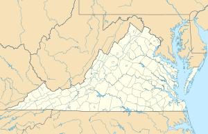
Location of Thompson Creek mouth
|
|
| Other name(s) | Tributary to Ararat River |
| Country | United States |
| State | Virginia |
| County | Patrick |
| Physical characteristics | |
| Main source | Pine Creek divide about 1 mile southwest of Bell Spur, Virginia 2,600 ft (790 m) 36°39′05″N 080°29′35″W / 36.65139°N 80.49306°W |
| River mouth | Ararat River about 0.5 miles west of Belair Springs, Virginia 1,520 ft (460 m) 36°37′44″N 080°29′21″W / 36.62889°N 80.48917°W |
| Length | 2.31 mi (3.72 km) |
| Basin features | |
| Progression | west then generally south |
| River system | Yadkin River |
| Basin size | 1.44 square miles (3.7 km2) |
| Tributaries |
|
| Bridges | Jar Gap Lane (x3) |
Thompson Creek is a small stream located in Patrick County, Virginia. It is about 2.31 miles (3.72 kilometers) long. This creek is a "first-order tributary," which means it's one of the smallest streams that flows directly into a larger river. Thompson Creek eventually joins the Ararat River.
The Journey of Thompson Creek
Thompson Creek starts in Patrick County, Virginia. It begins on a high area called the Pine Creek divide. This spot is about one mile southwest of a place called Bell Spur.
The creek first flows towards the west. Then, it makes a turn and starts flowing south. Thompson Creek finally meets the Ararat River. This meeting point is about half a mile west of Bell Spur.
Thompson Creek's Home Area: The Watershed
Every stream and river has a "watershed." A watershed is like a big bowl or area of land. All the rain and snow that falls in this area eventually drains into that specific stream or river.
Thompson Creek's watershed covers about 1.44 square miles (3.73 square kilometers). This area gets a lot of rain each year, about 55.8 inches (141.7 centimeters). A large part of this watershed, about 76%, is covered by forests. These forests help keep the water clean and healthy for the creek.
 | Frances Mary Albrier |
 | Whitney Young |
 | Muhammad Ali |


