Thoms Place, Wrangell facts for kids
Quick facts for kids
Thoms Place, Alaska
|
|
|---|---|
|
Former census-designated place
|
|

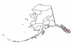
Location of Thoms Place, Alaska
|
|
| Country | United States |
| State | Alaska |
| Borough | Wrangell |
| Area | |
| • Total | 10.7 sq mi (27.6 km2) |
| • Land | 10.7 sq mi (27.6 km2) |
| • Water | 0.0 sq mi (0.0 km2) |
| Elevation | 410 ft (125 m) |
| Population
(2000)
|
|
| • Total | 22 |
| • Density | 2.1/sq mi (0.8/km2) |
| Time zone | UTC-9 (Alaska (AKST)) |
| • Summer (DST) | UTC-8 (AKDT) |
| Area code | 907 |
| FIPS code | 02-76970 |
| GNIS feature ID | 1865568 |
Thoms Place was once a very small community in Alaska, United States. It was located on Wrangell Island. In the year 2000, only 22 people lived there.
Thoms Place was known as a census-designated place (CDP). This means it was an area set up just for counting people in the U.S. Census. It was not an official town or city.
In 2008, Thoms Place became part of the larger City and Borough of Wrangell. This means it is no longer a separate CDP.
Where Was Thoms Place Located?
Thoms Place was found at these coordinates: 56.195077 degrees North and -132.198042 degrees West. This is a specific spot on a map.
The area of Thoms Place was about 10.6 square miles (27.6 square kilometers). All of this area was land, with no water.
Who Lived in Thoms Place?
| Historical population | |||
|---|---|---|---|
| Census | Pop. | %± | |
| 2000 | 22 | — | |
| U.S. Decennial Census | |||
In 2000, the last time it was counted as a CDP, 22 people lived in Thoms Place. These people made up 13 households. Seven of these households were families.
Most of the people in Thoms Place were White (about 86%). A smaller group (about 14%) were Native American.
The average age of people living there was 54 years old. Most residents were between 45 and 64 years old. There were more males than females living in Thoms Place.
 | Charles R. Drew |
 | Benjamin Banneker |
 | Jane C. Wright |
 | Roger Arliner Young |

