Wrangell Island facts for kids

Wrangell Island, Alaska
|
|
 |
|
| Geography | |
|---|---|
| Location | Alaska Panhandle |
| Coordinates | 56°17′51″N 132°10′30″W / 56.29750°N 132.17500°W |
| Archipelago | Alexander Archipelago |
| Area | 210.05 sq mi (544.0 km2) |
| Length | 28.5 mi (45.9 km) |
| Width | 3.75–14.2 mi (6.04–22.85 km) |
| Administration | |
|
United States
|
|
| State | Alaska |
| Borough | Wrangell |
| Largest settlement | Wrangell |
| Demographics | |
| Population | 2,009 (2020 census) |
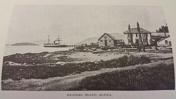
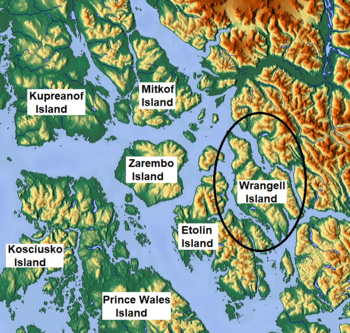
Wrangell Island (also known as Ostrova Vrangel) is a cool island located in the Alexander Archipelago. This group of islands is found in the Alaska Panhandle, which is the southeastern part of Alaska.
The island is about 28.5 miles (45.9 km) long. It measures between 3.75 miles (6.04 km) and 14.2 miles (22.9 km) wide. Wrangell Island covers an area of about 210.05 square miles (544.0 km2). This makes it the 29th largest island in the United States. A narrow waterway called the Blake Channel separates Wrangell Island from the mainland.
Contents
Island History: Early Explorers and Settlers
The first European to see Wrangell Island was James Johnstone. He was an officer with George Vancouver during his big expedition from 1791 to 1795. Johnstone saw the island in 1793. However, he only mapped its eastern side and did not realize it was a full island.
Russian Control and Naming
In 1834, the Russians took control of the island. It was named after Ferdinand von Wrangel. He was a Baltic German explorer who worked for the Russian navy. Wrangel was also a Russian government official.
He became the chief manager of the Russian-American Company in 1829. This meant he was the first married governor of Russian settlements in North America. These settlements are now part of Alaska. During his time as governor, from 1829 to 1835, Wrangel did many things. He grew potatoes on the island and started mines. He also built roads, bridges, and government buildings. He wrote down his observations about the geography and people for the navy.
United States Takes Over
The United States bought Alaska from Russia in 1867. After this, Wrangell Island became a U.S. military base until 1877. Later, it became a key spot for people heading out. Hunters, explorers, and miners would stop there. Miners used the Stikine River route to get to the Yukon area.
Life on Wrangell Island Today
The main city on the island is Wrangell, Alaska. The island is covered with thick forests. It is also home to many different kinds of wildlife. The only other small community is Thoms Place. It is located on the southwest side of the island. Thoms Place is across the Zimovia Strait from Etolin Island.
Economy and Activities
People on Wrangell Island work in fishing and mining. There used to be a lumber mill, but it closed in the 1990s. The island and its nearby areas offer many fun things to do outdoors. The Stikine River flows into the sea near the island. This river provides lots of chances for outdoor adventures.
Island Population
According to the 2020 census, Wrangell Island had a total population of 2,127 people. This number includes the population of Wrangell City and Borough.
See also
 In Spanish: Isla Wrangell para niños
 | Jessica Watkins |
 | Robert Henry Lawrence Jr. |
 | Mae Jemison |
 | Sian Proctor |
 | Guion Bluford |


