
Stikine River facts for kids
Quick facts for kids Stikine River |
|
|---|---|

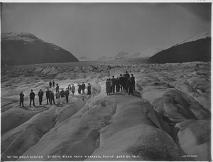
The Stikine River near Telegraph Creek
|
|

The Stikine River (highlighted in orange) and British Columbia
|
|
| Country | Canada, United States |
| Physical characteristics | |
| Main source | Spatsizi Plateau |
| River mouth | Eastern Passage, City and Borough of Wrangell, Alaska |
| Length | 539 km (335 mi) |
| Basin features | |
| Basin size | 52,000 km2 (20,000 sq mi) |
The Stikine River (called Shtaxʼhéen by the Tlingit people) is a long river in British Columbia, Canada, and Alaska, United States. It is about 610 kilometres (380 mi) (379 miles) long.
This amazing river is known for its wild beauty. It flows through deep, glacier-carved canyons in the Coast Mountains. The Stikine River ends in the Eastern Passage, near the city of Wrangell, Alaska. Its "Grand Canyon" section is famous among expert kayakers for being very challenging.
Contents
What's in a Name? The Stikine River's History
The name "Stikine" comes from the Coast Tsimshian dialect. It refers to the Tahltan people who live along the river. The Tsimshian-Nisga people named the river after them.
Another idea is that the name comes from the Tlingit language. It might mean "great river" or "the main river." This was reported by Captain Rowan in 1799.
The river was first called ryeka Stahkin in Russian in 1848. After the Alaska Purchase in 1869, its name changed to the current form. Over time, it has had many different spellings and names, like "Stickeen" and "Pelly's River."
Exploring the Stikine River's Path

The Stikine River's watershed (the area of land that drains into it) covers about 52,000 square kilometres (20,000 sq mi) (20,077 square miles). The famous naturalist John Muir once compared the lower part of the Stikine, with its many glaciers, to Yosemite National Park.
The Stikine River starts in the Spatsizi Plateau in northern British Columbia. From there, it flows north, then turns west and southwest. It passes by Telegraph Creek, a historic community.
One of the most amazing parts is the Grand Canyon of the Stikine. This canyon is about 45-mile-long (72 km) and 300-metre-deep (980 ft). Below Telegraph Creek, other rivers like the Tuya and Tahltan River join the Stikine. Closer to the U.S. border, the Iskut and other large rivers also flow into it.
The river then goes through a deep gorge near the Canada–U.S. border. For its last 64 kilometres (40 mi) (40 miles), it enters southeast Alaska. Here, it forms a river delta (a landform created by sediment at the river's mouth) near Wrangell, Alaska. The Stikine's different branches flow into the ocean in various places, including Frederick Sound and Sumner Strait.
The Stikine: A River Across Borders
The Stikine River is an "international river" because it flows through two countries: Canada and the United States. Even though the river's mouth is now in Alaska, a treaty from 1901–03 gave Canadian boats the right to travel on the river from the sea. This was important for mining and trade in the past. However, this right is not used much today because the river's mouth has changed over time.
Rivers Joining the Stikine: Its Tributaries
Many smaller rivers flow into the Stikine River. These are called its tributaries. Here are some of the main ones, listed from the Stikine's source (where it begins) downstream:
- Duti River
- Chukachida River
- Spatsizi River
- Pitman River
- McBride River
- Klappan River
- Little Klappan River
- Tanzilla River
- Klastline River
- Tuya River
- Tahltan River
- Little Tahltan River
- Chutine River
- Porcupine River
- Choquette River
- Scud River
- Iskut River
- Tasakili River
A Look Back: The Stikine River's History
The Stikine River has been an important travel route for a long time. The coastal Tlingit people used it to travel into the interior lands.
- Early Explorers: In 1824, Samuel Black was the first European to explore the river's upper parts. Later, in 1838, Robert Campbell of the Hudson's Bay Company explored more of it. This helped complete the company's long canoe route across the continent.
- John Muir's Journey: In 1879, the famous naturalist John Muir traveled the lower part of the river. He said it was like "a Yosemite that was a hundred miles long." He counted over 300 glaciers along the river!
- Kayaking Challenge: The Grand Canyon of the Stikine is known as one of the world's toughest whitewater rivers. Only a few expert kayakers have successfully navigated it.
- Gold Rushes: From 1897 to 1898, the Stikine River was a difficult route for people heading to the Klondike Gold Rush in the Yukon Territory. There were plans to build a railway along the river to help with travel, but these plans never happened. Several river steamers were built to carry supplies.
- Modern Connections: In the 1970s, the first road bridge was built across the river as part of the Stewart-Cassiar Highway.
- Conservation Efforts: In 1978, there was a plan to build two dams on the Stikine. However, groups who wanted to protect nature strongly opposed this. The river's mouth in Alaska is now a protected area called the Stikine-LeConte Wilderness, important for migratory birds.
- Named After the River: A Canadian Navy ship, the CFAV Stikine (YPT-612), is named after this powerful river.
See also
 In Spanish: Río Stikine para niños
