Little Iskut River facts for kids
Quick facts for kids Little Iskut River |
|
|---|---|
|
Mouth of Little Iskut River
|
|
| Country | Canada |
| Province | British Columbia |
| District | Cassiar Land District |
| Physical characteristics | |
| Main source | Little Ball Lake Tahltan Highland 1,500 m (4,900 ft) 57°20′55″N 130°35′20″W / 57.34861°N 130.58889°W |
| River mouth | Iskut River Tahltan Highland 740 m (2,430 ft) 57°26′55″N 130°16′7″W / 57.44861°N 130.26861°W |
| Length | 45 km (28 mi) |
| Basin features | |
| Basin size | 453 km2 (175 sq mi), |
| Topo map | NTS 104G8 Refuge Lake NTS 104G9 Kinaskan Lake NTS 104G10 Mount Edziza NTS 104G7 Mess Lake |
The Little Iskut River is a river in British Columbia, Canada. It is a smaller river that flows into the Iskut River. The Iskut River then flows into the much larger Stikine River. This means the Little Iskut River is part of the big Stikine River system.
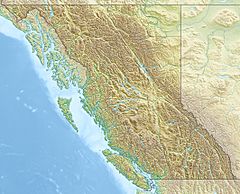
The river starts at Little Ball Lake. This lake is found inside Mount Edziza Provincial Park. The Little Iskut River flows for about 45 km (28 mi). It generally flows north, then turns southeast and south. It joins the Iskut River near a place called Cascade Falls.
The area drained by the Little Iskut River is about 453 km2 (175 sq mi). This area is called its watershed. The river's average water flow is about 12.8 m3/s (450 cu ft/s). The land around the river is mostly conifer forest (36.8%), barren land (27.9%), and shrubland (17.3%).
The mouth of the Little Iskut River is in a remote area. It is about 73 km (45 mi) southeast of Telegraph Creek, British Columbia. It is also about 110 km (68 mi) south of Dease Lake. The river flows through the traditional lands of the Tahltan First Nation and Iskut First Nation. These are parts of the Tahltan people's territory.
Contents
Where the River Flows
The Little Iskut River begins at Little Ball Lake. This lake is just south of Kounugu Mountain. The river flows northeast through the southern part of Mount Edziza Provincial Park. Then, it turns north. It forms the southeastern edge of the park.
Tributaries and Trails
Many smaller streams flow into the Little Iskut River. These streams come from the east side of the Spectrum Range. For example, Stewbomb Creek and Bourgeaux Creek are two of these streams. They bring water from high mountains like Yeda Peak and Tadeda Peak.
An old trail called the Yukon Telegraph Trail crosses the Little Iskut River. This trail used to be part of a telegraph line. It followed Bourgeaux Creek over Raspberry Pass. The trail then continued north to Telegraph Creek on the Stikine River.
After Bourgeaux Creek, near Mowdade Lake, the Little Iskut River makes a sharp turn. It then flows southeast. Finally, it empties into the Iskut River. This happens just below Cascade Falls.
River Features
The Little Iskut River is an important branch of the Iskut River. About 5% of the land it drains is covered by glaciers. The lower part of the Little Iskut River is "braided." This means it splits into many smaller channels that weave together.
How the River Was Formed
Millions of years ago, during a time called the Miocene epoch, something amazing happened here. Lava flowed from the nearby Mount Edziza volcanic complex. This lava flowed east into the Little Iskut River valley.
The lava created a natural lava dam. This dam blocked the river's flow. Water then collected behind the dam, forming a lake called Raspberry Lake. Over time, the water from this ancient lake found a way to cut through the edge of the lava dam. This created a new path for the Little Iskut River to flow.
See also
 | James B. Knighten |
 | Azellia White |
 | Willa Brown |


