Dease Lake facts for kids
Quick facts for kids
Dease Lake
|
|
|---|---|
|
Unincorporated community
|
|
| Country | Canada |
| Province | British Columbia |
| Regional district | Kitimat–Stikine |
| Area | |
| • Total | 8.49 km2 (3.28 sq mi) |
| Population
(2021)
|
|
| • Total | 229 |
| • Density | 26.97/km2 (69.86/sq mi) |
| Time zone | UTC−08:00 (PST) |
| • Summer (DST) | UTC−07:00 (DST) |
| Area code(s) | 250 / 778 / 236 |
| Highways | |
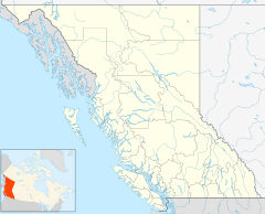
Dease Lake (pronounced DEES) is a small community in the northern part of British Columbia, Canada. It's located about 230 kilometers south of the Yukon border. You can find it on Stewart–Cassiar Highway (Highway 37), right at the southern end of the lake that shares its name.
This community is important for travelers heading north. It's the last main stop before you reach the famous Alaska Highway. It's also where you can turn off to visit Telegraph Creek and the amazing Grand Canyon of the Stikine. The Tahltan First Nation government manages the nearby Dease Lake Indian Reserve No. 9.
Dease Lake sits on a special spot called a drainage divide. This means that water on one side flows towards the Pacific Ocean (through the Stikine River). Water on the other side flows towards the Arctic Ocean (through the Liard and Mackenzie Rivers). This makes it part of the Continental Divide of the Americas, which separates water flowing to different oceans.
The community has a school and several stores. You can also find a gas station and a hotel here. There's even a Northern Lights College campus. Many visitors come to Dease Lake in the summer. They are often tourists heading to the Alaska Highway, Yukon, and Alaska. People also come for hunting and other outdoor adventures. The local economy gets a boost from gold, copper, and jade mining in the area.
History of Dease Lake
The history of Dease Lake goes back to the fur trade. In 1837, the Hudson's Bay Company set up a trading post here. It was called Lake House. Robert Campbell created this post on the shore of Dease Lake. The lake itself was named in 1834 after a man named Peter Warren Dease.
This spot became a key meeting point for miners. They were traveling to the gold rush in Cassiar. Even though the trading post was later left empty, the town around it continued to grow. It was officially renamed Dease Lake in 1934.
In the 1960s and 1970s, BC Rail started building a railway line towards Dease Lake. However, the construction was stopped before it was finished. You can still see where the railway was planned from the air today.
Geography and Climate
Dease Lake is located in a beautiful, wild part of British Columbia. To the north, you'll find Good Hope Lake (about 138 km away) and then the Alaska Highway (about 235 km away). To the south, there's Iskut (about 65 km away), Stewart (about 398 km away), and Kitwanga (about 489 km away).
What is the Climate Like in Dease Lake?
Dease Lake has a subarctic climate. This means it has mild summers and very cold, snowy winters. It's a typical climate for northern British Columbia.
- Summers: Are usually mild, but nights can be chilly.
- Winters: Are very cold with lots of snow. On average, about 212.8 centimeters of snow falls each year.
- Seasons: Autumn usually starts in early September. Winter begins in October and can last until late March or early April. Spring lasts until late May or early June.
- Snowfall: Because Dease Lake is high up, it's possible for snow to fall during any month of the year!
| Climate data for Dease Lake (Dease Lake Airport) WMO ID: 71958; coordinates 58°25′42″N 130°00′38″W / 58.42833°N 130.01056°W; elevation: 806.6 m (2,646 ft); 1991–2020 normals, extremes 1944−present |
|||||||||||||
|---|---|---|---|---|---|---|---|---|---|---|---|---|---|
| Month | Jan | Feb | Mar | Apr | May | Jun | Jul | Aug | Sep | Oct | Nov | Dec | Year |
| Record high humidex | 7.8 | 10.2 | 13.7 | 21.2 | 33.6 | 31.4 | 33.3 | 34.5 | 29.8 | 20.0 | 11.7 | 6.8 | 34.5 |
| Record high °C (°F) | 8.9 (48.0) |
11.7 (53.1) |
17.9 (64.2) |
22.2 (72.0) |
35.3 (95.5) |
33.9 (93.0) |
33.3 (91.9) |
32.2 (90.0) |
28.9 (84.0) |
20.6 (69.1) |
14.4 (57.9) |
7.9 (46.2) |
35.3 (95.5) |
| Mean daily maximum °C (°F) | −11.2 (11.8) |
−5.7 (21.7) |
0.2 (32.4) |
7.5 (45.5) |
14.5 (58.1) |
18.1 (64.6) |
19.3 (66.7) |
18.2 (64.8) |
12.9 (55.2) |
5.0 (41.0) |
−4.4 (24.1) |
−10.2 (13.6) |
5.3 (41.5) |
| Daily mean °C (°F) | −15.9 (3.4) |
−11.8 (10.8) |
−6.7 (19.9) |
1.3 (34.3) |
7.3 (45.1) |
11.4 (52.5) |
13.2 (55.8) |
12.0 (53.6) |
7.4 (45.3) |
0.6 (33.1) |
−8.5 (16.7) |
−14.9 (5.2) |
−0.4 (31.3) |
| Mean daily minimum °C (°F) | −19.7 (−3.5) |
−17.1 (1.2) |
−13.1 (8.4) |
−4.9 (23.2) |
0.1 (32.2) |
4.5 (40.1) |
6.7 (44.1) |
5.6 (42.1) |
1.8 (35.2) |
−3.5 (25.7) |
−12.3 (9.9) |
−18.1 (−0.6) |
−5.8 (21.6) |
| Record low °C (°F) | −51.2 (−60.2) |
−48.3 (−54.9) |
−42.8 (−45.0) |
−31.7 (−25.1) |
−14.2 (6.4) |
−5.6 (21.9) |
−2.2 (28.0) |
−6.1 (21.0) |
−15.0 (5.0) |
−27.3 (−17.1) |
−42.5 (−44.5) |
−46.1 (−51.0) |
−51.2 (−60.2) |
| Record low wind chill | −58.2 | −56.4 | −53.7 | −35.6 | −12.8 | −5.9 | −2.8 | −4.1 | −15.4 | −33.0 | −51.6 | −58.9 | −58.9 |
| Average precipitation mm (inches) | 34.3 (1.35) |
17.1 (0.67) |
20.4 (0.80) |
12.4 (0.49) |
27.8 (1.09) |
52.2 (2.06) |
60.3 (2.37) |
60.1 (2.37) |
49.9 (1.96) |
31.1 (1.22) |
32.4 (1.28) |
26.4 (1.04) |
424.5 (16.71) |
| Average rainfall mm (inches) | 0.4 (0.02) |
0.1 (0.00) |
1.0 (0.04) |
2.9 (0.11) |
29.0 (1.14) |
49.9 (1.96) |
66.6 (2.62) |
59.2 (2.33) |
50.5 (1.99) |
17.6 (0.69) |
2.0 (0.08) |
0.9 (0.04) |
280.0 (11.02) |
| Average snowfall cm (inches) | 45.0 (17.7) |
25.6 (10.1) |
26.0 (10.2) |
12.5 (4.9) |
5.2 (2.0) |
0.1 (0.0) |
0.0 (0.0) |
0.1 (0.0) |
2.1 (0.8) |
19.3 (7.6) |
39.7 (15.6) |
37.1 (14.6) |
212.8 (83.8) |
| Average precipitation days (≥ 0.2 mm) | 13.1 | 8.7 | 11.4 | 7.0 | 10.7 | 15.4 | 17.4 | 17.1 | 16.4 | 14.9 | 15.1 | 12.2 | 159.5 |
| Average rainy days (≥ 0.2 mm) | 0.2 | 0.2 | 0.8 | 2.3 | 9.8 | 15.0 | 17.6 | 17.2 | 15.8 | 8.4 | 1.1 | 0.4 | 88.8 |
| Average snowy days (≥ 0.2 cm) | 13.0 | 9.8 | 10.2 | 6.2 | 3.2 | 0.2 | 0.1 | 0.1 | 1.2 | 8.5 | 13.8 | 12.4 | 78.7 |
| Average relative humidity (%) (at 1300 LST) | 81 | 78 | 66 | 53 | 46 | 49 | 56 | 60 | 63 | 71 | 82 | 82 | 66 |
| Average dew point °C (°F) | −19.8 (−3.6) |
−13.5 (7.7) |
−9.1 (15.6) |
−4.8 (23.4) |
−1.5 (29.3) |
3.5 (38.3) |
7.0 (44.6) |
7.1 (44.8) |
3.5 (38.3) |
−1.3 (29.7) |
−8.8 (16.2) |
−16.5 (2.3) |
−4.5 (23.9) |
| Mean monthly sunshine hours | 58.2 | 97.3 | 142.8 | 189.5 | 211.1 | 220.4 | 212.5 | 188.2 | 117.5 | 74.1 | 50.7 | 38.0 | 1,600.3 |
| Percent possible sunshine | 26.2 | 37.2 | 39.1 | 43.9 | 40.6 | 40.4 | 39.1 | 39.4 | 30.4 | 23.2 | 21.4 | 18.9 | 33.3 |
| Source: Environment and Climate Change Canada (rain/rain days, snow/snow days, humidex, wind chill 1981–2010) Canadian Climate Normals 1981–2010 (dew point, humidity 1951–1980) Canadian Climate Normals 1951–1980 | |||||||||||||
 | Chris Smalls |
 | Fred Hampton |
 | Ralph Abernathy |


