Tahltan River facts for kids
Quick facts for kids Tahltan River |
|
|---|---|
|
Mouth of Tahltan River
|
|
| Country | Canada |
| Province | British Columbia |
| District | Cassiar Land District |
| Physical characteristics | |
| Main source | Tahltan Highland 2,197 m (7,208 ft) 58°2′39″N 131°55′52″W / 58.04417°N 131.93111°W |
| River mouth | Stikine River Near Telegraph Creek 243 m (797 ft) 58°0′35″N 130°58′51″W / 58.00972°N 130.98083°W |
| Length | 95 km (59 mi) |
| Basin features | |
| Basin size | 1,851 km2 (715 sq mi), |
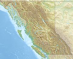
The Tahltan River is a river in British Columbia, Canada. It is a tributary of the Stikine River. This means it flows into the Stikine River. The Tahltan River flows for about 95 km (59 mi). It generally moves east and southeast.
The river joins the Stikine River near a place called Tahltan, British Columbia. The lower part of the Tahltan River forms a natural border. It separates the Tahltan Highland from the Nahlin Plateau. Both of these areas are part of the larger Stikine Plateau.
The area of land that drains into the Tahltan River is called its watershed. This watershed covers about 1,851 km2 (715 sq mi). The river's average water flow is about 21.5 m3/s (760 cu ft/s). The mouth of the Tahltan River is about 15 km (9.3 mi) northeast of Telegraph Creek.
The land in the Tahltan River's watershed is mostly covered by forests and shrubs. About 35% is conifer forest and 29.6% is shrubland. The river is named after the Tahltan people. It flows through their traditional lands.
Contents
River's Journey: Where the Tahltan River Flows
The Tahltan River starts in high, icy mountains. These mountains are on the edge of the Boundary Ranges and the Tahltan Highland. At first, the river flows south and southeast. Then it turns east and northeast. Along its way, many small streams join it.
Key Tributaries and Confluences
After flowing past Tahltan Lake, the river gets bigger. It is joined by Johnny Tashoots Creek, which flows from Tahltan Lake. Then, Harper Reed Creek and Lovell Creek join from the north. Tutesheta Creek also adds its water from the south.
The most important river that joins the Tahltan is the Little Tahltan River. This happens near the Indian reserve of Tahltan Forks 5. This area belongs to the Tahltan First Nation. After this, the Tahltan River turns east and southeast again. Many other streams join it, like Bear Creek and Middle Creek.
Finally, the Tahltan River flows south for its last few kilometers. It joins the Stikine River in a deep valley called the Grand Canyon of the Stikine. This meeting point is at the Tahltan locality and the Tahltan Indian Reserve Tahltan 1.
River's Past: History of the Tahltan River Area
The Tahltan River watershed has an interesting history. The old Yukon Telegraph Trail used to run through this area. This trail followed Tutesheta Creek, which is a tributary of the Tahltan River. The trail crossed the Tahltan River near where the Little Tahltan River joins it. This trail was important for communication in the past.
River Life: Fish and Ecology
The Tahltan River is very important for fish. It helps support the large numbers of salmon in the Stikine River. It is especially important for Chinook salmon and sockeye salmon. Other fish like steelhead trout also live here. These fish are all part of the salmonid family.
Fish Migration and Challenges
Fish can find places to lay their eggs all along the Tahltan River. However, there is a natural waterfall called Decheeka Falls. It is about 3 km (1.9 mi) upstream from where the Little Tahltan River joins. Sometimes, this waterfall can make it hard for fish to swim upstream.
In 2014, a big rock slide happened in the river. It was about 1.1 km (0.68 mi) above where the Tahltan River meets the Stikine River. This slide partly blocked the river. It made it harder for salmon to swim past. In 2018, people worked to fix this problem. They made the river wider and moved some of the rocks. This helped the fish to move more easily. However, the rocks from the slide can still be a challenge for fish when the water levels are certain ways.
See also
 | Delilah Pierce |
 | Gordon Parks |
 | Augusta Savage |
 | Charles Ethan Porter |


