Tuya River facts for kids
Quick facts for kids Tuya River |
|
|---|---|
|
Mouth of Tuya River
|
|
| Country | Canada |
| Province | British Columbia |
| District | Cassiar Land District |
| Physical characteristics | |
| Main source | High Tuya Lake Tuya Range 1,480 m (4,860 ft) 59°13′42″N 130°31′25″W / 59.22833°N 130.52361°W |
| River mouth | Stikine River 236 m (774 ft) 58°2′25″N 130°51′4″W / 58.04028°N 130.85111°W |
| Length | 200 km (120 mi) |
| Basin features | |
| Basin size | 3,575 km2 (1,380 sq mi), |
| Topo maps | NTS 104J Dease Lake NTS 104O Jennings River |
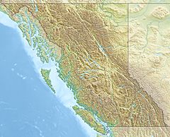
The Tuya River is a big river in British Columbia, Canada. It flows for about 200 km (120 mi) through the northwestern part of the province. This river is a main branch, or tributary, of the larger Stikine River.
The Tuya River starts at High Tuya Lake. This lake is found in Tuya Mountains Provincial Park. The river then flows south and joins the Stikine River. This meeting point is in a place called the Grand Canyon of the Stikine. The Tuya River's main smaller river joining it is the Little Tuya River.
The area around the Tuya River is quite large. It covers about 3,575 km2 (1,380 sq mi). The river's average water flow is about 36.9 m3/s (1,300 cu ft/s). The land around the river is mostly covered by shrubland and conifer forest.
The word "tuya" is also a special term in geology. It describes a type of volcano that has a flat top and steep sides. These volcanoes form when hot lava erupts through a thick glacier or ice sheet. The name comes from Tuya Butte, which is near Tuya Lake. The word "tuya" might even come from the Tahltan language.
The Tuya River flows through the traditional lands of several First Nations groups. These include the Tahltan First Nation, the Kaska Dena First Nation, and the Teslin Tlingit First Nation.
Contents
Where the Tuya River Flows
The Tuya River begins at High Tuya Lake. This lake is located in Tuya Mountains Provincial Park. It's just south of Ash Mountain, which is the highest peak in the Tuya Range.
From High Tuya Lake, the river flows south. It passes by Tuya Lake, which is southeast of Tuya Butte. Another stream called Butte Creek flows into Tuya Lake. After leaving Tuya Lake, the Tuya River continues its journey south. Many smaller streams, like Josephine Creek, also join it.
As the Tuya River keeps flowing south, it passes east of Tachilta Lakes. More streams add their water to the river, including Cody Creek and Ross Creek. A few kilometers west of Cariboo Meadows, the river meets its most important branch, the Little Tuya River.
Near the end of its journey, the Tuya River is joined by Classy Creek. It then flows under the Telegraph Creek Road. Finally, the Tuya River empties into the Stikine River. This meeting point is close to Days Ranch and the Tahltan Indian reserve called "Tahltan 10".
Rocks and Resources Around Tuya River
People have found coal in the rocks near the Tuya River. Coal has also been found in the areas where the Little Tuya River and Mansfield Creek flow. These areas are located between the towns of Dease Lake and Telegraph Creek in northwestern British Columbia.
This area is known as the Tuya River Coal Basin. Coal was first discovered here in 1904. However, most of the work to see how much coal was there happened later. This exploration took place from the late 1970s to the 1990s.
Amazing Fish and Wildlife
The Tuya River is a very important place for salmon to lay their eggs. This is called spawning. However, there are some natural barriers in the river that make it hard for fish to swim upstream. One barrier is an 11 m (36 ft) waterfall about 3 km (1.9 mi) from the river's mouth. Another big barrier is about 51 km (32 mi) further upstream.
In 2006, a landslide also created a new barrier near the mouth of the Tuya River. Because of these blockages, Chinook salmon can only spawn in the lowest part of the river.
In the 1950s, experts thought the Tuya River had the best potential for salmon spawning. They believed it could support more sockeye salmon than the entire Stikine River system.
The Pacific Salmon Commission works to protect salmon in rivers that cross the border between the US and Canada. They have made the Tuya River a key part of their efforts. Their goal is to help increase the number of fish in the Stikine River watershed.
In 2008, explosives were used to clear the landslide barrier. This helped create a path for the fish. Studies in 2009 showed that the barrier was successfully removed. Many types of salmon and trout were found in the Tuya River in 2009. These included:
See also
 | James B. Knighten |
 | Azellia White |
 | Willa Brown |


