Classy Creek facts for kids
Quick facts for kids Classy Creek |
|
|---|---|
|
Mouth of Classy Creek
|
|
| Country | Canada |
| Province | British Columbia |
| District | Cassiar Land District |
| Physical characteristics | |
| Main source | Level Mountain Nahlin Plateau 1,218 m (3,996 ft) 58°10′58″N 131°0′36″W / 58.18278°N 131.01000°W |
| River mouth | Tuya River 529 m (1,736 ft) 58°6′50″N 130°47′22″W / 58.11389°N 130.78944°W |
| Length | 20 km (12 mi) |
| Basin features | |
| Basin size | 108 km2 (42 sq mi), |
| Topo map | NTS 104J2 Classy Creek |
Classy Creek is a small river, also called a tributary, located in the northwest part of British Columbia, Canada. It flows into the Tuya River. The creek is about 20 kilometers (12 miles) long.
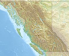
Classy Creek joins the Tuya River about 10 kilometers (6 miles) north of where the Tuya River meets the Stikine River. This area is close to the Grand Canyon of the Stikine. You can find it near Telegraph Creek Road, which is also known as British Columbia Highway 51.
The area that Classy Creek drains, called its watershed, covers about 108 square kilometers (42 square miles). The average amount of water flowing in the creek is about 0.808 cubic meters per second (28.5 cubic feet per second).
The mouth of Classy Creek is about 32 kilometers (20 miles) northeast of Telegraph Creek, British Columbia. It's also about 130 kilometers (81 miles) east of Juneau, Alaska. And it's roughly 375 kilometers (233 miles) southeast of Whitehorse, Yukon.
Most of the land around Classy Creek is covered by shrubland (46.8%). There are also mixed forests (23.3%) and conifer forests (20.3%). The rest is made up of other types of land cover.
Classy Creek flows through the traditional lands of the Tahltan people.
Contents
Where Classy Creek Starts and Flows
Classy Creek begins from lakes on the south side of a huge volcano called Level Mountain. This is close to where other creeks like Hartz Creek and Riley Creek also start. It's about 55 kilometers (34 miles) southeast of Meszah Peak. Meszah Peak is the highest point on Level Mountain.
The Creek's Journey
The creek first flows southwest, then turns south. It travels through Level Mountain's high and mostly bare lava plateau. This plateau was formed by ancient lava flows.
Classy Creek Indian Reserve
About halfway along the creek's path, there is a special area called "Classy Creek 8". This is an Indian reserve that belongs to the Tahltan First Nation. It is located just south of Mincho Lake, where the creek turns to flow south.
Joining the Tuya River
As Classy Creek gets closer to its end, it flows down into the canyon of the Tuya River. This is where it finally joins the larger Tuya River.
See also
 | Emma Amos |
 | Edward Mitchell Bannister |
 | Larry D. Alexander |
 | Ernie Barnes |


