Little Tuya River facts for kids
Quick facts for kids Little Tuya River |
|
|---|---|
|
Mouth of Little Tuya River
|
|
| Country | Canada |
| Province | British Columbia |
| District | Cassiar Land District |
| Physical characteristics | |
| Main source | Level Mountain Nahlin Plateau 1,820 m (5,970 ft) 58°29′31″N 131°22′4″W / 58.49194°N 131.36778°W |
| River mouth | Tuya River 500 m (1,600 ft) 58°14′21″N 130°43′3″W / 58.23917°N 130.71750°W |
| Length | 71 km (44 mi) |
| Basin features | |
| Basin size | 569 km2 (220 sq mi), |
| Topo maps | NTS 104J6 Beatty Creek NTS 104J7 Little Tuya River |
The Little Tuya River is a smaller river that flows into the Tuya River in the northwest part of British Columbia, Canada. It flows about 71 kilometers (44 miles) generally south and east, joining the Tuya River near a place called Cariboo Meadows. The area of land that drains into the Little Tuya River, called its watershed, is about 569 square kilometers (220 square miles). On average, about 6.69 cubic meters (236 cubic feet) of water flow through the river every second.
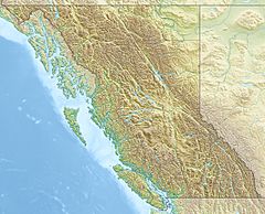
The mouth of the Little Tuya River is located about 45 kilometers (28 miles) northeast of Telegraph Creek, British Columbia. It is also about 48 kilometers (30 miles) west-southwest of Dease Lake, British Columbia. The land around the river is mostly shrubland (37.8%), conifer forest (28.8%), and mixed forest (14.6%). Some areas are also barren (9.2%), meaning they have very little plant life.
The Little Tuya River was named because it flows into the Tuya River. A tuya is a special type of volcano that has a flat top and steep sides. These volcanoes form when hot lava erupts through a thick glacier or ice sheet. The word "tuya" comes from Tuya Butte, which was named after Tuya Lake. The name itself might come from the Tahltan language. The Little Tuya River is in the traditional territory of the Tahltan First Nation, who are the Tahltan people.
River's Journey and Surroundings
The Little Tuya River begins on the east side of a huge shield volcano called Level Mountain. This area is near where other streams like the Koshin River and Beatty Creek also start. It's also close to Meszah Peak, which is the highest point on Level Mountain.
The river first flows through Level Mountain's high and mostly bare lava plateau. A lava plateau is a large, flat area made from many layers of hardened lava. After this, the river moves into rugged areas covered with forests. Its lower part also flows through these forested lands, where it is joined by its main branch, Mansfield Creek. Finally, the Little Tuya River empties into the Tuya River near the old settlement of Cariboo Meadows.
Rocks and Resources
People have found coal in the rocks along the Little Tuya River and Mansfield Creek. These coal deposits are located between the communities of Dease Lake and Telegraph Creek in northwestern British Columbia. Coal was first discovered here in 1904. However, most of the work to see if the coal could be dug up and used happened between the 1980s and 1990s.
See also
 | Toni Morrison |
 | Barack Obama |
 | Martin Luther King Jr. |
 | Ralph Bunche |


