Koshin River facts for kids
Quick facts for kids Koshin River |
|
|---|---|
|
Mouth of Koshin River
|
|
| Country | Canada |
| Province | British Columbia |
| District | Cassiar Land District |
| Physical characteristics | |
| Main source | Level Mountain Nahlin Plateau 1,465 m (4,806 ft) 58°33′57″N 131°35′2″W / 58.56583°N 131.58389°W |
| River mouth | Nahlin River 614 m (2,014 ft) 58°52′27″N 131°48′6″W / 58.87417°N 131.80167°W |
| Length | 58 km (36 mi) |
| Basin features | |
| Basin size | 437 km2 (169 sq mi), |
| Topo maps | NTS 104J12 Dididontu River NTS 104J13 Prairie Lake |
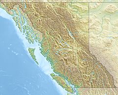
The Koshin River is a river in British Columbia, Canada. It flows into the Nahlin River. The Nahlin River then becomes part of the Taku River system. The Koshin River is about 58 km (36 mi) long. It flows mostly north through the Nahlin Plateau.
The area of land that drains into the Koshin River is called its watershed. This watershed covers about 437 km2 (169 sq mi). The amount of water flowing in the river each year is about 4.89 m3/s (173 cu ft/s). The river's end point is near Juneau, Alaska and Telegraph Creek, British Columbia.
The land around the Koshin River has different types of plant life. Almost half of the area is covered by conifer forests. There are also large areas of shrubland and some mixed forests. Other parts have barren land and wetlands.
The Koshin River flows through the traditional lands of two First Nations groups. These are the Taku River Tlingit First Nation (part of the Tlingit people) and the Tahltan First Nation (part of the Tahltan people).
Contents
River's Journey and Surroundings
The Koshin River starts on the north side of Level Mountain. This mountain is located on the Nahlin Plateau. From its start, the river flows generally north for about 58 km (36 mi).
First, the river flows northwest towards Hatin Lake. This part of the river is near Callison Ranch. After Hatin Lake, the Koshin River flows north. It winds through many wetland areas.
Tributaries and Lakes
Several smaller streams join the Koshin River. Lost Creek flows into the Koshin from Level Mountain. A few kilometers further, Kaha Creek also joins the Koshin, coming from Level Mountain. As the river continues north, it passes by lakes like Tedideech Lake. Finally, the Koshin River flows into the Nahlin River at a place called Nahlin Crossing.
Historic Trail Along the River
An old trail called the Yukon Telegraph Trail follows much of the Koshin River. This trail goes through Callison Ranch and continues north along the river to Nahlin Crossing. It's a reminder of how people used to communicate long ago.
See also
 | Dorothy Vaughan |
 | Charles Henry Turner |
 | Hildrus Poindexter |
 | Henry Cecil McBay |


