Kaha Creek facts for kids
Quick facts for kids Kaha Creek |
|
|---|---|
|
Mouth of Kaha Creek
|
|
| Country | Canada |
| Province | British Columbia |
| District | Cassiar Land District |
| Physical characteristics | |
| Main source | Level Mountain Nahlin Plateau 1,645 m (5,397 ft) 58°33′29″N 131°24′11″W / 58.55806°N 131.40306°W |
| River mouth | Koshin River 910 m (2,990 ft) 58°41′15″N 131°41′24″W / 58.68750°N 131.69000°W |
| Length | 30 km (19 mi) |
| Basin features | |
| Basin size | 95.1 km2 (36.7 sq mi), |
| Topo map | NTS 104J12 Dididontu River NTS 104J11 Granite Lake |
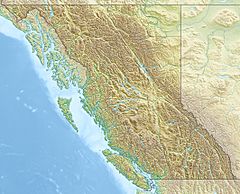
Kaha Creek is a small river, also called a tributary, that flows into the Koshin River. It is located in the northwest part of British Columbia, Canada. The creek flows mostly northwest for about 30 kilometers (19 miles). It joins the Koshin River near Hatin Lake.
The area of land that drains water into Kaha Creek is called its watershed. This watershed covers about 95.1 square kilometers (36.7 square miles). On average, about 1.19 cubic meters (42 cubic feet) of water flow through Kaha Creek every second.
Kaha Creek's mouth is located about 93 kilometers (58 miles) north of Telegraph Creek, British Columbia. It is also about 165 kilometers (103 miles) east of Juneau, Alaska, and 103 kilometers (64 miles) west of Dease Lake, British Columbia.
The land around Kaha Creek's watershed has different types of plant cover. About 41% is conifer forest (trees like pine and spruce). Another 40% is shrubland, which means it's covered in bushes and shrubs. About 12% is barren, meaning it has very little plant life.
Kaha Creek is in the traditional lands of two First Nations groups: the Tlingit Taku River Tlingit First Nation and the Tahltan First Nation. These groups have lived in this area for a very long time.
Where Kaha Creek Starts and Flows
Kaha Creek begins on the north side of a huge volcano called Level Mountain. It starts near the beginnings of other creeks like Lost Creek and Matsatu Creek. This area is about 9 kilometers (5.6 miles) north of Meszah Peak, which is the highest point on Level Mountain.
The creek first flows north and northwest across Level Mountain's high, rocky lava plateau. A plateau is a large, flat area of land that is higher than the land around it. After this, it flows through rugged areas with many trees.
In its last 2 kilometers (1.2 miles), Kaha Creek enters the flat, low-lying area around the Koshin River. It then empties into the Koshin River in the wet, marshy lands north of Hatin Lake. The old Yukon Telegraph Trail, which followed the Koshin River, crosses Kaha Creek close to where it joins the Koshin River.
See also
 | Emma Amos |
 | Edward Mitchell Bannister |
 | Larry D. Alexander |
 | Ernie Barnes |


