Mansfield Creek facts for kids
Quick facts for kids Mansfield Creek |
|
|---|---|
|
Mouth of Mansfield Creek
|
|
| Country | Canada |
| Province | British Columbia |
| District | Cassiar Land District |
| Physical characteristics | |
| Main source | Level Mountain Nahlin Plateau 1,310 m (4,300 ft) 58°18′32″N 131°6′3″W / 58.30889°N 131.10083°W |
| River mouth | Little Tuya River 627 m (2,057 ft) 58°15′14″N 130°47′15″W / 58.25389°N 130.78750°W |
| Length | 35 km (22 mi) |
| Basin features | |
| Basin size | 143 km2 (55 sq mi), |
| Topo maps | NTS 104J2 Classy Creek NTS 104J3 Tahltan River NTS 104J6 Beatty Creek NTS 104J7 Little Tuya River |
Mansfield Creek is a stream located in the northwest part of British Columbia, Canada. It is a tributary, meaning a smaller stream that flows into a larger one. Mansfield Creek flows into the Little Tuya River. The Little Tuya River then flows into the Tuya River, which is part of the much larger Stikine River watershed.
The creek travels about 35 km (22 mi) (22 miles). It generally flows towards the south and then east. It joins the Little Tuya River about 4.5 km (2.8 mi) (2.8 miles) before the Little Tuya River meets the Tuya River.
The area of land that drains into Mansfield Creek, called its watershed, covers 143 km2 (55 sq mi) (55 square miles). The average amount of water flowing through the creek each year is about 1.46 m3/s (52 cu ft/s) (51.5 cubic feet per second).
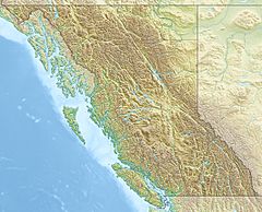
Mansfield Creek's mouth, where it empties into the Little Tuya River, is located near several towns. It is about 45 km (28 mi) (28 miles) northeast of Telegraph Creek, British Columbia. It is also about 50 km (31 mi) (31 miles) west-southwest of Dease Lake, British Columbia. The creek is roughly 210 km (130 mi) (130 miles) east of Juneau, Alaska.
The land around Mansfield Creek's watershed is mostly covered by shrubland (40.5%) and conifer forest (35.3%). There is also some mixed forest (17.6%) and other types of land cover. This area is part of the traditional territory of the Tahltan First Nation, who are the Tahltan people.
Geography of Mansfield Creek
Mansfield Creek begins high up on the southern side of Level Mountain. Level Mountain is a huge shield volcano. The creek's source is about 27 km (17 mi) (17 miles) southeast of Meszah Peak. Meszah Peak is the highest point in the Level Mountain Range. This range has many bare peaks on top of Level Mountain.
The Creek's Journey
From its starting point, Mansfield Creek flows through a large U-shaped valley. This valley is also home to Beatty Creek. Mansfield Creek then travels generally south and east. It passes through wetlands, lakes, and open, barren lands. These areas are all found on Level Mountain's high lava plateau. A lava plateau is a wide, flat area formed by ancient lava flows.
Entering the Canyon
After leaving the high plateau, Mansfield Creek enters a deep, forested canyon. This canyon was carved into the steep escarpment on the southeastern edge of Level Mountain. An escarpment is a long, steep slope or cliff. The creek flows east through this canyon. Finally, it empties into the Little Tuya River.
See also
 | Frances Mary Albrier |
 | Whitney Young |
 | Muhammad Ali |


