Thunder Lake (Alberta) facts for kids
Quick facts for kids Thunder Lake |
|
|---|---|

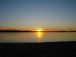
Sunset at Thunder Lake
|
|
| Location | County of Barrhead No. 11, Alberta |
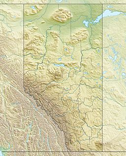
| Coordinates | 54°07′37″N 114°45′30″W / 54.12694°N 114.75833°W |
| Basin countries | Canada |
| Max. length | 2.8 km (1.7 mi) |
| Max. width | 5.4 km (3.4 mi) |
| Surface area | 7.03 km2 (2.71 sq mi) |
| Average depth | 3.0 m (9.8 ft) |
| Max. depth | 6.1 m (20 ft) |
| Surface elevation | 656 m (2,152 ft) |
Thunder Lake is a lovely lake located in Alberta, Canada. It's a popular spot for outdoor fun and is known for its beautiful sunsets.
Exploring Thunder Lake
Thunder Lake is found in northern Alberta. It is about 25 kilometres (16 mi) west of a town called Barrhead. You can also find it just south of Tiger Lily.
How Big is Thunder Lake?
The lake sits at an elevation of 656 m (2,152 ft) above sea level. It is not a very deep lake. Its average depth is about 3.0 m (9.8 ft). At its deepest point, Thunder Lake reaches 6.1 m (20 ft).
Nearby Attractions
There are some cool places right by Thunder Lake. On the north-eastern side, you'll find Thunder Lake Provincial Park. This park is a great place for camping and enjoying nature.
On the south-eastern side of the lake, there is a small community. It is also called Thunder Lake. Many people enjoy visiting or living near this peaceful lake.
 | Valerie Thomas |
 | Frederick McKinley Jones |
 | George Edward Alcorn Jr. |
 | Thomas Mensah |


