Tipaza Province facts for kids
Quick facts for kids
Tipaza Province
ولاية تيبازة
|
|
|---|---|

City of Tipaza
|
|

Map of Algeria highlighting Tipaza
|
|
| Country | |
| Capital | Tipaza |
| Area | |
| • Total | 2,166 km2 (836 sq mi) |
| Population
(2008)
|
|
| • Total | 617,661 |
| • Density | 285.16/km2 (738.57/sq mi) |
| Time zone | UTC+01 (CET) |
| Area Code | +213 (0) 24 |
| ISO 3166 code | DZ-42 |
| Districts | 10 |
| Municipalities | 28 |
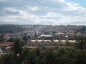
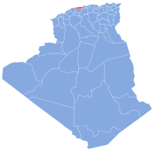
Tipaza (also called Tipasa) is a special area in Algeria called a wilaya, or province. It's located right on the coast, which means it has beaches and a view of the sea. The main city and capital of this province is also called Tipaza. It's about 50 kilometers (31 miles) west of Algiers, the capital city of Algeria.
Contents
History of Tipaza Province
Tipaza Province was created in 1984. Before that, it was part of another province called Blida Province. Creating new provinces helps manage different parts of the country better.
How Tipaza Province is Organized
Tipaza Province is split into smaller sections to help with its administration. Think of it like a big school district being divided into smaller zones.
Districts of Tipaza
The province has 10 main areas called daïras, or districts. Each district helps manage the towns and villages within its borders.
- Ahmer El Aïn
- Bou Ismaïl
- Cherchell
- Damous
- Fouka
- Gouraya
- Hadjout
- Koléa
- Sidi Amar
- Tipaza
Communes of Tipaza
Inside these 10 districts, there are even smaller areas called communes or municipalities. Tipaza Province has 28 of these communes. These are like local towns or villages that have their own local governments.
- Aghbal
- Ahmar El Ain
- Ain Tagourait
- Attatba
- Beni Milleuk
- Bou Ismaïl
- Bouharoun
- Bourkika
- Chaiba
- Cherchell
- Damous
- Douaouda
- Fouka
- Gouraya
- Hadjeret Ennous
- Hadjout
- Khemisti
- Kolea
- Larhat
- Menaceur
- Messelmoun
- Meurad
- Nador
- Sidi Amar
- Sidi Ghiles
- Sidi Rached
- Sidi Semiane
- Tipaza
See also
 In Spanish: Provincia de Tipasa para niños

