Tissington Trail facts for kids
The Tissington Trail is a special path in Derbyshire, England. It's perfect for walking, cycling, and horse riding. This path follows an old railway line that used to connect the towns of Ashbourne and Buxton. The trail gets its name from the nearby village of Tissington. It opened in 1971 and is now part of the National Cycle Network. The Tissington Trail is about 13 miles (21 km) long. It starts in the north at Parsley Hay and ends in the south at Ashbourne.
At Parsley Hay, a small area near Hartington, the Tissington Trail connects with another path called the High Peak Trail. This trail is 17 miles (27 km) long. It runs from High Peak Junction near Cromford, Matlock, to Dowlow, close to Buxton.
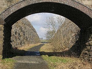
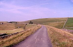
The Tissington Trail has a smooth surface made of crushed limestone. This makes it easy for cyclists, walkers, and people using wheelchairs to enjoy. You can easily get onto the trail at many points along its route. The path is quite high up, especially at Parsley Hay, where it's over 1,000 feet (300 meters) above sea level. This means you get amazing views, but it can also be windy in bad weather. The trail gently slopes downhill as you go south from Parsley Hay. However, there's a short dip and rise near Ashbourne where an old bridge was removed. Both slopes are about 40 meters (130 feet) long and quite steep.
Contents
What Can You Do on the Tissington Trail?
The Tissington Trail is a fantastic place for outdoor activities. You can walk, run, cycle, or even ride a horse along the path. It's a great way to explore the beautiful countryside of the Peak District.
Cycle Hire and Information Centres
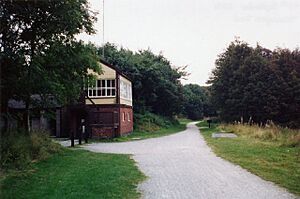
If you don't have your own bike, you can rent one! The National Park Authority has cycle hire centres at both ends of the trail. The old Hartington signal box, which is next to the trail, has been turned into an Information Centre. It's open during the summer on Saturdays, Sundays, and Bank Holidays. Here, you can find out more about the trail and the local area.
Part of the Pennine Bridleway
From Hartington station heading north, the Tissington Trail is part of a much longer route called the Pennine Bridleway. This huge trail is 130 miles (209 km) long! It's a leisure route that includes 73 miles (117 km) through Derbyshire. The Pennine Bridleway has a few different starting points.
Where Can You Find Facilities Along the Trail?
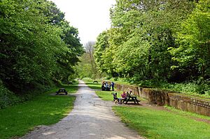
There are several places along the Tissington Trail where you can find useful facilities like car parks, toilets, and picnic spots.
- At Parsley Hay: You'll find a car park, toilets, a picnic area, visitor information, a cafe, and cycle hire. You can get straight onto the trail from here.
- At Hartington Station: There's a car park with toilets and a picnic area. You can easily access the trail.
- At Ruby Wood: This spot has a car park and a picnic area.
- At Alsop-en-le-Dale Station: There's a car park with a picnic area and easy access to the trail.
- At Tissington Station: You'll find a car park, toilets, and a picnic area. There's also a tea room in Tissington village itself.
- At Thorpe Station: This has a small car park and a picnic area, with direct access to the trail.
- At Narlows Lane, near Thorpe: There's a car park here.
- At Mapleton Lane, near Ashbourne: This location offers a car park, toilets, and cycle hire.
The History of the Tissington Trail Railway
The railway line that became the Tissington Trail was built by the London and North Western Railway (LNWR). It opened in 1899. This line connected with the Cromford and High Peak Railway at Parsley Hay. The Cromford and High Peak Railway was much older, built almost 70 years earlier. It was designed to link canals for transporting goods. The Tissington Trail railway was the very last railway line built in the Peak District.
How the Railway Was Used
The section from Parsley Hay to Ashbourne had only one track. However, the railway builders made space for a second track if it was ever needed, but it never was. There were special sections called "passing loops" at Hartington, Alsop-en-le-Dale, Tissington, and Thorpe Cloud. These allowed trains going in opposite directions to pass each other.
Even though this railway line was quite short, it was very popular with walkers and ramblers. It was most popular in the 1930s. People loved the amazing views over the Peak District. Also, the line passed close to the beautiful area of Dovedale. For a while, you could even travel directly from London Euston to Buxton and Manchester without changing trains! A daily train also carried local milk to London.
Why the Railway Closed
The railway line passed through an area where not many people lived. This meant it didn't have enough passengers or goods to transport to stay open. Regular passenger trains stopped running in 1954. All services between Ashbourne and Hartington, including special trips, ended in October 1963. The part of the route between Hartington and Parsley Hay continued until October 1967. After the railway closed, the tracks were removed, and the path was created for everyone to enjoy today.
Images for kids
 | William M. Jackson |
 | Juan E. Gilbert |
 | Neil deGrasse Tyson |


