Toms Brook, Virginia facts for kids
Quick facts for kids
Toms Brook, Virginia
|
|
|---|---|

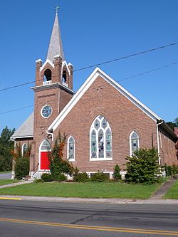
St. Peter's Lutheran Church (1904)
|
|

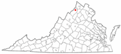
Location of Toms Brook, Virginia
|
|
| Country | United States |
| State | Virginia |
| County | Shenandoah |
| Area | |
| • Total | 0.13 sq mi (0.33 km2) |
| • Land | 0.13 sq mi (0.33 km2) |
| • Water | 0.00 sq mi (0.00 km2) |
| Elevation | 702 ft (214 m) |
| Population
(2010)
|
|
| • Total | 258 |
| • Estimate
(2019)
|
272 |
| • Density | 2,158.73/sq mi (832.95/km2) |
| Time zone | UTC−5 (Eastern (EST)) |
| • Summer (DST) | UTC−4 (EDT) |
| ZIP code |
22660
|
| Area code(s) | 540 |
| FIPS code | 51-79024 |
| GNIS feature ID | 1500231 |
Toms Brook is a small and friendly town located in Shenandoah County, Virginia, in the United States. In 2010, about 258 people called Toms Brook home.
Contents
A Look Back: Toms Brook History
During the American Civil War, an important battle called the Battle of Tom's Brook happened near the town. The Union Army won this battle. People sometimes called it "the Woodstock Races" because of how quickly the Confederate soldiers retreated.
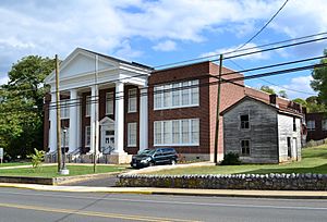
The historic Toms Brook School was added to the National Register of Historic Places in 2011. This means it's a special building protected for its history.
Where is Toms Brook?
Toms Brook is located at these coordinates: 38°56′50″N 78°26′23″W / 38.94722°N 78.43972°W.
The United States Census Bureau says the town is very small. It covers about 0.2 square miles (0.4 square kilometers) of land. There is no water area within the town limits.
Toms Brook Weather
The weather in Toms Brook has hot and humid summers. Winters are usually mild to cool. This type of weather is known as a humid subtropical climate. On climate maps, it's often shown as "Cfa."
Getting Around Toms Brook
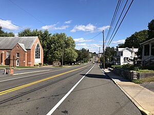
U.S. Route 11 is the main highway that goes through Toms Brook. This road helps people travel locally. It also connects to Interstate 81, which is a bigger highway nearby.
If you're on Interstate 81, you can take Exit 291. From there, you can get to Toms Brook using US 11 and Mount Olive Road (SR 651).
Who Lives in Toms Brook?
| Historical population | |||
|---|---|---|---|
| Census | Pop. | %± | |
| 1860 | 598 | — | |
| 1930 | 240 | — | |
| 1940 | 219 | −8.7% | |
| 1950 | 256 | 16.9% | |
| 1960 | 244 | −4.7% | |
| 1970 | 258 | 5.7% | |
| 1980 | 226 | −12.4% | |
| 1990 | 227 | 0.4% | |
| 2000 | 255 | 12.3% | |
| 2010 | 258 | 1.2% | |
| 2019 (est.) | 272 | 5.4% | |
| U.S. Decennial Census | |||
In the year 2000, there were 255 people living in Toms Brook. These people made up 100 households and 70 families. The town had about 1,652 people per square mile.
Most of the people living in Toms Brook were White (94.90%). A smaller number were African American, Native American, or from other backgrounds. About 0.78% of the people were Hispanic or Latino.
Families and Ages
About 30% of the households had children under 18 living with them. Many households (53%) were married couples. The average household had about 2.55 people.
The ages of people in Toms Brook varied. About 22.4% were under 18 years old. About 32.5% were between 25 and 44 years old. The average age in the town was 37 years.
See also
 In Spanish: Toms Brook (Virginia) para niños
 | Dorothy Vaughan |
 | Charles Henry Turner |
 | Hildrus Poindexter |
 | Henry Cecil McBay |


