Shenandoah County, Virginia facts for kids
Quick facts for kids
Shenandoah County
|
|||
|---|---|---|---|

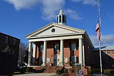
Shenandoah County Courthouse in Woodstock
|
|||
|
|||

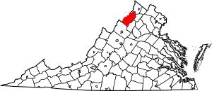
Location within the U.S. state of Virginia
|
|||
 Virginia's location within the U.S. |
|||
| Country | |||
| State | |||
| Founded | 1772 | ||
| Named for | Shenandoah River | ||
| Seat | Woodstock | ||
| Largest town | Strasburg | ||
| Area | |||
| • Total | 512 sq mi (1,330 km2) | ||
| • Land | 509 sq mi (1,320 km2) | ||
| • Water | 3.4 sq mi (9 km2) 0.7% | ||
| Population
(2020)
|
|||
| • Total | 44,186 | ||
| • Density | 86.30/sq mi (33.32/km2) | ||
| Time zone | UTC−5 (Eastern) | ||
| • Summer (DST) | UTC−4 (EDT) | ||
| Congressional district | 6th | ||
Shenandoah County is a county in the state of Virginia. It was once called Dunmore County. In 2020, about 44,186 people lived there. The main town, or county seat, is Woodstock. Shenandoah County is part of the beautiful Shenandoah Valley area of Virginia.
Contents
History of Shenandoah County
George Washington gave the name Shenandoah to the river, valley, and county. He did this to honor John Skenandoa. Skenandoa was a Christian chief from the Oneida people. He helped the Americans during the American Revolutionary War. His people, the Oneida and Tuscarora warriors, supported the Americans. They even helped the soldiers survive the harsh winter at Valley Forge.
In 1744, Colonial Governor Gooch bought the entire Shenandoah Valley. He bought it from the Six Nations of the Iroquois. The Iroquois used the valley for hunting. But European settlers had already started to move in. During Pontiac's War (1763–1766), the Shawnee people tried to push Europeans away. Their efforts reached as far east as the current county.
Shenandoah County was first created in 1772. It was named 'Dunmore County' after John Murray, 4th Earl of Dunmore. He was Virginia's last royal governor. Woodstock was chosen as the county seat. Governor Dunmore was forced out of office during the American Revolution. Because of this, the county's name was changed to 'Shenandoah' in 1778.
George Washington was a member of the Virginia House of Burgesses. He represented Frederick County from 1758 to 1765. This area included Woodstock until 1772. The new village of Woodstock was officially started in 1761. Washington supported the law that created it. He also named the town Woodstock at that time.
The town of Woodstock's website says it was started in March 1761. It was part of Frederick County back then. The town began with a land grant from Lord Fairfax. It was first named Muellerstadt (Miller Town) in 1752 by its founder, Jacob Miller. It was renamed Woodstock when George Washington helped get its charter approved. Woodstock has been the county seat of Shenandoah County since 1772.
During the American Civil War, a big battle happened here. The Battle of New Market took place in the county on May 15, 1864.
Geography and Nature
Shenandoah County covers about 512 square miles. Most of this is land (509 square miles). Only a small part (3.4 square miles) is water. Fort Valley is located here. Also, the western side of the Massanutten Mountain is within the county.
Neighboring Counties
- Hardy County, West Virginia – to the northwest
- Frederick County – to the northeast
- Warren County – to the east
- Page County – to the southeast
- Rockingham County – to the southwest
Protected Natural Areas
- Cedar Creek and Belle Grove National Historical Park (part of it is in the county)
- George Washington National Forest (part of it is in the county)
Getting Around: Transportation
The Shenandoah Valley Commuter Bus Service helps people travel. It offers bus service on weekdays. You can go from the Northern Shenandoah Valley, including Shenandoah County, to Northern Virginia and Washington, D.C.. This includes places like Arlington County and Fairfax County. Buses start in Woodstock in Shenandoah County. They also start in Front Royal and Linden in Warren County.
Main Roads
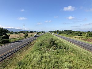
 I-81
I-81 US 11
US 11 US 48
US 48 US 211
 SR 42
SR 42 SR 55
SR 55 SR 211
 SR 263
Population Information
| Historical population | |||
|---|---|---|---|
| Census | Pop. | %± | |
| 1790 | 10,510 | — | |
| 1800 | 13,823 | 31.5% | |
| 1810 | 13,646 | −1.3% | |
| 1820 | 18,926 | 38.7% | |
| 1830 | 19,750 | 4.4% | |
| 1840 | 11,618 | −41.2% | |
| 1850 | 13,768 | 18.5% | |
| 1860 | 13,896 | 0.9% | |
| 1870 | 14,936 | 7.5% | |
| 1880 | 18,204 | 21.9% | |
| 1890 | 19,671 | 8.1% | |
| 1900 | 20,253 | 3.0% | |
| 1910 | 20,942 | 3.4% | |
| 1920 | 20,808 | −0.6% | |
| 1930 | 20,655 | −0.7% | |
| 1940 | 20,898 | 1.2% | |
| 1950 | 21,169 | 1.3% | |
| 1960 | 21,825 | 3.1% | |
| 1970 | 22,852 | 4.7% | |
| 1980 | 27,559 | 20.6% | |
| 1990 | 31,636 | 14.8% | |
| 2000 | 35,075 | 10.9% | |
| 2010 | 41,993 | 19.7% | |
| 2020 | 44,186 | 5.2% | |
| US Decennial Census 1790–1960 1900–1990 1990–2000 2010 2020 |
|||
2020 Population Details
| Group | Number in 2010 | Number in 2020 | Percent in 2010 | Percent in 2020 |
|---|---|---|---|---|
| White (not Hispanic) | 37,886 | 37,304 | 90.22% | 84.42% |
| Black or African American (not Hispanic) | 699 | 1,031 | 1.66% | 2.33% |
| Native American or Alaska Native (not Hispanic) | 71 | 84 | 0.17% | 0.19% |
| Asian (not Hispanic) | 210 | 344 | 0.50% | 0.78% |
| Pacific Islander (not Hispanic) | 6 | 8 | 0.01% | 0.02% |
| Other Race (not Hispanic) | 28 | 149 | 0.07% | 0.34% |
| Mixed Race (not Hispanic) | 516 | 1,540 | 1.23% | 3.49% |
| Hispanic or Latino (any race) | 2,577 | 3,726 | 6.14% | 8.43% |
| Total Population | 41,993 | 44,186 | 100.00% | 100.00% |
Note: The US Census counts Hispanic/Latino as an ethnic group. This means people of Hispanic/Latino background can be of any race.
Education in the County
Private Schools
High Schools
- Shenandoah Valley Academy
- Massanutten Military Academy
Elementary Schools
- Shenandoah Valley Adventist Elementary School
- Valley Baptist Christian School
Public Schools
High Schools
- Stonewall Jackson High School
- Strasburg High School
- Central High School (Woodstock)
Elementary and Middle Schools
- W.W. Robinson Elementary School (Woodstock)
- Peter Muhlenberg Middle School (Woodstock)
- Ashby-Lee Elementary School (Quicksburg)
- North Fork Middle School (Quicksburg)
- Sandy Hook Elementary School (Strasburg)
- Signal Knob Middle School (Strasburg)
Other Schools
- Triplett Tech (Mount Jackson)
- Massanutten Regional Governor's School (for high school students, in Mount Jackson)
Communities in Shenandoah County
Towns
- Edinburg (population 1,041)
- Mount Jackson (population 1,994)
- New Market (population 2,155)
- Strasburg (population 7,083)
- Toms Brook (population 258)
- Woodstock (population 5,097)
Census-Designated Places
These are areas that are like towns but are not officially incorporated.
- Basye (population 1,374)
- Bowmans Crossing
- Clary
- Columbia Furnace
- Conicville
- Fishers Hill
- Forestville
- Lebanon Church
- Locust Grove
- Hudson Crossroads
- Maurertown
- Mount Clifton
- Mount Olive
- Orkney Springs (population 58)
- Quicksburg
- Saumsville
Other Small Communities
- Alonzaville
- Bedford
- Borden
- Calvary
- Carmel
- Coleytown
- Detrick
- Hamburg
- Harrisville
- Hawkinstown
- Hepners
- Jadwyn
- Jerome
- Kings Crossing
- Lantz Mill
- Macanie
- Moore's Store
- Mount Hermon
- Oak Grove
- Oranda
- Saint Luke
- Silver City
- Swover Creek
- Valley View
- Walkers Chapel
- Wesley Chapel
- Wheatfield
- Williamsville
- Zepp
Law Enforcement
| Shenandoah County Sheriff's Office | |
|---|---|
| Abbreviation | SCSO |
| Agency overview | |
| Formed | May 26, 1772 |
| Employees | 100+ |
| Jurisdictional structure | |
| Constituting instrument |
|
| General nature | |
| Operational structure | |
| Headquarters | Woodstock, Virginia |
| Agency executive |
|
| Website | |
| Official Website: http://www.shencosheriff.com/ | |
The Shenandoah County Sheriff's Office (SCSO) is the main police agency in the county. It started on May 26, 1772. Back then, the main job of the High Sheriff was to collect taxes.
The SCSO was recognized for its professional standards from 2006 to 2022.
Politics and Voting
Shenandoah County is known for usually voting for the Republican Party. This trend started even before other parts of western Virginia began to move away from the Democratic Party. The county first voted for a Republican president in 1896. Since 1936, it has voted Republican in every presidential election. It has voted Republican in all but one election since 1920.
Before 1900, the county was mostly Democratic. But it started voting Republican in state elections around the early 1900s. By the 1920s, it became strongly Republican at the state level. This was partly because many rural voters were German American Republicans. This was a stronger group than the conservative Southern Democrats in towns like New Market, Woodstock, and Strasburg.
In 1856, Shenandoah was the only county in Virginia to vote for John C. Frémont. He was the candidate for the new Republican Party.
| Year | Republican | Democratic | Third party | |||
|---|---|---|---|---|---|---|
| No. | % | No. | % | No. | % | |
| 2024 | 17,215 | 70.30% | 6,914 | 28.23% | 360 | 1.47% |
| 2020 | 16,463 | 69.51% | 6,836 | 28.86% | 385 | 1.63% |
| 2016 | 14,094 | 68.72% | 5,273 | 25.71% | 1,141 | 5.56% |
| 2012 | 12,538 | 64.72% | 6,469 | 33.39% | 366 | 1.89% |
| 2008 | 12,005 | 62.45% | 6,912 | 35.96% | 306 | 1.59% |
| 2004 | 11,820 | 68.94% | 5,186 | 30.25% | 140 | 0.82% |
| 2000 | 9,636 | 66.68% | 4,420 | 30.58% | 396 | 2.74% |
| 1996 | 7,440 | 56.02% | 4,224 | 31.81% | 1,616 | 12.17% |
| 1992 | 7,746 | 55.74% | 3,956 | 28.47% | 2,194 | 15.79% |
| 1988 | 8,612 | 71.74% | 3,276 | 27.29% | 116 | 0.97% |
| 1984 | 9,048 | 76.03% | 2,771 | 23.29% | 81 | 0.68% |
| 1980 | 7,517 | 67.10% | 3,137 | 28.00% | 549 | 4.90% |
| 1976 | 6,296 | 64.05% | 3,364 | 34.22% | 170 | 1.73% |
| 1972 | 7,128 | 82.46% | 1,422 | 16.45% | 94 | 1.09% |
| 1968 | 5,461 | 62.91% | 1,654 | 19.05% | 1,566 | 18.04% |
| 1964 | 3,981 | 55.54% | 3,184 | 44.42% | 3 | 0.04% |
| 1960 | 4,144 | 66.85% | 2,053 | 33.12% | 2 | 0.03% |
| 1956 | 4,164 | 69.18% | 1,769 | 29.39% | 86 | 1.43% |
| 1952 | 4,284 | 71.12% | 1,734 | 28.78% | 6 | 0.10% |
| 1948 | 3,349 | 64.65% | 1,603 | 30.95% | 228 | 4.40% |
| 1944 | 3,517 | 64.12% | 1,962 | 35.77% | 6 | 0.11% |
| 1940 | 3,527 | 58.87% | 2,450 | 40.89% | 14 | 0.23% |
| 1936 | 3,152 | 52.29% | 2,861 | 47.46% | 15 | 0.25% |
| 1932 | 2,514 | 48.19% | 2,635 | 50.51% | 68 | 1.30% |
| 1928 | 3,420 | 68.28% | 1,589 | 31.72% | 0 | 0.00% |
| 1924 | 2,214 | 48.80% | 2,186 | 48.18% | 137 | 3.02% |
| 1920 | 2,683 | 56.05% | 2,077 | 43.39% | 27 | 0.56% |
| 1916 | 1,425 | 48.70% | 1,440 | 49.21% | 61 | 2.08% |
| 1912 | 706 | 27.61% | 1,336 | 52.25% | 515 | 20.14% |
| 1908 | 1,449 | 52.31% | 1,294 | 46.71% | 27 | 0.97% |
| 1904 | 1,189 | 51.32% | 1,098 | 47.39% | 30 | 1.29% |
| 1900 | 1,862 | 48.09% | 1,965 | 50.75% | 45 | 1.16% |
| 1896 | 2,102 | 49.44% | 2,052 | 48.26% | 98 | 2.30% |
| 1892 | 1,705 | 40.26% | 2,315 | 54.66% | 215 | 5.08% |
| 1888 | 2,063 | 48.44% | 2,164 | 50.81% | 32 | 0.75% |
| 1884 | 1,872 | 48.65% | 1,976 | 51.35% | 0 | 0.00% |
| 1880 | 350 | 11.23% | 2,768 | 88.77% | 0 | 0.00% |
More to Explore
- National Register of Historic Places listings in Shenandoah County, Virginia
- New Market Airport
- Shenandoah County Sheriff’s Office
- Shenandoah Local History Collection at James Madison University's Special Collections
- Shenandoah Valley Miscellaneous Ledgers, Minute Books and Registers collection at James Madison University's Special Collections
See also
 In Spanish: Condado de Shenandoah para niños


