Mount Jackson, Virginia facts for kids
Quick facts for kids
Mount Jackson, Virginia
|
|||
|---|---|---|---|
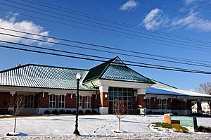
Mount Jackson Town Hall, Visitor Center, Museum and Library in December 2013
|
|||
|
|||
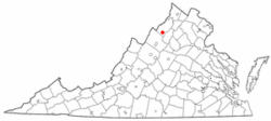
Location of Mount Jackson, Virginia
|
|||
| Country | United States | ||
| State | Virginia | ||
| County | Shenandoah | ||
| Area | |||
| • Total | 3.84 sq mi (9.93 km2) | ||
| • Land | 3.81 sq mi (9.87 km2) | ||
| • Water | 0.03 sq mi (0.07 km2) | ||
| Elevation | 909 ft (277 m) | ||
| Population
(2010)
|
|||
| • Total | 1,994 | ||
| • Estimate
(2019)
|
2,118 | ||
| • Density | 555.91/sq mi (214.65/km2) | ||
| Time zone | UTC-5 (Eastern (EST)) | ||
| • Summer (DST) | UTC-4 (EDT) | ||
| ZIP code |
22842
|
||
| Area code(s) | 540 | ||
| FIPS code | 51-53992 | ||
| GNIS feature ID | 1498404 | ||
Mount Jackson is a town in Shenandoah County, Virginia, in the United States. In 2010, about 1,994 people lived there.
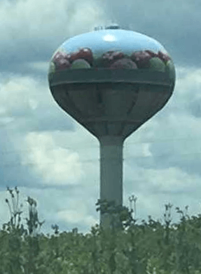
If you're driving on I-81, you'll spot Mount Jackson by its water tower. It's painted like a big basket of apples! This town has a long history. It was once a busy center for trade and railroads. It also played a big part in the Civil War. Many of its old buildings are now part of a special historic district.
Contents
A Look Back: Mount Jackson's History
In 1739, a man named Benjamin Allen bought land here. He was looking for good land and plenty of water. By 1746, he had built a grist mill. This mill used water power to grind grain. More settlers came and built their own mills. The village was first called Mount Pleasant. On January 28, 1826, its name was changed. It was renamed Mount Jackson to honor General Andrew Jackson. He was a hero from the War of 1812.
Mount Jackson became quite successful. It was located about halfway between Winchester and Staunton. This was along the Valley Turnpike in the Shenandoah Valley. Mill Creek also flowed into the North Fork of the Shenandoah River. This provided power for mills. Another important road, Howard's Lick Turnpike, started here in 1856. It led towards western Virginia.
The town grew even more with the Manassas Gap Railroad. This railroad connected Mount Jackson to Strasburg, Virginia. It was finished in 1859. The railroad helped farmers send their crops and goods to markets. The Civil War stopped further building. The railroad line ended at Mount Jackson for a while. In 1868, the Baltimore & Ohio company bought the line. They fixed it after the war. Then, the rail line was completed all the way to Harrisonburg. Mount Jackson became an important place for shipping grain, apples, and livestock. It continued to thrive as a mill and railroad town for many years.
Mount Jackson During the Civil War
Mount Jackson played a role in the Civil War. Company G of the 33rd Regiment of Virginia Infantry was formed here. This group was part of the famous "Stonewall Brigade." It was led by General Thomas "Stonewall" Jackson.
The town saw many battles and was occupied by soldiers. General Stonewall Jackson used a manor south of town as his headquarters. This was during his Valley Campaign of 1862. This spot was called Rude's Hill. It was a strong defensive position. It overlooked the Valley Pike and the Shenandoah River. Both armies fought over and camped on Rude's Hill from 1862 to 1865.
In November 1863, Union cavalry fought Confederate soldiers near Mount Jackson. The Confederates retreated through town. They crossed bridges and went to Rude's Hill. The Union troops then pulled back.
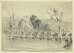
In May 1864, there was a lot of fighting near Mount Jackson. This was around the Battle of New Market, which was 7 miles away. On May 14, Confederate cavalry slowed down the Union advance. This allowed General John Breckinridge to gather his forces at New Market. After losing the battle on May 15, Union General Franz Sigel retreated. He crossed the Shenandoah River to Mount Jackson. The Union army crossed Mill Creek and burned the bridge. This stopped the Confederates from catching them.
Rude's Hill was also a place where Confederates made a stand. This was after their defeat at the Battle of Fisher's Hill in September 1864. General Jubal Early gathered his soldiers on the hill. They fought off two divisions of Union cavalry. Early then retreated from Rude's Hill.
In October 1864, Confederate Captain John McNeill led a raid. His rangers attacked Union soldiers guarding a bridge near Mount Jackson. Most Union cavalry were captured. But McNeill was badly wounded. He later died from his injuries.
As part of Union General Phil Sheridan's plan, Mount Jackson's mill was destroyed in October 1864. This was to prevent its use by the Confederates. Towards the end of the war, there was another cavalry fight at Rude's Hill. This happened on March 7, 1865.
Mount Jackson was a good place for military hospitals. This was because it was at the end of a railroad line. A Confederate hospital was built here in 1861. Wounded and sick soldiers were brought by train. Dr. Andrew Russell Meem ran the hospital. It could hold 500 patients. The hospital treated soldiers from many battles. Sometimes, Union soldiers were also treated there. A Confederate cemetery was built across from the hospital. After the war, Union troops tore down the hospital. They used the wood to build a post on Rude's Hill. Today, only the Confederate cemetery remains.
Historic Buildings and Places
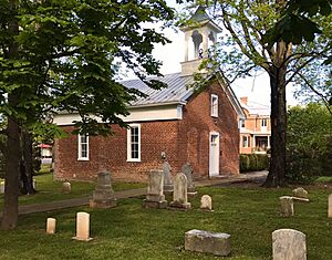
One of the most famous buildings in Mount Jackson is the Union Church. It's a small red brick church in the center of town. It was built around 1825. In 1822, a settler gave land for a church. It was meant for any Christian groups to use. The church was used as a hospital during the Civil War. Soldiers even carved things into its walls. Many early citizens are buried in the churchyard. The Union Church is on the National Register of Historic Places.
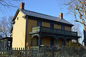
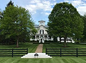
The Mount Jackson Historic District includes 125 buildings. These buildings show how the town grew. They are from the late 1800s and early 1900s. This was when the town was most successful. They are built in different styles. These include Gothic Revival and Queen Anne styles. Other important buildings are the Stoneburner House and the Lonas Store. The historic district was added to the National Register of Historic Places in 1993.
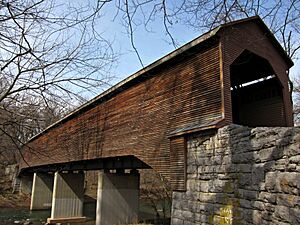
Other important places listed on the National Register of Historic Places are the Bauserman Farm, Meems Bottom Covered Bridge, and the J.W.R. Moore House.
Mount Jackson's Geography
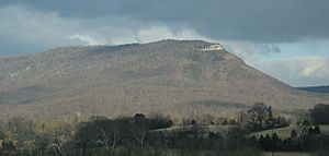
Mount Jackson is in the middle of the Shenandoah Valley. It's in the southern part of Shenandoah County, Virginia. The town is just west of Short Mountain. This is a tall ridge of the Massanutten Mountain Ridge. Short Mountain is seven miles long.
The most famous part of Short Mountain is "The Knob." It's a rocky, bare top at the mountain's south end. It's an iconic landmark that overlooks Mount Jackson. An image of The Knob is even on the town's official seal. People worked together to protect The Knob. They raised money to buy the land in 2020. Now, its 91 acres are part of the George Washington National Forest.
The United States Census Bureau says the town covers about 1.2 square miles (3.2 km2). All of this area is land.
Local Businesses
Mount Jackson has several businesses that serve the area. These include Holtzman Propane and Valley Fertilizer & Chemical Company. Bowman Andros Products has a fruit processing factory here. A well-known business in town is Route 11 Potato Chips. They moved their factory to Mount Jackson in 2008.
Getting Around Mount Jackson
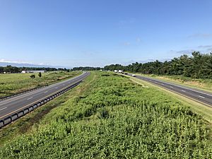
The main highway near Mount Jackson is Interstate 81. It goes south to Tennessee and north to New York. Virginia State Route 292 connects I-81 to U.S. Route 11. Route 11 is the historic Valley Turnpike. It runs through downtown Mount Jackson. Virginia State Route 263 goes west from Route 11. It leads to the Orkney Springs resort area in the mountains.
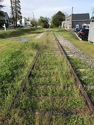
Norfolk Southern has a rail line that goes through Mount Jackson. It was part of the old Manassas Gap Railroad. However, this line is no longer used for trains. The last train traveled south from Mount Jackson in 2014. In 2016, Norfolk Southern said they would not maintain the tracks anymore. Now, the rail line is overgrown with plants. A group is working to turn this old rail line into a multi-use trail. This trail would be about 38.5 miles long. It would go from Strasburg to Broadway, passing through Mount Jackson.
Population Information
| Historical population | |||
|---|---|---|---|
| Census | Pop. | %± | |
| 1860 | 560 | — | |
| 1870 | 270 | −51.8% | |
| 1880 | 494 | 83.0% | |
| 1900 | 472 | — | |
| 1910 | 479 | 1.5% | |
| 1920 | 500 | 4.4% | |
| 1930 | 575 | 15.0% | |
| 1940 | 562 | −2.3% | |
| 1950 | 732 | 30.2% | |
| 1960 | 722 | −1.4% | |
| 1970 | 681 | −5.7% | |
| 1980 | 1,419 | 108.4% | |
| 1990 | 1,583 | 11.6% | |
| 2000 | 1,664 | 5.1% | |
| 2010 | 1,994 | 19.8% | |
| 2019 (est.) | 2,118 | 6.2% | |
| U.S. Decennial Census | |||
In 2000, there were 1,664 people living in Mount Jackson. There were 667 households. About 29.7% of households had children under 18. About 49.2% were married couples. The average household had 2.49 people.
The population was spread out by age. About 24.5% were under 18. About 15.8% were 65 or older. The average age was 36 years. For every 100 females, there were about 97.4 males.
See also
 In Spanish: Mount Jackson (Virginia) para niños
 | Toni Morrison |
 | Barack Obama |
 | Martin Luther King Jr. |
 | Ralph Bunche |


