Tontogany, Ohio facts for kids
Quick facts for kids
Village Of Tontogany, Ohio
|
|
|---|---|
|
Village
|
|

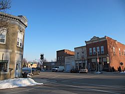
Looking East in downtown Tontogany, Ohio from Main and Broad streets toward the railroad intersection.
|
|

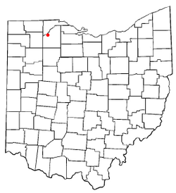
Location of Tontogany, Ohio
|
|

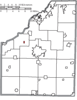
Location of Tontogany in Wood County
|
|
| Country | United States |
| State | Ohio |
| County | Wood |
| Township | Washington |
| Area | |
| • Total | 0.30 sq mi (0.79 km2) |
| • Land | 0.30 sq mi (0.79 km2) |
| • Water | 0.00 sq mi (0.00 km2) |
| Elevation | 666 ft (203 m) |
| Population
(2020)
|
|
| • Total | 387 |
| • Density | 1,268.85/sq mi (490.17/km2) |
| Time zone | UTC-5 (Eastern (EST)) |
| • Summer (DST) | UTC-4 (EDT) |
| ZIP code |
43565
|
| Area code(s) | 419 |
| FIPS code | 39-77070 |
| GNIS feature ID | 2399994 |
Tontogany is a small village located in Wood County, Ohio, in the United States. In 2020, about 387 people lived there. Every autumn, Tontogany hosts a fun event called "ToganyFest," which brings many people from the county together.
Contents
History of Tontogany
Tontogany was first planned out in 1855. It was named after a Native American chief. A post office opened in the village in 1857, helping people send and receive mail. The village officially became a town in 1874. In 2016, a train accident happened in downtown Tontogany. Six cars from a CSX train went off the tracks, causing some damage to the area.
Geography of Tontogany
Tontogany is a small village. The United States Census Bureau says the village covers about 0.31 square miles (0.79 square kilometers) of land. There is no water area within the village limits.
Population Facts
The number of people living in Tontogany has changed over the years. Here's how the population has grown and shrunk:
| Historical population | |||
|---|---|---|---|
| Census | Pop. | %± | |
| 1880 | 343 | — | |
| 1890 | 283 | −17.5% | |
| 1900 | 352 | 24.4% | |
| 1910 | 314 | −10.8% | |
| 1920 | 303 | −3.5% | |
| 1930 | 367 | 21.1% | |
| 1940 | 369 | 0.5% | |
| 1950 | 368 | −0.3% | |
| 1960 | 380 | 3.3% | |
| 1970 | 395 | 3.9% | |
| 1980 | 367 | −7.1% | |
| 1990 | 364 | −0.8% | |
| 2000 | 364 | 0.0% | |
| 2010 | 367 | 0.8% | |
| 2020 | 387 | 5.4% | |
| U.S. Decennial Census | |||
2010 Population Details
In 2010, there were 367 people living in Tontogany. These people lived in 146 different homes, and 103 of those were families. The village had about 1,184 people per square mile (457 people per square kilometer). There were 162 housing units, which are places where people can live.
Most of the people in Tontogany were White (97.8%). A small number were Native American (0.3%), and some were from other races (1.1%) or a mix of races (0.8%). About 8.7% of the population identified as Hispanic or Latino.
About 34.9% of the homes had children under 18 living there. Half of the homes (50.0%) were married couples living together. Some homes had a female head of household without a husband (13.7%), and a few had a male head of household without a wife (6.8%). About 29.5% of homes were not families.
Almost a quarter of all homes (23.3%) had only one person living in them. About 10.2% of homes had someone living alone who was 65 years old or older. On average, there were 2.51 people in each home and 2.95 people in each family.
The average age of people in the village was 37.5 years old. About 28.1% of residents were under 18. About 7.3% were between 18 and 24, and 25.1% were between 25 and 44. People aged 45 to 64 made up 26.2% of the population, and 13.4% were 65 or older. The village had slightly more males (51.2%) than females (48.8%).
See also
 In Spanish: Tontogany (Ohio) para niños
 | Jessica Watkins |
 | Robert Henry Lawrence Jr. |
 | Mae Jemison |
 | Sian Proctor |
 | Guion Bluford |

