Tootool, New South Wales facts for kids
Quick facts for kids TootoolNew South Wales |
|
|---|---|

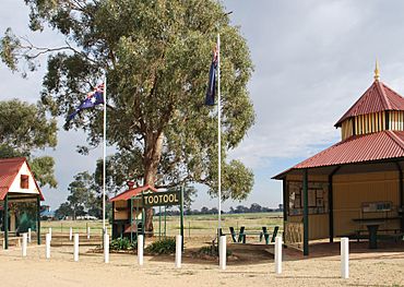
Tootool rest area
|
|
| Postcode(s) | 2655 |
| Elevation | 188 m (617 ft) |
| Location |
|
| LGA(s) | Lockhart Shire |
| County | Mitchell |
| State electorate(s) | Wagga Wagga |
Tootool is a small rural community located in the central eastern part of the Riverina region in New South Wales, Australia. It's a quiet place, surrounded by farms and open land.
Discovering Tootool
Tootool is a rural community. This means it's a place with lots of open space. It is mostly made up of farms and a few houses. It's a great example of a country town.
Where is Tootool?
Tootool is easy to find on a map. It is about 4 kilometres east of a town called French Park. If you travel west from Tootool, you will reach The Rock in about 16 kilometres. Both French Park and The Rock are also in New South Wales.
A Look Back: Tootool's History
Even small communities have interesting histories! Tootool once had its own Post Office. This Post Office opened a long time ago, on 1 August 1901. It was an important place for people to send and receive mail. However, the Post Office eventually closed its doors in 1966.
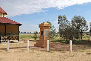
You can also find a war memorial in Tootool. This memorial helps us remember brave people from the area. It honors those who served in wars. It is a special place for reflection.
 | Victor J. Glover |
 | Yvonne Cagle |
 | Jeanette Epps |
 | Bernard A. Harris Jr. |


