Topton, Pennsylvania facts for kids
Quick facts for kids
Topton, Pennsylvania
|
|||
|---|---|---|---|

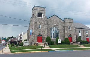
Trinity Evangelical Lutheran Church in Topton, 2015
|
|||
|
|||

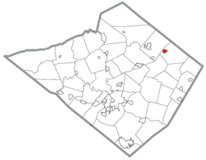
Location in Berks County, Pennsylvania
|
|||
| Country | United States | ||
| State | Pennsylvania | ||
| County | Berks | ||
| Area | |||
| • Total | 0.69 sq mi (1.80 km2) | ||
| • Land | 0.69 sq mi (1.79 km2) | ||
| • Water | 0.00 sq mi (0.00 km2) | ||
| Elevation | 486 ft (148 m) | ||
| Population
(2020)
|
|||
| • Total | 2,041 | ||
| • Estimate
(2019)
|
2,069 | ||
| • Density | 2,985.57/sq mi (1,153.05/km2) | ||
| Time zone | UTC-5 (EST) | ||
| • Summer (DST) | UTC-4 (EDT) | ||
| ZIP Code |
19562
|
||
| Area code(s) | 610 and 484 | ||
| FIPS code | 42-77104 | ||
Topton is a small borough in Berks County, Pennsylvania, United States. A borough is like a town with its own local government. In 2020, about 2,041 people lived there.
Where is Topton Located?
Topton is found at 40°30′11″N 75°42′6″W / 40.50306°N 75.70167°W. This is its exact spot on a map.
The U.S. Census Bureau says Topton covers about 0.7 square miles (1.8 square kilometers). All of this area is land.
A stream called Toad Creek flows through Topton. It goes east into the Little Lehigh Creek. A small hill on the west side of Topton separates it from the Schuylkill River area.
How Many People Live in Topton?
| Historical population | |||
|---|---|---|---|
| Census | Pop. | %± | |
| 1880 | 515 | — | |
| 1890 | 500 | −2.9% | |
| 1900 | 542 | 8.4% | |
| 1910 | 809 | 49.3% | |
| 1920 | 1,147 | 41.8% | |
| 1930 | 1,667 | 45.3% | |
| 1940 | 1,568 | −5.9% | |
| 1950 | 1,572 | 0.3% | |
| 1960 | 1,684 | 7.1% | |
| 1970 | 1,744 | 3.6% | |
| 1980 | 1,818 | 4.2% | |
| 1990 | 1,987 | 9.3% | |
| 2000 | 1,948 | −2.0% | |
| 2010 | 2,069 | 6.2% | |
| 2020 | 2,041 | −1.4% | |
| 2019 (est.) | 2,069 | 0.0% | |
| Sources: | |||
In the year 2000, there were 1,948 people living in Topton. These people lived in 805 households. A household is a group of people living together.
About 31% of households had children under 18 years old. Most households (56%) were married couples. Around 24% of households were single people living alone.
The average age of people in Topton was 38 years old. About 23% of the people were under 18. Around 15% were 65 or older.
The average income for a household in Topton was about $45,888 in 2000. For families, the average income was about $56,667.
Getting Around Topton
As of 2019, Topton had about 9.81 miles of public roads. Most of these roads (8.95 miles) are taken care of by the borough itself. The rest (0.86 miles) are maintained by the state's Department of Transportation.
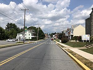
Topton does not have any major numbered highways going through it. The main roads you'll find in the borough are Weis Street, Main Street, and Home Avenue.
See also
 In Spanish: Topton para niños
 | Delilah Pierce |
 | Gordon Parks |
 | Augusta Savage |
 | Charles Ethan Porter |


