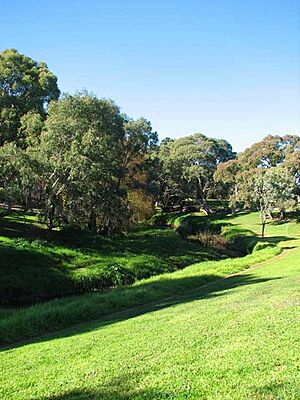
Torrens Linear Park facts for kids
The Torrens Linear Park is a special park in Australia. It was finished in 1997 and was the first park of its kind in the country. It's also the largest park that stretches from hills all the way to the coast!
This park was first planned to help stop floods along the River Torrens. The river flows from the Adelaide Hills, through the city of Adelaide, and out to the sea.
You can walk or ride your bike on a path that goes for about 30 kilometers (19 miles) through the park. The path starts in Athelstone in the north-east. It goes through the Northern Parklands in the city of Adelaide. Finally, it reaches the river's end at Henley Beach in the west.
As you travel through the park, especially in the city area, you'll see famous places. These include the Adelaide Zoo, the Adelaide Botanic Gardens, the Festival Theatre, and Elder Park. There are paths for walking and cycling on both sides of the river for most of the park. There's also a path along one side of the O-Bahn Busway.
Why Was the Torrens Linear Park Created?
For a long time, the River Torrens valley, especially the parts closer to the sea, became very dirty after people settled there in 1836. When forests were cut down, more water ran off the land. This caused big floods in 1917 and 1933.
To help with flooding, a new channel called Breakout Creek was built in 1937. This channel sent floodwaters straight to the sea. This also made it possible to build more houses in the western parts of the city, especially after World War II. Many houses were also built in the eastern areas.
People realized that more houses meant more water runoff, which could lead to even more floods. So, in the 1950s and 1960s, different ideas were suggested to stop floods. Some ideas were to cover the river with concrete or put it in an underground pipe.
How the Park Idea Came to Life
The idea for the Torrens Linear Park was different. It suggested using the river valley for two things at once:
- As a green, open space for people to enjoy.
- To help control floods.
This idea was first written down in studies in 1979 and 1980. The plan for the River Torrens Linear Park and Flood Mitigation Scheme was approved by the government in 1981. Another study even suggested adding a transport option to a part of the park, which became the O-Bahn guided busway.
Building the park needed many groups to work together. The state government bought the land and did the flood control work. The local councils (there were 12, now 8) along the river helped make the park beautiful and built the walking and cycling paths.
Work on the park started in January 1982. It took many years to complete, finally finishing in September 1997.
Protecting the Park for the Future
To make sure the Torrens Linear Park would always be there for people to enjoy, a special law was passed. This law, called the River Torrens Linear Park Act, was approved on June 21, 2006. It protects the park from being used for other buildings or developments.
Between 2007 and 2008, a new underground water pipe was built along an eastern part of the park. This pipe carries water from Gorge Weir to the Hope Valley Reservoir. In 2012, the land where an old open water channel used to be was added to the Linear Park, making it even bigger.
 | Stephanie Wilson |
 | Charles Bolden |
 | Ronald McNair |
 | Frederick D. Gregory |


