
Tortequesne facts for kids
Quick facts for kids
Tortequesne
|
||
|---|---|---|
|
||

Tortequesne
Location in France

Tortequesne
Location in Hauts-de-France
|
||
| Country | France | |
| Region | Hauts-de-France | |
| Department | Pas-de-Calais | |
| Arrondissement | Arras | |
| Canton | Vitry-en-Artois | |
| Intercommunality | Communauté de communes Osartis | |
| Area
1
|
3.37 km2 (1.30 sq mi) | |
| Population
(1999)
|
686 | |
| • Density | 203.6/km2 (527.2/sq mi) | |
| Time zone | UTC+01:00 (CET) | |
| • Summer (DST) | UTC+02:00 (CEST) | |
| INSEE/Postal code |
62825 /62490
|
|
| Elevation | 36–71 m (118–233 ft) (avg. 42 m or 138 ft) |
|
| 1 French Land Register data, which excludes lakes, ponds, glaciers > 1 km2 (0.386 sq mi or 247 acres) and river estuaries. | ||

Tortequesne is a small town, also known as a commune, located in the northern part of France. It is found in the Nord-Pas-de-Calais region, which is like a large state or province. Within this region, Tortequesne is part of the Pas-de-Calais department, which is a smaller area similar to a county.
About Tortequesne
Tortequesne is a quiet place with a population of 686 people, based on a count from 1999. It is situated in the Arras area and is part of the Vitry-en-Artois canton. A canton is a small administrative area in France.
Geography and Location
The village of Tortequesne is located at about 50.29 degrees north latitude and 3.03972222222 degrees east longitude. Its elevation, or how high it is above sea level, ranges from 36 meters (about 118 feet) to 71 meters (about 233 feet). The average elevation is 42 meters (about 138 feet). The total area of the commune is 3.37 square kilometers (about 1.3 square miles).
Local Government
Like all communes in France, Tortequesne has a mayor who helps run the town. André Martin was the mayor from 2008 to 2014. The commune is also part of a group called the Communauté de communes Osartis. This group helps different towns work together on shared projects and services.
Images for kids
-
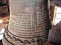
‘Jeanne-Juliette’, the church bell, installed in 1923

See also
 In Spanish: Tortequesne para niños
