Toyahvale, Texas facts for kids
Quick facts for kids
Toyahvale
|
|
|---|---|
| Country | United States |
| State | Texas |
| County | Reeves |
| Elevation | 3,323 ft (1,013 m) |
| Population
(2000)
|
|
| • Total | approx. 60 |
| Time zone | UTC-6 (Central (CST)) |
| • Summer (DST) | UTC-5 (CDT) |
| ZIP codes |
79786
|
| GNIS feature ID | 1370067 |
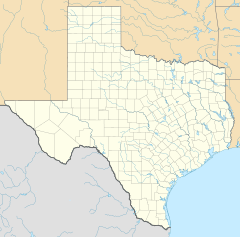
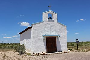
Toyahvale is a small, unincorporated community in southern Reeves County, Texas, United States. It is located along State Highway 17 and FM 3078. This community is south of Pecos, which is the main town of Reeves County.
About Toyahvale
Even though their names sound similar, Toyahvale is different from the town of Toyah. Toyah is about 25 miles (40 km) north of Toyahvale. Toyahvale sits at an elevation of 3,323 feet (1,013 meters) above sea level. Even though it's a small community, it has its own post office with the ZIP code 79786.
How Many People Live Here?
The number of people living in Toyahvale has changed over the years.
- In 1925, about 25 people lived there.
- By 1926, the population grew to 150.
- In 1933, it went back down to 25 people.
- From 1950 to 1990, the population stayed around 50 to 60 people.
- The most recent count in 2000 showed about 60 people living in Toyahvale.
The Name Toyahvale
The name "Toyahvale" is a portmanteau. This means it's a word made by blending parts of two other words. The first part, "Toyah," comes from a local Native American word meaning "flowing water." The second part, "vale," means a valley. So, Toyahvale means "valley of flowing water."
The community started after 1884. Its first post office opened in 1894. This post office closed in 1931 but reopened just two years later in 1933. Toyahvale was also the end point for the Pecos Valley Southern Railway until 1971. Today, Toyahvale is known for being the location of Balmorhea State Park, a popular place to visit.
Climate
Toyahvale has a semi-arid climate. This type of climate means it is generally dry, but not as dry as a desert. On climate maps, this is often shown as "BSk."
 | Toni Morrison |
 | Barack Obama |
 | Martin Luther King Jr. |
 | Ralph Bunche |


