
Tronadora facts for kids
Quick facts for kids
Tronadora
|
|
|---|---|
|
District
|
|

Tronadora
|
|

Tronadora
Location in Costa Rica
|
|
| Country | |
| Province | Guanacaste |
| Canton | Tilarán |
| Area | |
| • Total | 142.28 km2 (54.93 sq mi) |
| Elevation | 600 m (2,000 ft) |
| Population
(2011)
|
|
| • Total | 1,795 |
| • Density | 12.616/km2 (32.675/sq mi) |
| Time zone | UTC−06:00 |
| Postal code |
50803
|
Tronadora is a district in Costa Rica. It's part of the Tilarán canton, located in the Guanacaste province. This area sits on the west shore of Lake Arenal.
You can reach Tronadora by road from Tejona and Tilarán using Route 142. The weather here can change quickly. This is because it's where the Pacific coast weather and the lake weather meet. Tronadora is also cooler and drier than the Pacific coast. This is due to its higher elevation of about 614 meters (2014 feet).
Contents
What is Tronadora Like?
Tronadora covers an area of 142.28 square kilometers. It is located at an elevation of 600 meters above sea level.
Nearby Communities
Several small communities are part of Tronadora. These include Arenal Viejo, Colonia Menonita, Río Chiquito Abajo, and Silencio.
How Many People Live Here?
Tronadora has been home to many people over the years. We can see how its population has changed:
| Historical population | |||
|---|---|---|---|
| Census | Pop. | %± | |
| 1927 | 734 | — | |
| 1950 | 1,614 | 119.9% | |
| 1963 | 2,565 | 58.9% | |
| 1973 | 2,623 | 2.3% | |
| 1984 | 1,505 | −42.6% | |
| 2000 | 1,745 | 15.9% | |
| 2011 | 1,795 | 2.9% | |
|
Instituto Nacional de Estadística y Censos |
|||
According to the 2011 census, Tronadora had a population of 1,795 people.
Getting Around Tronadora
Tronadora is connected by several important roads.
Road Routes
The district is covered by these main road routes:
 National Route 926
 National Route 936
Images for kids
-
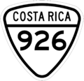
National Route 926 sign
-
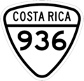
National Route 936 sign


See Also

- In Spanish: Tronadora (Tilarán) for kids
