Trooper, Pennsylvania facts for kids
Quick facts for kids
Trooper
|
|
|---|---|

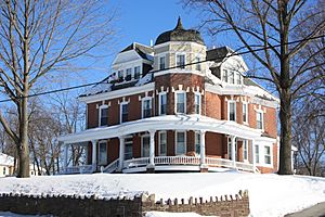
Victorian house on Ridge Pike
|
|
| Country | United States |
| State | Pennsylvania |
| County | Montgomery |
| Township | Lower Providence |
| Area | |
| • Total | 2.4 sq mi (6 km2) |
| • Land | 2.4 sq mi (6 km2) |
| • Water | 0.0 sq mi (0 km2) |
| Elevation | 377 ft (115 m) |
| Population
(2010)
|
|
| • Total | 5,744 |
| • Density | 2,390/sq mi (924/km2) |
| Time zone | UTC-5 (EST) |
| • Summer (DST) | UTC-4 (EDT) |
| ZIP code |
19403
|
| Area code(s) | 610 |
Trooper is a community in Lower Providence Township, Montgomery County, Pennsylvania, United States. It is known as a census-designated place (CDP). This means it is an area that the government uses for counting people and collecting statistics. In 2010, about 5,744 people lived in Trooper.
Contents
Where is Trooper Located?
Trooper is found in the state of Pennsylvania. Its exact location is at coordinates 40.148845 degrees North and 75.397170 degrees West.
The community covers a total area of about 2.4 square miles. All of this area is land, meaning there are no large bodies of water within its boundaries.
Who Lives in Trooper?
This section looks at the people who live in Trooper and how the population has changed over time.
Population Changes Over Time
The number of people living in Trooper has changed through the years.
| Historical population | |||
|---|---|---|---|
| Census | Pop. | %± | |
| 1990 | 5,137 | — | |
| 2000 | 6,061 | 18.0% | |
| 2010 | 5,744 | −5.2% | |
| 2020 | 5,481 | −4.6% | |
In 1990, there were 5,137 people. By 2000, the population grew to 6,061. In 2010, it slightly decreased to 5,744. The most recent count in 2020 showed 5,481 residents.
Community Makeup
In 2010, most people in Trooper were White (86.9%). Other groups included Black or African American (2.2%) and Asian (6.8%). A small number of people were Native American or Alaskan Native (0.1%). Some people identified as being of two or more races (1.0%). About 3.2% of the population had Hispanic or Latino family backgrounds.
In 2000, there were 2,056 households in Trooper. A household is a group of people living together. Most of these (70.0%) were married couples. About 42.1% of households had children under 18 living with them. The average household had about 2.95 people.
The median age in Trooper in 2000 was 38 years old. This means half the people were younger than 38 and half were older. About 29.1% of the population was under 18. Also, 11.5% of residents were 65 years or older.
Education in Trooper
The Methacton School District is responsible for the schools that serve the Trooper area.
Elementary Schools
Parts of Trooper are served by different elementary schools. These include Eagleville Elementary School, Woodland Elementary School, and Arrowhead Elementary School.
Middle and High Schools
For older students, there are Skyview Upper Elementary School and Arcola Intermediate School. Both of these schools are located within the Trooper CDP. Methacton High School serves all parts of the district. It is located close to the Eagleville community.
Other Schools
The Roman Catholic Archdiocese of Philadelphia also runs a school nearby. This school is called Visitation B.V.M. School. It is located in West Norriton Township, which is close to Trooper.
See also
 In Spanish: Trooper (Pensilvania) para niños


