Tugaloo facts for kids
Tugaloo (pronounced Too-gah-loo), also known as Dugiluyi (ᏚᎩᎷᏱ) in the Cherokee language, was an important Cherokee town. It was located on the Tugaloo River, right where Toccoa Creek flows into it. This spot is in what we now call Stephens County, Georgia.
Long ago, different groups of Native American people lived here. The South Appalachian Mississippian culture built a large platform mound and a village. This place was a key center for their leaders and important ceremonies.
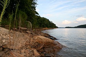
Another historic Cherokee town called Estatoe was about six miles up the river. Both Tugaloo and Estatoe, including their ancient sites, are now covered by the waters of Lake Hartwell. This lake was created when the Hartwell Dam was built.
What's in a Name?
The Cherokee name for Tugaloo was Dugiluyi (ᏚᎩᎷᏱ), sometimes shortened to Dugilu (ᏚᎩᎷ). In English, people spelled it in many ways, like Tugalo or Toogoola.
The exact meaning of Tugaloo in Cherokee is not fully known. However, it seems to describe a "place where streams meet."
Tugaloo's Story
Early 1700s Events
Tugaloo was one of the Cherokee "Lower Towns." These towns were in what is now southwestern South Carolina and northeastern Georgia. The English traders and settlers used "Lower Towns" to describe Cherokee communities along the Keowee River and Tugaloo River. These Cherokee people spoke the Eastern Dialect of their language.
In 1715, a military group led by Colonel Maurice Moore traveled to the Cherokee Lower Towns. They arrived at Tugaloo on December 29, 1715. An important person on this trip, George Chicken, said Tugaloo was "the most ancient town in these parts." He helped convince Cherokee leaders to join the English in fighting other Native American groups.
In 1716, a sad event happened at Tugaloo. The Cherokee killed eleven ambassadors from the Lower Creek people. This event, known as the Tugaloo Massacre, led to more conflict between the Cherokee and the Lower Creek. By 1717, a trading post was set up at Tugaloo.
Later Times
After the American Revolutionary War, in 1788, General Joseph Martin visited Tugaloo. He was a U.S. agent working with Native American groups. From Tugaloo, he wrote a letter to Alexander McGillivray, a leader of the Creek Nation. Martin wanted to end problems between the United States and the Creek. He also asked for help getting back horses that were supposedly stolen.
This letter was found by others, and it caused an investigation. However, it was later discovered that Martin was secretly working for Patrick Henry. He was trying to find out if McGillivray was connected to the Spanish, who were active in nearby Spanish Florida. Martin was cleared of any wrongdoing.
In 1798, Benjamin Hawkins, who was in charge of relations with Native Americans, used Tugaloo as a landmark. It helped mark the border between the state of Georgia and the Muscogee Creek lands.
After the forced removal of the Cherokee and Creek peoples in the late 1830s, European Americans moved into these lands. They started large cotton farms, and much of the area was used for farming for many years.
Modern Discoveries
In 1959, archaeologists from the University of Georgia studied the areas of Tugaloo and Estatoe. They did this before the sites were flooded by Lake Hartwell. This was a "salvage study," meaning they worked quickly to find and collect as much information and as many artifacts as possible before the ancient sites were covered by water.
Today, the Tugaloo Bend Heritage Park has been created near where Estatoe was believed to be. This park protects 87 acres of land. For a long time, after the Cherokee were forced to leave, this land was used for farming.
The park is at the northern end of the Historic Tugaloo River Corridor. This corridor is about 10 miles long and goes downriver to Lake Hartwell. Along this path, you can find signs of early frontier settlements, old farm properties, and important Cherokee sites, including where the Tugaloo mound and village once stood.
 | Chris Smalls |
 | Fred Hampton |
 | Ralph Abernathy |


