Tunitas, California facts for kids
Quick facts for kids
Tunitas, California
|
|
|---|---|
| Country | United States |
| State | California |
| County | San Mateo |
| Time zone | UTC-8 (Pacific (PST)) |
| • Summer (DST) | UTC-7 (PDT) |
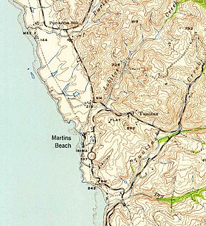
Tunitas, California was once a small, unnamed community in San Mateo County. It was located along the coast of California. Today, this area is known as Lobitos.
Contents
What Was Tunitas?
Tunitas was an "unincorporated community." This means it was a group of homes and buildings that were not part of an official town or city. It was a small settlement that grew over time.
Over the years, Tunitas became what is sometimes called a "ghost town." This happens when most people move away, and the community becomes very small or disappears.
Where Was Tunitas Located?
The original Tunitas community was found right on State Route 1. This famous highway runs along the California coast. However, the path of State Route 1 was later changed.
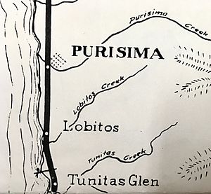
When the highway moved, the area where Tunitas once stood was renamed. It is now known as Lobitos. This new name refers to a nearby creek.
The Meaning Behind the Name
The name "Tunitas" comes from a Spanish phrase: Arroyo de las Tunitas. This phrase was used on old maps from around 1839. These maps were for land grants like San Gregorio and Canada Verde.
The name means "a small bush." This bush grew a lot near the mouth of a creek in the area. Its fruit was known as "sea apples" to people living there long ago.
Tunitas and the Ocean Shore Railroad
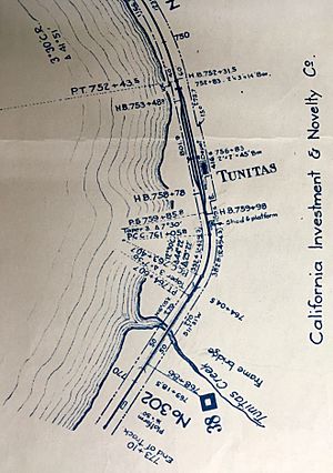
Tunitas was also connected to the Ocean Shore Railroad. This railroad was planned to run along the coast. It would connect San Francisco to Santa Cruz.
Early plans for the railroad included a stop or "flag stop" near Tunitas. This stop was often called Lobitos, after the nearby creek. The railroad helped connect small coastal communities like Tunitas to bigger cities.
The Ocean Shore Railroad was built in the early 1900s. It was a big project for its time. Even though the railroad eventually stopped running, it played a role in the history of places like Tunitas.
 | Valerie Thomas |
 | Frederick McKinley Jones |
 | George Edward Alcorn Jr. |
 | Thomas Mensah |


