Turtletown, Tennessee facts for kids
Quick facts for kids
Turtletown, Tennessee
|
|
|---|---|

Turtletown
|
|
| Country | United States |
| State | Tennessee |
| County | Polk |
| Elevation | 1,558 ft (475 m) |
| Time zone | UTC-5 (Eastern (EST)) |
| • Summer (DST) | UTC-4 (EDT) |
| ZIP code |
37391
|
| Area code(s) | 423 |
| GNIS feature ID | 1327270 |
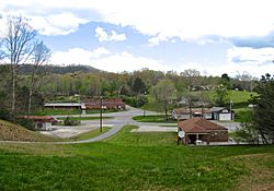
Turtletown is a small place in Polk County, Tennessee, in the United States. It's called an unincorporated community, which means it doesn't have its own local government like a city or town. Instead, it's managed by the county.
Turtletown is found along Tennessee State Route 68. It's about 6.5 miles (10.5 km) north-northeast of another place called Ducktown.
What is Turtletown Like?
Turtletown is mostly a mountainous area. It's covered in thick forests, but you'll also see some open spaces. These open areas are usually where farmers have cleared land, or where there are ponds and roads. You can also find many small creeks flowing through the area.
Turtletown has its own post office, which uses the ZIP code 37391. This helps people send and receive mail.
What About Its Borders?
Sometimes, the exact edges of Turtletown can be a bit confusing. Some people believe that a small part of it is known as "Dogtown." This name has even appeared on a few local maps, like those from the USGS and the U.S. Forest Service. However, other people think it's all just Turtletown, and Dogtown isn't a real separate place.
The Old School
Right across the street from the Post Office, there's an old building that used to be the Turtletown School. It's not used as a school anymore.
How Many People Live Here?
According to the United States Census Bureau, about 1,325 people live in the area considered Turtletown. This is a small part of the total population of Polk County, which has around 16,730 residents.
 | Tommie Smith |
 | Simone Manuel |
 | Shani Davis |
 | Simone Biles |
 | Alice Coachman |


