Ulverston Canal facts for kids
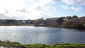
The Ulverston Canal is a special waterway in Ulverston, Cumbria, England. It's about 2 kilometers (1.25 miles) long. The canal goes from the town all the way to the coast of Morecambe Bay. It's super straight and completely flat! This canal is unique because it doesn't connect to the bigger canal network in England.
Contents
The Ulverston Canal Story
How the Canal Was Built
Even though Ulverston was about 2 kilometers (1.25 miles) from the sea, it was made a port in 1774. This meant certain goods could be shipped without extra taxes. Big ships could reach the shore at high tide. Trade in things like slate and ore was growing fast.
People started getting excited about building canals everywhere. A local lawyer, William Burnthwaite, called a meeting in 1791. They wanted to build a canal to make it easier for ships to reach Ulverston. The first idea was to build it for about £2,000.
By 1792, they had raised enough money. A famous engineer named John Rennie drew up proper plans. His plan for a ship canal, including a sea lock, would cost about £3,084. By October 1792, they had raised even more money, around £3,800. So, they decided to go ahead with the project.
A special law, called an Act of Parliament, was passed on May 8, 1793. This law allowed "The Company of Proprietors of the Ulverstone Canal Navigation" to raise £4,000. They could also raise an extra £3,000 if needed.
Work on the main canal started on August 23, 1793. It was supposed to be finished by September 1794. However, the first builders had problems and stopped working in 1795. Another company, led by H. Baird, took over. The canal was finally finished in October 1796.
The canal opened in 1796, giving Ulverston its own port. The water in the canal was 4.6 meters (15 feet) deep and 20 meters (66 feet) wide. But ships had to fit through the lock. The lock could hold vessels up to 30 meters (100 feet) long and 8.2 meters (27 feet) wide. The water level was kept steady by water from Newland Beck.
Building the canal ended up costing over £9,200. This was much more than planned! When it opened, the trade in ore was slow. In 1797, they started building a warehouse and a toll office. They also built special docks for moving slate and coal.
How the Canal Was Used
Before the Furness Railway was built, the Furness area was hard to reach by land. Mountains blocked the way, and people often had to cross dangerous sands. The canal made travel much easier.
A passenger ferry started running from Ulverston Canal to Liverpool in 1835. Later, another ferry went from Barrow-in-Furness to Fleetwood. The canal helped move goods like coal and cinders. Ships could even travel to places as far as Glasgow and Cardiff.
Many businesses grew because of the canal. Industries like charcoal burning and making wooden hoops were common. Shipbuilding, gas and chemical factories, and paper mills also created jobs. In the 1800s, Ulverston was famous for building strong wooden sailing ships. These ships were made to carry heavy loads of local ore.
Why the Canal Closed
The opening of the Furness Railway in 1846 hurt the canal's business. Trains could move goods faster and cheaper. The railway company eventually bought the canal.
Also, Barrow-in-Furness became a big, deep-water port. This meant fewer ships needed to use the Ulverston Canal. After 1878, no more ships were built in Ulverston. The canal was used for business until the First World War. It was officially closed after the Second World War in 1945.
Today, the Ulverston town council helps take care of the canal. There's a walking path on its eastern side. The western side still has factories, including a large GlaxoSmithKline factory. Glaxo bought the canal in 1974 to use it as an emergency water supply. In 2009, GlaxoSmithKline sold the canal to the Ulverston Canal Company. A special fund was also set up to help manage and keep the canal in good condition.
Exploring the Canal's Path
On the western side of the canal, there are still some industrial buildings. You can also find a place where sheep and cattle are sold. Some old buildings have been fixed up, while others are still run down.
At the very end of the canal, called Canal Foot, there's a pub called The Bay Horse. It's on the site of an old inn from the 1700s. This spot is also part of the Cumbria Coastal Way, a long walking path.
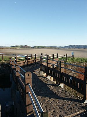
The canal starts at Hammerside Hill near Morecambe Bay. It ends at a basin and docks in Ulverston. At its start, there's a 34-meter (112-foot) long sea lock. This is the only lock on the whole canal. There's also a public swing bridge over the canal at Hammerside.
Cool Places Along the Canal
| Point | Coordinates (Links to map resources) |
OS Grid Ref | Notes |
|---|---|---|---|
| Ulverston basin | 54°11′51″N 3°05′01″W / 54.1976°N 3.0837°W | SD294785 | |
| Furness Railway bridge | 54°11′47″N 3°04′45″W / 54.1964°N 3.0793°W | SD296783 | |
| Old railway bridge | 54°11′37″N 3°04′03″W / 54.1936°N 3.0676°W | SD304780 | |
| Entrance lock | 54°11′25″N 3°03′14″W / 54.1903°N 3.0539°W | SD313776 | Morecambe Bay |
 | Claudette Colvin |
 | Myrlie Evers-Williams |
 | Alberta Odell Jones |


