Union Island (California) facts for kids

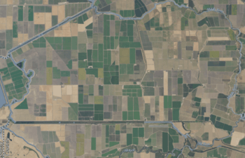
USGS aerial imagery of the island.
|
|
| Geography | |
|---|---|
| Location | Northern California |
| Coordinates | 37°50′15″N 121°30′56″W / 37.8374268°N 121.5155042°W |
| Adjacent bodies of water | Sacramento–San Joaquin River Delta |
| Administration | |
|
United States
|
|
| State | |
| County | San Joaquin |
Union Island is a small piece of land surrounded by water, located in the San Joaquin River delta in California. It's part of San Joaquin County. The island is looked after by special groups called Reclamation Districts 1 and 2, which help manage the land and water. You can find Union Island at these coordinates: 37°50′15″N 121°30′56″W / 37.8374268°N 121.5155042°W.
Contents
Discover Union Island
Union Island is a fascinating place within California's large delta system. It might be small, but it plays a part in the important agricultural areas of the state. Imagine an island that's mostly flat, surrounded by winding rivers and channels. That's Union Island!
Where is Union Island?
Union Island is located in the northern part of California. Specifically, it sits within the Sacramento–San Joaquin River Delta. This delta is a huge area where the Sacramento and San Joaquin Rivers meet. They then flow into San Francisco Bay. Union Island is found in the southern part of this delta, within San Joaquin County. This county is known for its rich farmland.
What is a River Delta?
A river delta is a special type of landform. It's created when a river flows into a larger body of water, like a sea, lake, or another river. As the river slows down, it drops the mud, sand, and tiny rocks it has been carrying. Over a long time, these materials build up, forming new land. This new land often looks like a triangle or a fan shape. Deltas are usually very fertile, meaning they have rich soil. This makes them great for farming. The Sacramento–San Joaquin River Delta is one of the biggest in the world.
Managing the Land: Reclamation Districts
Union Island, like many other islands in the delta, is managed by groups called Reclamation Districts. These districts are local government bodies. Their main job is to protect and manage land that is often low-lying or prone to flooding. They build and maintain levees, which are like walls of earth. These levees keep the river water from flooding the island. They also manage drainage systems. This helps keep the land dry enough for farming. For Union Island, Reclamation Districts 1 and 2 work together to ensure the island remains safe and productive.
 | Aurelia Browder |
 | Nannie Helen Burroughs |
 | Michelle Alexander |


