
Uniontown, Kentucky facts for kids
Quick facts for kids
Uniontown, Kentucky
|
|
|---|---|

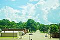
Main Street
|
|

Location of Uniontown in Union County, Kentucky.
|
|
| Country | United States |
| State | Kentucky |
| County | Union |
| Area | |
| • Total | 0.94 sq mi (2.44 km2) |
| • Land | 0.85 sq mi (2.20 km2) |
| • Water | 0.09 sq mi (0.24 km2) |
| Elevation | 364 ft (111 m) |
| Population
(2020)
|
|
| • Total | 929 |
| • Density | 1,092.94/sq mi (421.83/km2) |
| Time zone | UTC-6 (Central (CST)) |
| • Summer (DST) | UTC-5 (CDT) |
| ZIP code |
42461
|
| Area code(s) | 270 |
| FIPS code | 21-78492 |
| GNIS feature ID | 0505827 |
Uniontown is a city in Union County, Kentucky, United States. In 2020, about 929 people lived there. The John T. Myers Locks and Dam is a large structure on the river nearby. It helps boats travel safely.
Contents
History of Uniontown
Uniontown got its name because two towns, Francisburg and Locust Port, joined together in 1840. This joining formed a "union" of the two places. A post office opened in Uniontown in 1842.
Protecting Uniontown from Floods
The Ohio River flood of 1937 was a very big flood. To protect Uniontown from future floods, a large wall called a levee was built. This levee was finished in 1951.
Geography and Location
Uniontown is located at 37°46′20″N 87°55′55″W / 37.77222°N 87.93194°W. It sits right next to the Ohio River, where Highland Creek flows into it. The levee helps keep the city safe from high river levels.
Roads and Waterways
Two main roads, Kentucky Route 130 and Kentucky Route 360, meet in the center of Uniontown. Kentucky Route 130 goes over the levee and connects the city to the Uniontown Ferry Boat Dock on the river.
Land and Water Area
The city covers about 1.0 square mile (2.6 square kilometers). Most of this area is land, about 0.9 square miles (2.3 square kilometers). The rest, about 0.1 square miles (0.26 square kilometers), is water.
Natural Landmarks Nearby
The Henderson Sloughs are a special natural area. They are located east of Uniontown, right on the county line. This area is known for its important natural features.
Population Over Time
| Historical population | |||
|---|---|---|---|
| Census | Pop. | %± | |
| 1860 | 1,046 | — | |
| 1870 | 896 | −14.3% | |
| 1880 | 1,015 | 13.3% | |
| 1890 | 1,037 | 2.2% | |
| 1900 | 1,532 | 47.7% | |
| 1910 | 1,356 | −11.5% | |
| 1920 | 1,094 | −19.3% | |
| 1930 | 1,235 | 12.9% | |
| 1940 | 1,327 | 7.4% | |
| 1950 | 1,054 | −20.6% | |
| 1960 | 1,255 | 19.1% | |
| 1970 | 1,255 | 0.0% | |
| 1980 | 1,169 | −6.9% | |
| 1990 | 1,008 | −13.8% | |
| 2000 | 1,064 | 5.6% | |
| 2010 | 1,002 | −5.8% | |
| 2020 | 929 | −7.3% | |
| U.S. Decennial Census | |||
In 2000, there were 1,064 people living in Uniontown. Most people were White (91.54%), and some were African American (7.61%). A small number of people were Native American or Asian.
Community Life
Many households in Uniontown had children under 18 living with them. The average household had about 2 to 3 people. The population included people of all ages, from children to seniors.
Education in Uniontown
Students in Uniontown attend schools run by the Union County Public Schools, Kentucky.
Local Schools
- Younger students go to Uniontown Elementary.
- Older students attend Union County Middle School and Union County High School. These schools are located outside of Morganfield.
Public Library
Uniontown also has a lending library. It is a part of the Union County Public Library system. Here, people can borrow books and other materials.
Images for kids
-
Main Street in Uniontown
-

Map showing Uniontown's location in Union County
See also
 In Spanish: Uniontown (Kentucky) para niños
