Unstrut-Hainich Rural District facts for kids
Quick facts for kids
Landkreis Unstrut-Hainich
|
|
|---|---|
 |
|
| Country | |
| State | Thuringia |
| Capital | Mühlhausen |
| Area | |
| • Total | 975 km2 (376 sq mi) |
| Population
(2002)
|
|
| • Total | 117,324 |
| • Density | 120.33/km2 (311.66/sq mi) |
| Time zone | UTC+1 (CET) |
| • Summer (DST) | UTC+2 (CEST) |
| Vehicle registration | UH |
| Website | landkreis-unstrut-hainich.de |
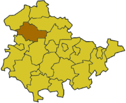
Unstrut-Hainich is a Landkreis, which is like a county or district, located in the northern part of Thuringia, a state in Germany. It's a place where many towns and villages come together to form one larger administrative area.
Contents
Discovering Unstrut-Hainich's Past
How the District Was Formed
The Unstrut-Hainich district was created on July 1, 1994. It was formed by combining two older districts: Mühlhausen and Bad Langensalza. This brought many communities together under one new administration.
Building Friendships: Partnerships
Connecting with Other Regions
Unstrut-Hainich has special friendships, called partnerships, with other areas. One partnership is with the Wetteraukreis in Hesse, another German state. This friendship started in 1990, around the time Germany became one country again. The district also has partnerships with two areas in Lithuania: Ukmerge and Raseiniai. These partnerships help people from different places learn from each other.
Exploring Unstrut-Hainich's Nature
Rivers, Hills, and a National Park
The district gets its name from two important natural features. One is the Unstrut river, which flows through the area. The other is a chain of hills called the Hainich. A large part of the Hainich became Germany's 13th national park in 1997. National parks are special places protected for their natural beauty and wildlife.
Understanding the District's Symbols
The Unstrut-Hainich Coat of Arms
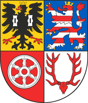
The district's coat of arms is like a special symbol that tells a story about its history. It combines symbols from different historical areas that now make up the district.
|
These symbols together show the rich history and different parts that came together to form the Unstrut-Hainich district.
Towns and Communities of Unstrut-Hainich
Major Towns and Independent Municipalities
The Unstrut-Hainich district includes several towns and many smaller communities. Some towns and municipalities manage their own affairs directly.
| Verwaltungsgemeinschaft-free towns | and municipalities |
|---|---|
|
|
Grouped Communities: Verwaltungsgemeinschaften
Many smaller towns and villages in Germany group together to share administrative tasks. These groups are called Verwaltungsgemeinschaften. It helps them manage things like local services more efficiently.
| Verwaltungsgemeinschaften | ||
|---|---|---|
|
|
|
| 1seat of the Verwaltungsgemeinschaft; 2town | ||
See also
 In Spanish: Unstrut-Hainich-Kreis para niños
 | Jackie Robinson |
 | Jack Johnson |
 | Althea Gibson |
 | Arthur Ashe |
 | Muhammad Ali |


