Upland, Indiana facts for kids
Quick facts for kids
Upland, Indiana
|
|
|---|---|
 |
|

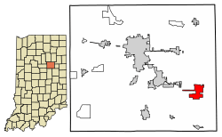
Location of Upland in Grant County, Indiana.
|
|
| Country | United States |
| State | Indiana |
| County | Grant |
| Township | Jefferson |
| Area | |
| • Total | 3.15 sq mi (8.16 km2) |
| • Land | 3.14 sq mi (8.13 km2) |
| • Water | 0.01 sq mi (0.03 km2) |
| Elevation | 912 ft (278 m) |
| Population
(2020)
|
|
| • Total | 3,821 |
| • Density | 1,217.65/sq mi (470.12/km2) |
| Time zone | UTC-5 (Eastern (EST)) |
| • Summer (DST) | UTC-4 (EDT) |
| ZIP code |
46989
|
| Area code(s) | 765 |
| FIPS code | 18-77966 |
| GNIS feature ID | 2397707 |
| Website | https://www.in.gov/towns/upland/ |
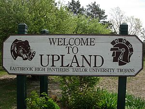
Upland (pronounced "up-land") is a small town in Indiana, United States. It is located in Grant County. Upland is famous for being the home of Taylor University, a Christian college. In 2020, about 3,821 people lived there.
Contents
History of Upland
Most of the land that is now Upland was bought by John Oswalt in the 1830s. He was a speculator, meaning he bought land hoping its value would increase. He thought a canal connecting Indianapolis and Fort Wayne might pass through the area.
The town of Upland was officially started in the late 1860s by Jacob Bugher. He planned for it to be a stop on the Indiana Central Railroad. The town's name comes from the belief that it was the highest point on the train line between Columbus and Chicago. By 1880, Upland had about 150 people. It had a school, two churches, several stores, a blacksmith shop, and a sawmill.
Upland grew a lot because of the "gas boom" in central Indiana. This boom started in 1886 and lasted until around 1900. Natural gas was found in Upland in 1888. This new resource helped the town become rich and grow quickly. By the 1890s, Upland had over 1,000 people. It had street lights, water and gas pipes, and a factory that made glass.
Taylor University moved to Upland in the summer of 1893. The school was having money problems in Fort Wayne. The gas boom allowed Upland to offer the university $10,000 in cash and 10 acres (40,000 m²) of land. This helped the university move and continue its work.
Geography of Upland
Upland is located between two larger cities. It is about one hour north of Fort Wayne by car. It is also about 1 hour and 15 minutes south of Indianapolis.
The town is also close to other universities. It is about 30 minutes from Muncie, where Ball State University is located. Upland is also about 15 minutes from Marion and Indiana Wesleyan University.
According to the 2010 census, Upland covers an area of about 3.15 square miles (8.16 km²). Most of this area is land, with only a small part being water.
Population of Upland
Upland's population has changed over the years. Here's how many people have lived in the town during different census years:
| Historical population | |||
|---|---|---|---|
| Census | Pop. | %± | |
| 1880 | 176 | — | |
| 1900 | 1,208 | — | |
| 1910 | 1,080 | −10.6% | |
| 1920 | 1,301 | 20.5% | |
| 1930 | 906 | −30.4% | |
| 1940 | 900 | −0.7% | |
| 1950 | 1,565 | 73.9% | |
| 1960 | 1,999 | 27.7% | |
| 1970 | 3,202 | 60.2% | |
| 1980 | 3,335 | 4.2% | |
| 1990 | 3,295 | −1.2% | |
| 2000 | 3,803 | 15.4% | |
| 2010 | 3,845 | 1.1% | |
| 2020 | 3,821 | −0.6% | |
| U.S. Decennial Census | |||
Upland's Population in 2010
In 2010, there were 3,845 people living in Upland. There were 872 households, which are groups of people living together. About 589 of these were families. The town had about 1,224 people per square mile (472 per km²).
The average age of people in Upland was 21.8 years old. This is quite young, partly because of the many students at Taylor University. Many households had children under 18 living with them. Most households were married couples living together.
Education in Upland
Upland has a public library called the Barton Rees Pogue Memorial Public Library. This library lends books and other materials to the community.
The town also has an elementary school, which is called Eastbrook South. As mentioned before, Upland is also the home of Taylor University.
See also
 In Spanish: Upland (Indiana) para niños
 | James Van Der Zee |
 | Alma Thomas |
 | Ellis Wilson |
 | Margaret Taylor-Burroughs |


