Upper Don Walk facts for kids
The Upper Don Walk is a fun path that stretches for about six miles (almost 10 kilometers). It connects the heart of Sheffield to a village called Oughtibridge, located northwest of the city. This path follows the beautiful River Don. Part of it also uses National Cycle Network route 627, which is a branch of the Trans Pennine Trail. The walk starts off really well, especially near the city center. The rest of the path is a mix of different surfaces, including walking paths, roads, and woodland trails.
Contents
What is the Upper Don Walk?
The Upper Don Walk is a special route designed for everyone to enjoy. It's great for walking, cycling, and even for people using wheelchairs or prams. The path also connects to other popular routes. These include the Five Weirs Walk near Lady's Bridge and the Trans Pennine Trail in Oughtibridge.
How the Walk Started
A group called the Upper Don Walk Trust was created in 2004. It was a charity made up of people who wanted to build this amazing walk. They worked hard to make sure the path could be used by many different people. This included walkers, cyclists, and even those who enjoy canoeing or fishing.
New Name, Bigger Plans
In November 2019, the Trust changed its name to the Upper Don Trail Trust. This new name shows that the path is for shared use, meaning both walkers and cyclists can enjoy it. The group also decided to make the trail even longer. They plan to extend it north of Oughtibridge, all the way to Stocksbridge and the Peak District.
Exploring the Upper Don Walk Route
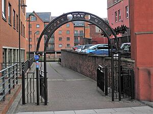
The Upper Don Walk begins (53°23′08″N 1°27′56″W / 53.38564°N 1.46547°W) in a new part of the city called Riverside Exchange. This area has a rich industrial past. It used to be known as Millsands and had a corn mill since the 1100s. Later, the Vickers family developed it for making steel.
Through Sheffield's History
The path starts on a paved surface along the south side of the river. You will pass the Nursery Street footbridge. You will also see a stone column that remembers the terrible Great Sheffield Flood of 1864. The walk then goes through the Bridgehouses roundabout using pedestrian crossings. After that, you enter the Kelham Island Quarter. Here, you can see the industrial museum, which is full of interesting history.
The Missing Bridge
There were plans for a special footbridge to connect Kelham Island back to the south side of the river. This bridge was meant to be a smaller copy of the famous Brooklyn Bridge in New York City. It would have celebrated the strong industrial links between Sheffield and Brooklyn from the 1800s.
However, big floods in 2007 stopped these plans. Even though new flood defenses were built, the bridge was never constructed. Reports from 2016 said permission was given for a new, simpler bridge. It would be about 20 meters long.
Because the bridge isn't there, the walk uses public roads like Green Lane and Ball Street. You will pass old industrial sites like the Green Lane Works and Cornish Place. Then, you cross to the north side of the Don using the Grade II listed Ball Street Bridge. After crossing, you turn left onto a riverside path that leads to the area of Neepsend.
There are no riverside paths directly through Neepsend. So, you need to follow the busy Neepsend Lane for about 750 yards. This leads you to Hillfoot Bridge. From there, you follow Club Mill Road for about one and a half miles. This road first goes through an industrial area. Then, it becomes a path that passes the old Wardsend Cemetery before reaching the suburb of Owlerton.
Into Beeley Wood
The next part of the walk, about one and a half miles, is on paved roads. This section leads to Beeley Wood. There are two main ways to go here. One route goes via Middlewood Road. The leaflet for the walk suggests visiting the Niagara weir. However, this weir was damaged in the 2007 floods. It is now only half its original height and not as impressive. This route then continues through Middlewood Park to the closed Middlewood Tavern. You enter Beeley Wood by the Rocher footbridge.
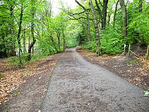
The other option from Wardsend goes by Herries Road South, Clay Wheels Lane, and Beeley Wood Lane. The last mile of the walk goes through Beeley Wood itself. This part has a hard-surfaced path. It is great for cyclists, runners, and people walking their dogs. The path finally ends in the center of Oughtibridge (53°26′11″N 1°32′16″W / 53.43636°N 1.53784°W).
 | James Van Der Zee |
 | Alma Thomas |
 | Ellis Wilson |
 | Margaret Taylor-Burroughs |


