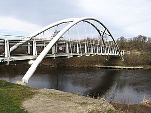
River Don, Yorkshire facts for kids
Quick facts for kids River Don |
|
|---|---|
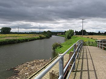
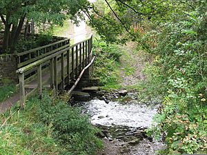
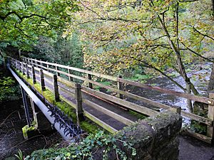
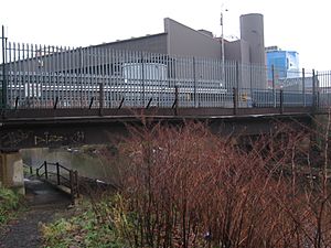
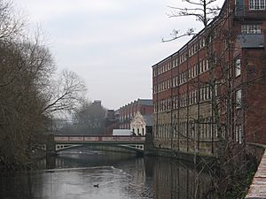
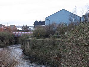
A footbridge, looking towards Newton
|
|
 |
|
| Country | England |
| Physical characteristics | |
| Main source | Pennines 53°31′08″N 1°45′43″W / 53.519°N 1.762°W |
| River mouth | River Trent/River Ouse 53°41′49″N 0°52′01″W / 53.697°N 0.867°W |
| Length | 70 mi (110 km) |
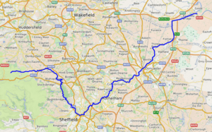
The River Don (sometimes called River Dun) is a river in South Yorkshire and the East Riding of Yorkshire, England. It starts in the Pennines mountains, west of Dunford Bridge. The river flows for 70 miles (110 km) eastwards through the Don Valley. It passes through towns like Penistone, Sheffield, Rotherham, Mexborough, Conisbrough, Doncaster, and Stainforth.
Originally, the River Don joined the River Trent. However, in the 1620s, a Dutch engineer named Cornelius Vermuyden changed its path. He created a new channel called the Dutch River. Now, the Don joins the River Ouse at Goole. The area around the river near Doncaster is even called Don Valley in the UK Parliament.
Contents
- What's in a Name?
- River Don's Journey
- River Don's Past
- River Don's Water Quality
- Towns and Cities on the Don
- River Don's Path
- Bridges Over the Don
- Bridges in the Upper Don Area
- Bridges in the Hillsborough Area
- Bridges in the Sheffield Area
- Hillfoot Bridge
- Rutland Road Bridge
- Ball Street Bridge
- Borough Bridge
- Iron Footbridge
- A61 Roundabout East Side Bridge
- Nursery Street Footbridge
- Lady's Bridge
- Blonk Street Bridge
- Willey Street Footbridge
- Derek Dooley Way Bridge
- Wicker Viaduct
- Cobweb Bridge
- Bailey Bridge
- Midland Railway Viaduct
- Norfolk Bridge
- Bridges in the Attercliffe / Brightside Area
- Bridges in the Meadowhall / Tinsley Area
- Plants and Animals
- See also
What's in a Name?
The name "Don" likely comes from an old British word, Dānā. This word meant "water" or "river". The name of the Celtic mother goddess, Dôn (or Danu), has the same origin.
The River Don also gave its name to the Don River in Toronto, Canada.
River Don's Journey
The River Don can be split into different parts based on how people have changed it.
- The upper parts, and some of its smaller rivers, have dams. These dams hold water for people to drink.
- The middle part has many weirs. Weirs are like small dams that raise the water level. They were built to power mills and factories.
- The lower part has weirs and locks. These help keep the water level steady for boats to travel.
The Don has several important smaller rivers that flow into it. These are the Loxley, the Rivelin, the Sheaf, the Rother, and the Dearne.
There are also walking and cycling paths along the river. The Five Weirs Walk goes along the Sheffield–Rotherham part of the river. Another path, the Upper Don Walk, is being built. It will let people walk or cycle from Sheffield city centre up to Oughtibridge.
River Don's Past
Long ago, the lower part of the Don, below Doncaster, twisted and turned through marshy land. It used to flow into the River Trent. There was also an older channel to the north, built by the Romans, called Turnbridgedike.
In 1626, a big project started to drain the Hatfield area. The Dutch engineer Cornelius Vermuyden changed the Don's path. He made it flow north along Turnbridgedike. He also built banks to create areas where water could spread out during floods. The main work was done by 1628.
However, there was a big flood in 1629. So, in 1632, they started building a new channel. This channel was 5 miles (8.0 km) long and went from Thorne east to the River Ouse at Goole. This new channel was finished in 1635 and cost £33,000. It was called the "Dutch River". It was not meant for boats at first.
The Dutch River was hard for boats to use. It had shallow spots, tricky bridges, and low water levels at certain times. In 1802, the Stainforth and Keadby Canal opened. This canal connected the Don at Stainforth to the Trent at Keadby. Most boats then used this new canal instead of the Dutch River.
Later, in 1889, a company called the Sheffield and South Yorkshire Navigation Company was formed. They wanted to improve the waterways. They built the New Junction Canal in 1905. This canal connected Stainforth to another canal system near Goole. After this, the Dutch River was mostly used for drainage, not for boats.
Boats on the Don
People worked to make the River Don easier for boats to travel on. They built weirs, locks, and canals. The first big improvements were allowed by a law in 1726. This law aimed to make the river navigable from Doncaster to Tinsley, near Sheffield. By 1740, boats could reach Rotherham. By 1751, they could reach Tinsley.
The Don is now part of the Sheffield and South Yorkshire Navigation system. This system includes the Don, the Stainforth and Keadby Canal, and the New Junction Canal. Some parts of the river can fit very large boats. However, above Rotherham, boats must be smaller.
In 1983, the navigation was improved again. It was made deep enough for 700-tonne Eurobarges up to Rotherham. But, not as much freight traffic as expected started using the waterways.
Floods on the Don
The River Don has caused some big floods.
- In 1536, a sudden rise in the river stopped an army from crossing at Doncaster. This forced them to talk with King Henry VIII's forces.
- The Great Sheffield Flood happened on March 11, 1864. It was caused by a dam breaking on a smaller river. This flood destroyed 800 houses and killed 270 people. It also damaged many bridges.
- The Don also flooded during the 2007 United Kingdom floods. On June 25, 2007, a lot of rain fell. The river burst its banks, flooding parts of Sheffield and Rotherham. Two people died. The army had to help in some areas.
- In November 2019, the Don burst its banks again. This flooded villages like Fishlake.
River Don's Water Area
The River Don and its main smaller rivers (the Rother and the Dearne) form a river system. This system covers 714 square miles (1,850 km2). About 1.4 million people lived in this area in 1997.
The ground under much of the region has carboniferous rocks with coal measures. This has caused pollution in the river system from old mines. The river starts in the Pennines on millstone grit moorlands. The lower parts flow through areas with thick layers of soil and rock on top of limestone and sandstone.
People living and working near the river have caused pollution. Dirty water from homes and factories, and waste from metal processing, made the river very polluted. For a long time, there were no fish in large parts of the Don.
However, a lot of work has been done to make the water cleaner. They have reduced metals, ammonia, and other harmful things. Water treatment plants have been improved. The steel industry has also declined, which means less pollution from factories.
Old mines still cause some problems. Near Penistone, orange-colored water from old mine workings used to flow into the river. This made the river orange for about six miles. Now, lagoons help to clean this water.
Even with improvements, it was hard to bring fish back. But in November 2011, the Environment Agency said they had put 1,000 barbel fish into the Don. They said the fish population was now healthy and breeding. This was the last step in a 10-year plan to help the Don recover from its industrial past.
River Don's Water Quality
The Environment Agency checks the water quality of rivers in England. They give each river an overall ecological status: high, good, moderate, poor, or bad. This status depends on things like the types of plants, animals, and fish in the water. They also check chemical status, which is rated good or fail.
Here is the water quality of the Don in 2019:
| Section | Ecological Status | Chemical Status | Overall Status | Length | Catchment |
|---|---|---|---|---|---|
| Don from Source to Scout Dyke | Moderate | Fail | Moderate | 11.9 miles (19.2 km) | 15.28 square miles (39.6 km2) |
| Don from Scout Dyke to the Little Don | Moderate | Fail | Moderate | 10.0 miles (16.1 km) | 9.55 square miles (24.7 km2) |
| Don from Little Don to River Loxley | Moderate | Fail | Moderate | 7.7 miles (12.4 km) | 12.07 square miles (31.3 km2) |
| Don from River Loxley to River Don Works | Poor | Fail | Poor | 8.7 miles (14.0 km) | 9.29 square miles (24.1 km2) |
| Don from River Don Works to River Rother | Poor | Fail | Poor | 3.5 miles (5.6 km) | 3.15 square miles (8.2 km2) |
| Don from River Rother to River Dearne | Moderate | Fail | Moderate | 13.7 miles (22.0 km) | 17.84 square miles (46.2 km2) |
| Don from River Dearne to Mill Dyke | Moderate | Fail | Moderate | 5.8 miles (9.3 km) | 8.52 square miles (22.1 km2) |
| Sheffield and South Yorkshire Navigation | Good | Fail | Moderate | 27.2 miles (43.8 km) | 8.52 square miles (22.1 km2) |
Towns and Cities on the Don
Here are the places along the River Don, from where it starts to where it ends. The biggest city on the river is Sheffield. Towns with more than 10,000 people are in bold. The river's start, its smaller rivers, and its end are in italics.
|
Winscar Reservoir
Confluence with Little Don River
|
|
|
River Don's Path
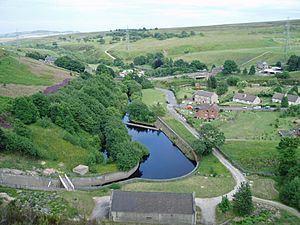
The River Don begins in the Peak District, on Great Grains Moss. This is a millstone grit moorland area, about 1,480 and 1,570 feet (450 and 480 m) above sea level. Small streams join together and flow into Winscar Reservoir. Other streams also feed into nearby reservoirs like Snailsden and Harden.
These reservoirs were built in the late 1800s to provide water. A new dam was built at Winscar between 1972 and 1975. It's 174 feet (53 m) high and made of rock. A special pool at the bottom of the dam helps to slow down the water flowing out. The reservoir provides drinking water and is also used for sailing.
The Don flows from Winscar Dam, through Dunford Bridge, and then towards Sheffield. Near Penistone, it is joined by Scout Dike. The Little Don River (or River Porter) joins near Deepcar. By the time it reaches Oughtibridge, the river is below 300 feet (91 m).
Old Factories and Mills
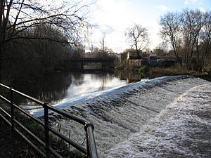
Below Oughtibridge, you can see many weirs along the river. These weirs were built to hold back water. This water was then used to power mills, hammers, and grinding wheels. The river drops about 160 feet (49 m) between Oughtibridge and Brightside. By 1600, there were many weirs, and no new ones were built after that.
Most of the old mill buildings are gone now, but the weirs remain. These weirs usually had a channel (called a goit) that led water from the river to a reservoir or dam. After the water was used, another channel returned it to the river.
- The weir near Station Lane, Oughtibridge, served the Upper Middlewood forge. This forge used a tilt hammer to shape metal.
- Middlewood Works was a rolling mill. It used four water wheels in the 1820s.
- Beeley Wood or Nova Scotia Tilts was a large operation. It had eight water wheels in the 1830s. In 2016, part of the Beeley Wood Lower Weir was removed to help fish move freely.
- Wadsley weir supplied several works, including a paper mill and a forge.
- Wadsley Furnace was built in 1583 but stopped working by the 1670s.
- Wadsley Forge was used from 1581 to the late 1800s. Part of this site is now Hillsborough Football Stadium.
Near Wadsley, the Don was joined by a small river with Rawsons Mill. Owlerton Rolling Mill was destroyed by fire in 1883 but rebuilt. Old Park corn mill was built around 1673. The River Loxley joins the Don near this mill site.
Sandbed wheel was built in 1723 and used three water wheels. Morton wheels existed in 1581. Kelham Wheel was used as a cutlers wheel, silk mill, and cotton mill. The Town Corn Mill was water-powered until 1877.
Wicker Tilts and wheel were two works. One was a grinding wheel, and the other was a tilt forge. The grinding wheel was replaced by a wire mill in the 1870s. The culverted Porter Brook and River Sheaf join the Don between Lady's Bridge and Blonk Street bridge.
Five Weirs Walk
The area from Lady's Bridge to Meadowhall is called the Five Weirs Walk. It's a path for walking and cycling that follows the river. It has the last five weirs before the part of the river where boats can travel.
- Walk Mill weir supplied the Upper and Nether Walk mills. These were used for fulling (cleaning cloth) and for cutlers (making knives).
- Burton Weir supplied Royds mill, which included a corn mill.
- Sanderson's weir provided water for the Upper Hammer and Nether Hammer. The Nether Hammer was first recorded in the 1580s.
- Brightside weir supplied a corn mill and later a forge. Tilt hammers from this site were moved to Abbeydale Industrial Hamlet.
- Hadfields Weir is the last weir on this section. It supplied Parker Wheel and later a paper mill. The weir can be seen from Meadowhall Shopping Centre.
Bridges Over the Don
Many bridges cross the River Don. Here are some of them, listed from the river's start to its end.
Bridges in the Upper Don Area
This area is from the source of the river down to Oughtibridge.
Dunford Bridge
This road bridge carries Windle Edge Road over the River Don. The river's source is about 2.5 miles (4 km) west of here.
Thurlstone Leapings Lane Footbridge
This is a path for walkers. It connects the A628 road with Leapings Lane. There is also a ford next to it, which cars can usually cross.
Penistone Viaduct
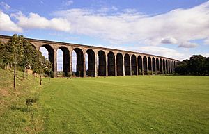
This is a long, curving railway bridge with 29 arches. It is 980 feet (300 m) long and 98 feet (30 m) high where it crosses the Don. It was built in 1850 for trains going from Sheffield to Huddersfield.
Oxspring Viaduct
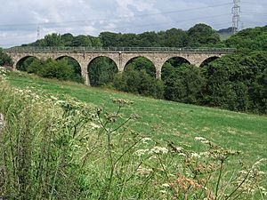
This railway bridge has seven arches and was built around 1855. It carries a railway line that is now used for local passenger trains.
Oxspring Willow Footbridge
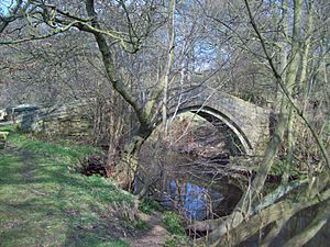
This narrow stone bridge was built around 1734. It was part of an old path for packhorses. Now, it's part of the Trans Pennine Trail.
Romtickle Viaduct
This large railway bridge carries the Trans Pennine Trail over the River Don. It was built in 1844 from local stone. Trains stopped using this part of the line in 1983.
Wortley Footbridge
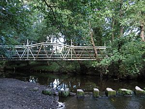
This footbridge is on the Barnsley Boundary Walk. It's a drier way to cross the river than the stepping stones next to it, especially when the river is high. It was made of steel and built after World War II.
Oughtibridge Station Lane Bridge
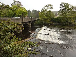
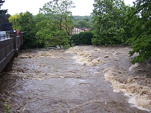
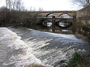
This bridge carries Station Lane over the River Don. The river here usually looks calm. But because of its wide area and heavy rain in the Pennines, the river can flood sometimes. The pictures show how different it can look.
Bridges in the Hillsborough Area
Rocher Bridge
This footbridge is the only crossing for 4 km between Oughtibridge and Hillsborough. It was built for workers to cross the river to mines and factories. During the 2007 floods, the road wall near this bridge was washed away.
Leppings Lane Bridge
This bridge carries the A6102 road over the River Don. Its name comes from old "leaping" stones that were used to cross the river.
Hillsborough Stadium Footbridge
This bridge connects Parkside Road to the main entrance of the football stadium. It was built for the Euro 1996 football competition. A memorial to the 96 fans who died at Hillsborough in 1989 is very close by. In 2007, the river flooded the entire stadium.
Penistone Road North Bridge
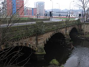
This bridge carries the A61 dual carriageway (a road with two lanes in each direction) over the River Don. This part of the road was made wider for the 1966 Football World Cup.
Cadbury's Works Bridges
There are two private bridges that connect the Cadbury's factory buildings on both sides of the Don. A public path goes under these bridges. The Cadbury's factory (formerly Bassett's) is famous for making sweets like Liquorice Allsorts.
Wardsend Bridge
This bridge carries Livesey Street over the Don. The old stone bridge was built in the 1700s. It was destroyed by the floods in 2007. A new, wider bridge was built and opened in 2009.
Bridges in the Sheffield Area
Hillfoot Bridge
This bridge carries Neepsend Lane (B6074) over the River Don. The old wooden bridge was swept away in the Great Sheffield Flood of 1864. It was replaced by a stone bridge in 1885.
Rutland Road Bridge
This bridge carries Rutland Road (B6070) over the River Don. It was built in 1854. During the Great Sheffield Flood of 1864, this bridge held strong, even with a lot of debris piled against it.
Ball Street Bridge
This road bridge carries Ball Street over the River Don. The original footbridge here was destroyed in the 1864 flood. It was rebuilt in 1865 with three cast-iron sections.
Borough Bridge
This stone bridge was built between 1853 and 1856. It has three arches. During the Great Flood, a lot of debris built up behind it. This caused another iron bridge downstream to be swept away.
Iron Footbridge
This iron footbridge was first built as a wooden bridge around 1726. It was replaced by one of the earliest iron bridges in 1795. This bridge was swept away in 1864 and replaced by a new iron bridge. It still carries a large water pipe over the river.
A61 Roundabout East Side Bridge
This road bridge carries the A61 inner relief road over the river. It was built as part of a big project to move traffic away from the city center.
Nursery Street Footbridge
This footbridge connects the redeveloped Exchange Brewery site with Nursery Street. It was built around 2005.
Lady's Bridge
Lady's Bridge This bridge carries the A6135 road over the River Don. It is the oldest bridge over the Don in Sheffield, built in 1485. It has five arches and has been widened and restored over the years.
Blonk Street Bridge
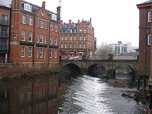
The culverted River Sheaf joins the Don next to this bridge. The three-arched bridge was built between 1827 and 1828.
Willey Street Footbridge
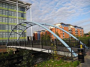
This new steel footbridge was built in 2010 to connect The Wicker with Furnival Road. It is part of flood defense improvements and helps link to the Five Weirs Walk.
Derek Dooley Way Bridge
This bridge carries the Sheffield Inner Ring Road over the River Don. This part of the road was named in 2008 after Derek Dooley, a famous local footballer.
Wicker Viaduct
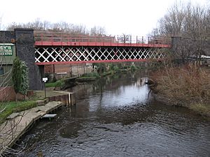
The Wicker Arches are a long railway bridge, 660-yard (600 m), built in 1848. It carries the railway over the canal, roads, and the River Don. The arch over the Don has a metal span.
Cobweb Bridge
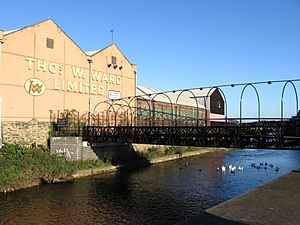
The Cobweb Bridge was finished in 2002. It helps the Five Weirs Walk path go under the large Wicker Arches Viaduct and cross the river. The bridge is suspended by steel cables, which gives it its name.
Bailey Bridge
This bridge is part of the Five Weirs Walk. It uses an old Bailey bridge from World War II. This type of bridge was designed to be built quickly from lightweight parts. This particular bridge was built in 1945, possibly for the D-Day landings.
Midland Railway Viaduct
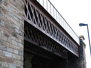
This bridge carries the railway line from Sheffield to Meadowhall Interchange. It was opened in 1870. A metal walkway for the Five Weirs Walk is suspended under one of its arches.
Norfolk Bridge
This three-arch bridge was built in 1856. It carries Leveson Street (B6071) over the river. It was named after Henry Fitzalan-Howard, 15th Duke of Norfolk, who was a politician and helped the city of Sheffield.
Bridges in the Attercliffe / Brightside Area
Washford Bridge
This bridge carries the A6178 Attercliffe Road over the River Don. It has been rebuilt many times since 1535. In 1940, an air raid badly damaged it.
East Coast Road Bridge
This metal bridge carries East Coast Road over the River Don. It connects Brightside Lane with Attercliffe Road.
Scrapyard Railway Bridge
This bridge carries a railway line to a metal scrapyard. The scrapyard specializes in taking apart old railway vehicles.
Stevenson Road Bridge
This bridge carries Stevenson Road over the River Don. It was named after one of the owners of an old mill. It was strengthened in 2004 for heavy trucks.
Newhall Road Bridge
This bridge carries Newhall Road (B6083) over the River Don. In the 1600s, it was a packhorse bridge in a very rural area. The road is named after a house that belonged to the Fell family, who were wealthy iron masters.
Amberley Street Footbridge
This bridge helps the Five Weirs Walk cross the River Don. It allows the path to avoid a long detour around the Sheffield Forgemasters steelworks.
Abyssinia Bridge
This bridge carries the A6102 Sheffield Outer Ring Road over the River Don. It got its name from a British military event in 1868. The first wooden bridge was built in 1868.
Forgemaster Works Bridges
There are three bridges (two for roads and one for pipes) within the Sheffield Forgemasters steelworks. These bridges are not open to the public.
Weedon Street Bridge
Also known as Brightside Bridge, this bridge carries Weedon Street. It is mentioned in records of the Great Sheffield Flood of 1864. A watchman barely escaped when the floodwaters rushed over the bridge.
Bridges in the Meadowhall / Tinsley Area
Sheffield District Railway Bridge
This metal bridge carried the Sheffield District Railway over the River Don. It opened in 1900. The railway lines were removed in 1999, but the bridge was still there in 2013.
Meadowhall Way (SW) Bridge
This bridge opened when the Meadowhall Shopping Centre did.
Meadowhall Works Bridge
This bridge provides a path for people between Meadowhall Road and the Five Weirs Walk. It originally gave access to one of the old factories that used to be where the shopping center is now.
Meadowhall Interchange Footbridge
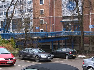
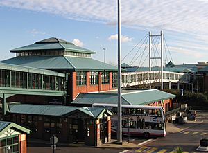
This enclosed footbridge connects Meadowhall Interchange (where trains, trams, and buses meet) with the Meadowhall Shopping Centre. It crosses the A6109 road, the Five Weirs Walk, and the River Don.
Meadowhall Way (N) Bridge
These two bridges also opened with the Meadowhall Shopping Centre.
Meadowhall Coach Park Bridges
These two bridges (one for walking, one for roads) connect the coach park and overflow car park to the shopping center.
Supertram Bridge
This bridge carries the Sheffield Supertram line over the River Don. The tram line opened in 1994.
South Yorkshire Railway Bridge
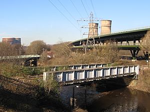
This bridge carries a railway line used only for freight (goods).
M1 Tinsley Viaduct
The Tinsley Viaduct carries the M1 motorway and the A631 road over the River Don. This bridge has two levels and is over 0.6 miles (1 km) long. It opened in 1968 and has been strengthened twice since then.
Blackburn Meadows Bridge
This bridge may have once provided road access to the Blackburn Meadows Power Station.
Halfpenny Bridge
This bridge carries the Trans-Pennine Trail over the River Don. Long ago, it cost half a penny to use a ferry here. The current steel bridge opened in 2001 and cost half a million pounds.
Plants and Animals
Fig trees grow on some parts of the river bank in Sheffield. Normally, fig seeds don't grow well in England's climate. But in the past, factories used river water to cool hot metal. This made the water warmer than 20 deg C[convert: unknown unit]. The warmer water helped the fig seeds to grow. Most of these trees are over 50 years old. Now that there are fewer factories, the water is cooler, and new fig trees are not growing.
The river used to be very polluted because of all the factories. But efforts to clean the water have worked! Now, salmon fish have been seen in the river near Doncaster. This shows that the river is getting much healthier.
See also
 In Spanish: Río Don (Inglaterra) para niños
 | Aaron Henry |
 | T. R. M. Howard |
 | Jesse Jackson |


