River Sheaf facts for kids
Quick facts for kids River Sheaf |
|
|---|---|
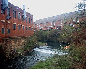
River Sheaf by Duchess Road at Highfield
|
|
| Country | England |
| Physical characteristics | |
| Main source | Pennines |
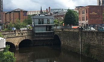
The River Sheaf is a river in Sheffield, South Yorkshire, England. It flows north, passing through areas like Dore and Abbeydale. Before joining the River Don, it flows underground through a culvert right beneath the center of Sheffield.
This lower part of the River Sheaf, along with a section of the River Don, once formed two sides of the boundary for Sheffield Castle.
The Sheaf has two main rivers that flow into it: the Porter Brook and the Meers Brook. The Porter Brook joins the Sheaf under Sheffield Midland station. For many years, the river was affected by pollution from industries like iron and steel making. It is now slowly getting cleaner. In the past, the river's power was used by many metal works, including the famous Abbeydale Industrial Hamlet.
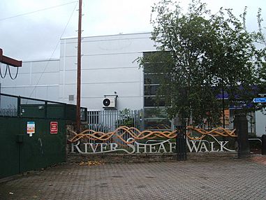
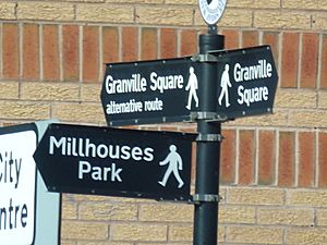
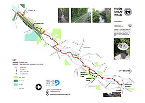
There's a special path called the River Sheaf Walk. It follows the river from Granville Square all the way to Millhouses Park and even further into the Peak District.
Contents
What's in a Name?
The name Sheaf used to be written as Scheth or Sheath until the 1600s. Some experts believe the name comes from an old English word, shed or sheth. These words mean "to divide" or "to separate."
Historically, the River Sheaf, along with its smaller streams like the Meers Brook and the Limb Brook, formed a border. It separated the ancient Anglo-Saxon kingdoms of Mercia and Northumbria. Later, it marked the border between Yorkshire and Derbyshire for a long time. The city of Sheffield actually got its name from the River Sheaf!
The River's Journey
The River Sheaf starts from several small streams high up in the Pennines hills. These streams, like Blacka Dike and Redcar Brook, combine to form Old Hay Brook. Another stream, Totley Brook, joins Old Hay Brook, and from there, the combined water becomes the River Sheaf.
Near where the river starts, it crosses the Hope Valley Line railway. The river and the railway often run side-by-side. They cross each other several times before reaching Sheffield Station.
From its start to the city center, the river drops about 400 feet (120 meters). This drop made it perfect for powering many industries since at least the 1500s.
The river valley is wide and cuts through layers of sandstone and clay. The harder rock in the area helped decide where weirs (small dams) and ponds were built to hold water for mills.
Many mills were built along the Sheaf. The river was important for different industries because it was close to Derbyshire, which had lots of lead. Lead ore was brought to areas like Dore and Norton. At least ten mills used the river's power to smelt (melt) lead ore. There were also mills for grinding corn and making paper. As metal industries grew, some of these mills changed to support them.
Old Mills Along the Sheaf
One of the oldest mills on the Sheaf was Walk Mill, built around 1280. It was first used for fulling (cleaning and thickening cloth). Later, it became a cutlers wheel, used for grinding tools. Over the years, it was used to make scythes, knives, and saws. In 1871, the land was sold to build Dore and Totley railway station, and the mill was taken down.
Further down, the Limb Brook flows into the Sheaf. Whirlow Wheel, on the Limb Brook, was a corn mill for many years. Later, it also became a grinding wheel. The building fell into disrepair, but local groups fought to save it from demolition.
Abbeydale Industrial Hamlet is another important site powered by the Sheaf. It used two water wheels and later a steam engine. After 1900, it declined but was saved from demolition and restored. In 1970, it opened as a museum, showing how industries used river power.
Below Abbeydale, the Abbey Brook joins the river. The river then flows past Millhouses Park. To prevent flooding and pollution, a large underground tank was built in the park in 2004-2005. This tank can hold a huge amount of storm water (10,000 cubic meters).
Little London wheel was used for making cutlery from the 1720s. It later became a grinding and plating forge and made scythes. Even when the railway was built over part of its dam, it continued to operate. Its water-powered tilt hammers (large hammers used in metalworking) were used until the mid-1950s.
The Meers Brook is the next tributary, flowing underground for its last section. Near its junction with the Sheaf was Heeley Station, built where Heeley Wheel once stood. The railway company demolished the mill and changed the river's path. Other parts of the river were also moved in the 1860s to make way for the railway.
The Underground River
From Granville Square to the River Don, the Sheaf mostly flows underground in culverts. The railway company bought the water rights to build Sheffield Midland Station over the river. The station now covers the site of old mills and their dams.
At Granville Square, a large screen stops rubbish from entering the underground culverts. This screen was built after serious flooding in 1990 and was updated in 2010. A new, bigger, and automated screen is being installed.
The river continues underground to the edge of the station. Here, the Porter Brook joins it, also flowing from its own culvert. The two rivers meet under platform 5a of the station.
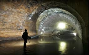
The Sheaf briefly comes to the surface near Pond Hill. Then it goes back underground through a series of huge tunnels. The most famous part is known as the 'Megatron'. This is a very large brick arch that was built to support the weight of an old tramway. The Sheaf finally joins the River Don under Castlegate bridge.
River Water Quality
The Environment Agency checks the water quality of rivers in England. They give each river an overall "ecological status" (how healthy the river environment is). This status can be high, good, moderate, poor, or bad. They also check "chemical status" (how clean the water is from chemicals).
In 2016, the water quality of the River Sheaf was:
| Section | Ecological Status | Chemical Status | Overall Status |
|---|---|---|---|
| Sheaf from Source to River Don | Moderate | Good | Moderate |
This means the river's overall health was "moderate," but its chemical status was "good."
Future Flood Protection
In September 2014, Sheffield City Council announced plans for new flood defenses. These defenses for the River Sheaf and its smaller streams are expected to cost £12 million.
Interesting River Spots
| Point | Coordinates (Links to map resources) |
OS Grid Ref | Notes |
|---|---|---|---|
| Junction with River Don | 53°23′07″N 1°27′44″W / 53.3854°N 1.4623°W | SK358877 | by Blonk Street bridge |
| Start of Sheffield Station culvert | 53°22′27″N 1°27′48″W / 53.3741°N 1.4632°W | SK358864 | Granville Square |
| A61 Queens Road bridge | 53°22′03″N 1°28′02″W / 53.3675°N 1.4671°W | SK355857 | Highfield |
| Junction with Meers Brook | 53°21′35″N 1°28′31″W / 53.3597°N 1.4753°W | SK350848 | (culverted at mouth) |
| Junction with Abbey Brook | 53°20′09″N 1°30′33″W / 53.3357°N 1.5093°W | SK327822 | Abbeydale |
| Junction with Limb Brook | 53°19′46″N 1°30′53″W / 53.3294°N 1.5147°W | SK324814 | Dore and Totley |
| Junction of Totley Brook and Oldhay Brook | 53°19′12″N 1°31′27″W / 53.3199°N 1.5241°W | SK318804 | Start of River Sheaf |
Sheaf & Porter Rivers Trust
In early 2019, the Sheaf & Porter Rivers Trust was created. This group works to improve the River Sheaf and Porter Brook.
Their main goals include:
- Deculverting: This means uncovering sections of the river that are currently flowing underground in culverts. One big project is at the old Castle Market site, where a 100-meter section of culvert needs repair or removal.
- Daylighting: Even where culverts can't be fully removed, they want to add "light-pipes" into the dark tunnels. This would allow fish and other animals to pass through more easily.
- Better Public Access: They want to make it easier for people to reach and enjoy the open parts of the river. This includes access for fishing and kayaking.
- Celebrating the River: They aim to mark and celebrate the hidden parts of the river using public art and guided tours.
- Understanding the River: They want to teach people about the river's history, wildlife, and how it helps the environment.
- Good Practices: They encourage landowners along the river to take good care of their sections.
River Sheaf Walk
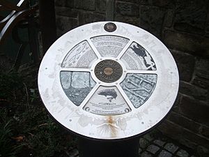
The River Sheaf Walk is a path that follows the river. It has signs and features 10 special "Sheaf Wheels" along the way. You can find more information about the walk online.
The River's Future
Sheffield City Council, the Environment Agency, and the Sheaf & Porter Rivers Trust are working together on a plan for the old Castle Market site. They want to remove a decaying concrete culvert there. This would "daylight" (uncover) that section of the River Sheaf and create a new city center park. This project aims to bring the river back into view for everyone to enjoy.
See also
 In Spanish: Río Sheaf para niños
 | Claudette Colvin |
 | Myrlie Evers-Williams |
 | Alberta Odell Jones |


