Limb Brook facts for kids
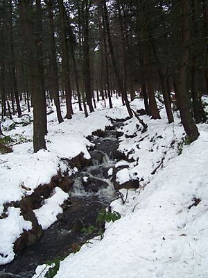
The Limb Brook is a stream located in Sheffield, South Yorkshire, England. It begins near the village of Ringinglow and flows east. The brook passes through areas like Whirlow and Ecclesall Woods. Eventually, it reaches the Beauchief area, where it joins the River Sheaf. Long ago, a part of the stream was redirected. This was done to power the millpond at Abbeydale Industrial Hamlet, an old industrial site. This redirected channel now flows through what is known as Beauchief Gardens.
Contents
History of the Limb Brook
Ancient Discoveries
People have lived near Limb Brook for a very long time. In 1952, a polished stone axehead from the Neolithic period (the New Stone Age) was found nearby. This shows that ancient humans were active in this area.
Experts from the University of Sheffield have also found signs of a lost Roman road near the brook. This road likely connected Templeborough with the Roman fort at Navio. The road was about 20 meters wide and had a paved surface. It would have passed close to a Roman villa (a large Roman house) that existed at nearby Whirlow Hall Farm.
An Old Border
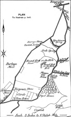
The Limb Brook is entirely within the City of Sheffield today. However, it used to be part of an important border. Along with the River Sheaf and Meers Brook, it formed part of the boundary between Yorkshire and Derbyshire. This border dates back to the Anglo-Saxon kingdoms of Mercia and Northumbria. In 1888, a writer named Sidney Oldall Addy mentioned that the Ordnance Survey map called this stream "Fenny Brook" where it flows past Ringinglow.
Working Brook: Past Industries
For many years, the Limb Brook was used to power local industries. You can still see the remains of old water-powered mills in Ecclesall Woods. These mills were used for different tasks, such as smelting lead and grinding corn.
There is also historical evidence of shallow coal mining near the brook. This mining took place in the Barber Fields area. The coal seam was called the Ringinglow seam. A short railway once served this mine, but both the mine and railway are now gone. All that remains is a pile of waste material on the north bank of the brook.
Close to the coal mine, there was also a copperas works. This was a place where a chemical called copperas was made. This works was no longer in use by 1877.
Limb Brook Today
Today, the Limb Brook no longer supports any industries. Instead, the brook and the woodlands around it are a valuable place for people to enjoy. The city council manages the area. They make sure it is good for both wildlife and the public. The Sheffield Round Walk, a popular walking route, follows almost the entire path of the Limb Brook. It goes from Abbeydale Road South all the way to Ringinglow.
Plants and Animals of Limb Brook
The Limb Brook starts in a special wet area called a sphagnum moss bog, right next to Ringinglow Road. From there, it flows through Lady Canning's Plantation. This is a forest with cone-bearing trees, managed by Sheffield City Council.
As the brook continues, it moves slowly through farmland. Here, you can find plants like reeds and sedges growing. When it reaches the Limb valley and flows through Ecclesall Woods, it is surrounded by steep hillsides. These hillsides have mature woodlands with large trees like Beech, Sycamore, Alder, Ash, and Hazel.
This environment is rich in life! Many small creatures without backbones (invertebrates) live here. You can also spot many birds and mammals. Some of the special animals that live near the Limb Brook include bright blue kingfishers and busy water voles. The rare white-clawed crayfish, a type of freshwater crustacean, has also been seen in the brook.
 | Jackie Robinson |
 | Jack Johnson |
 | Althea Gibson |
 | Arthur Ashe |
 | Muhammad Ali |


