Upper Fairfield Township, Pennsylvania facts for kids
Quick facts for kids
Upper Fairfield Township,
Lycoming County, Pennsylvania |
|
|---|---|
|
Township
|
|

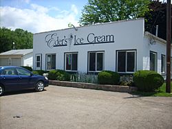
Eder's Ice Cream in Upper Fairfield Township
|
|

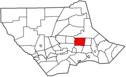
Map of Lycoming County, Pennsylvania highlighting Upper Fairfield Township
|
|

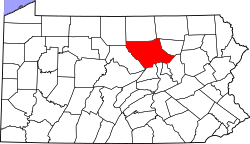
Map of Lycoming County, Pennsylvania
|
|
| Country | United States |
| State | Pennsylvania |
| County | Lycoming |
| Settled | 1800 |
| Incorporated | 1851 |
| Area | |
| • Total | 18.12 sq mi (46.93 km2) |
| • Land | 17.96 sq mi (46.52 km2) |
| • Water | 0.15 sq mi (0.40 km2) |
| Elevation | 896 ft (273 m) |
| Population
(2020)
|
|
| • Total | 1,807 |
| • Estimate
(2021)
|
1,801 |
| • Density | 100.48/sq mi (38.80/km2) |
| Time zone | UTC-5 (Eastern (EST)) |
| • Summer (DST) | UTC-4 (EDT) |
| FIPS code | 42-081-79024 |
| GNIS feature ID | 1216774 |
Upper Fairfield Township is a community located in Lycoming County, Pennsylvania, United States. It is a type of local government area called a township. In 2020, about 1,807 people lived here. This area is part of the larger Williamsport region.
Contents
A Look Back: History of Upper Fairfield
The story of Upper Fairfield Township began in 1851. Some people living in the southern part of Fairfield Township wanted to create their own separate area. Even though people in the northern part of Fairfield Township did not agree, the area was divided on September 12, 1851.
How Upper Fairfield Got Its Name
For its first two years, Upper Fairfield Township was called Pollock Township. It was named after Judge James Pollock. He was the judge who decided that the township should be divided. However, the people who lived in the new township were not happy with this name. They had not wanted the division in the first place.
So, they asked the court to change the name. On January 29, 1853, the Pennsylvania General Assembly (which makes laws for Pennsylvania) officially changed the name to Upper Fairfield Township.
Exploring the Geography of Upper Fairfield
Upper Fairfield Township is located in the east-central part of Lycoming County. It shares its borders with several other townships. To the north is Plunketts Creek Township. To the east, you'll find Mill Creek Township. Muncy Township is to the southeast, and Fairfield Township is to the south.
To the southwest, it borders Loyalsock Township. Finally, Eldred Township is to the west. The Loyalsock Creek forms a natural border between Upper Fairfield and both Loyalsock and Eldred townships.
Roads and Communities in the Township
Pennsylvania Route 87 runs through the western side of the township. It follows along the Loyalsock Creek. This highway goes south about 3 miles (5 km) to Montoursville. If you head northeast, it goes about 28 miles (45 km) to Forksville.
Along PA-87, you'll find two small communities: Farragut and Loyalsockville. Farragut is in the southern part of the township, and Loyalsockville is further north.
Pennsylvania Route 864 starts in Farragut, connecting with PA-87. It heads east along the Mill Creek valley. This route passes through Fairfield Center, which is near the eastern edge of the township. From there, it continues east about 8 miles (13 km) to Picture Rocks. Williamsport, which is the main city of Lycoming County, is about 10 miles (16 km) southwest of the township.
Land and Water Area
The United States Census Bureau reports that Upper Fairfield Township covers a total area of about 18.1 square miles (46.9 square kilometers). Most of this area, about 17.96 square miles (46.5 square kilometers), is land. The remaining part, about 0.15 square miles (0.40 square kilometers), is water. This means that about 0.86% of the township's total area is water.
Population and People of Upper Fairfield
| Historical population | |||
|---|---|---|---|
| Census | Pop. | %± | |
| 2010 | 1,823 | — | |
| 2020 | 1,807 | −0.9% | |
| 2021 (est.) | 1,801 | −1.2% | |
| U.S. Decennial Census | |||
In 2000, there were 1,854 people living in Upper Fairfield Township. These people made up 682 households, and 544 of those were families. The population density was about 102 people per square mile (40 per square kilometer). There were 736 housing units in total.
Most of the people in the township were White (99.35%). A small number were from other racial backgrounds (0.05%) or identified with two or more races (0.59%). About 0.49% of the population identified as Hispanic or Latino.
How People Live in the Township
Out of the 682 households, about 36.4% had children under 18 living with them. Most households (69.4%) were married couples living together. About 6.7% had a female head of household with no husband present. Around 20.2% were non-family households.
About 16.7% of all households were made up of individuals living alone. And 6.9% of these individuals were 65 years old or older. On average, there were 2.72 people in each household and 3.06 people in each family.
Age Groups in the Community
The population of the township was spread across different age groups. About 26.5% of the people were under 18 years old. Around 6.6% were between 18 and 24 years old. The largest group, 28.7%, was between 25 and 44 years old. People aged 45 to 64 made up 28.0% of the population. Finally, 10.2% of the people were 65 years old or older. The average age in the township was 38 years.
For every 100 females, there were about 96.6 males. If you look at just adults aged 18 and over, there were about 96.4 males for every 100 females.
Income and Economy
In 2000, the average income for a household in the township was $42,031. For families, the average income was $47,500. Males earned an average of $29,896, while females earned an average of $23,380. The per capita income (income per person) for the township was $18,193.
About 4.7% of families and 6.2% of the total population lived below the poverty line. This included 3.3% of those under 18 years old and 10.2% of those aged 65 or older.
See also
 In Spanish: Municipio de Upper Fairfield para niños
 | William L. Dawson |
 | W. E. B. Du Bois |
 | Harry Belafonte |

