
Uralla, New South Wales facts for kids
Quick facts for kids UrallaNew South Wales |
|||||||||
|---|---|---|---|---|---|---|---|---|---|
.JPG)
Uralla, NSW
|
|||||||||

Uralla
Location in New South Wales
|
|||||||||
| Population | 2,728 (2021 census) | ||||||||
| Established | 1855 | ||||||||
| Postcode(s) | 2358 | ||||||||
| Elevation | 1,012 m (3,320 ft) | ||||||||
| Location | |||||||||
| LGA(s) | Uralla Shire | ||||||||
| County | Sandon County | ||||||||
| State electorate(s) | Northern Tablelands | ||||||||
| Federal Division(s) | New England | ||||||||
|
|||||||||
Uralla is a cool town located in the Northern Tablelands, New South Wales, Australia. It sits where the New England Highway and Thunderbolts Way roads meet. Uralla is about 465 kilometers north of Sydney. It is also only about 23 kilometers southwest of the city of Armidale.
In 2016, Uralla had a population of 2,388 people. By 2021, this number grew to 2,728 people. The town is over 1,000 meters above sea level. This high location means Uralla has cool to cold winters. Its summers are usually mild.
Uralla has kept many of its old buildings and places. More than 50 sites are important for their history. During the 1980s and 1990s, the community worked together to buy and fix up McCrossins Mill. This old mill is now a museum, art gallery, and event center. Volunteers run it, and it's a great place to start a walk to see other historic spots.
Contents
History of Uralla

For about 35,000 years before Europeans arrived, the Indigenous Anēwan people lived in the Uralla area. The name "Uralla" comes from their language. It means a special place where people met or camped. Some children were taught that Uralla meant "chain of waterholes." This describes the creek that flows through the town very well.
In 1839, an Irish family, the McCrossins, first came to the Uralla area. They settled there in 1841. In the 1830s and 1840s, people called "squatters" started to move into the land. They were looking for good land to raise sheep. Some of these large sheep farms, like Balala and Gostwyck, are now protected as historic sites.
Uralla officially became a town in 1855. This happened because of a gold rush nearby at Rocky River a few years earlier. The gold rush made the town's population grow to over 5,000 people. By 1859, Uralla had hotels, shops, a post office, a mill, and a school. The town became its own local government area in 1882. Later, in 1948, it became the main center for the Uralla Shire. More gold was found in other areas nearby in the late 1800s, leading to new small villages.
The Legend of Captain Thunderbolt
The famous bushranger Captain Thunderbolt (whose real name was Frederick Ward) is buried in Uralla's old cemetery. Many things in Uralla remind people of Thunderbolt. The locals really like his story. There's a statue of him in the main street. There's also a pub, a motel, and even a rock named after him. This rock is where he used to hide and surprise travelers.
On May 25, 1870, Constable Alexander Walker shot and killed Thunderbolt near Uralla during a robbery. However, some people in Uralla believe it was actually Thunderbolt's uncle who was killed that day, not Fred Ward himself. The story of Captain Thunderbolt is shown at McCrossin's Mill Museum in Uralla. It includes paintings that tell the story of his life and death.
Uralla's Climate
Uralla has an oceanic climate. This means it has warm, stormy summers. The winters are cool to cold, with some snow and many frosty mornings.
| Climate data for Uralla (Dumaresq St, 1938–1967, rainfall 1901–2024); 1012 m AMSL; 30.64° S, 151.49° E | |||||||||||||
|---|---|---|---|---|---|---|---|---|---|---|---|---|---|
| Month | Jan | Feb | Mar | Apr | May | Jun | Jul | Aug | Sep | Oct | Nov | Dec | Year |
| Mean daily maximum °C (°F) | 26.4 (79.5) |
25.7 (78.3) |
24.0 (75.2) |
20.0 (68.0) |
15.8 (60.4) |
12.8 (55.0) |
11.8 (53.2) |
13.3 (55.9) |
17.0 (62.6) |
20.0 (68.0) |
23.6 (74.5) |
25.9 (78.6) |
19.7 (67.4) |
| Mean daily minimum °C (°F) | 12.5 (54.5) |
12.7 (54.9) |
11.1 (52.0) |
6.8 (44.2) |
3.0 (37.4) |
0.9 (33.6) |
−0.4 (31.3) |
0.4 (32.7) |
2.8 (37.0) |
6.2 (43.2) |
8.7 (47.7) |
11.1 (52.0) |
6.3 (43.4) |
| Average precipitation mm (inches) | 102.7 (4.04) |
83.9 (3.30) |
60.5 (2.38) |
39.4 (1.55) |
44.2 (1.74) |
53.2 (2.09) |
55.9 (2.20) |
54.1 (2.13) |
52.6 (2.07) |
71.9 (2.83) |
84.7 (3.33) |
88.2 (3.47) |
791.3 (31.13) |
| Average precipitation days (≥ 1.0 mm) | 7.6 | 7.0 | 5.8 | 4.5 | 5.0 | 6.3 | 6.7 | 6.2 | 5.9 | 7.1 | 7.8 | 7.8 | 77.7 |
| Source: Australian Bureau of Meteorology | |||||||||||||
Population of Uralla
| Historical population | ||
|---|---|---|
| Year | Pop. | ±% |
| 1921 | 972 | — |
| 1933 | 1,054 | +8.4% |
| 1947 | 1,186 | +12.5% |
| 1954 | 1,121 | −5.5% |
| 1961 | 1,658 | +47.9% |
| 1966 | 1,614 | −2.7% |
| 1971 | 1,754 | +8.7% |
| 1976 | 1,940 | +10.6% |
| 1981 | 2,090 | +7.7% |
| 1986 | 2,250 | +7.7% |
| 1991 | 2,324 | +3.3% |
| 1996 | — | |
| 2001 | 2,304 | — |
| 2006 | 2,267 | −1.6% |
| 2011 | 2,388 | +5.3% |
| 2016 | 2,421 | +1.4% |
| 2021 | 2,385 | −1.5% |
| Source: Australian Bureau of Statistics data. | ||
The 2016 census showed that Uralla had 2,421 people.
- About 11.7% of the people were Aboriginal and Torres Strait Islander.
- Most people (86.7%) were born in Australia.
- Almost everyone (93.3%) spoke only English at home.
- The most common religions were Anglican (28.8%), No Religion (22.8%), and Catholic (22.3%).
Historic Places in Uralla
Uralla has many places that are listed for their historical importance. These include:
- 6 East Street: New England Brass and Iron Lace Foundry
- Main Northern railway: Uralla railway station
- Salisbury Street: McCrossins Mill
- Uralla Square: Captain Thunderbolt's Grave
- New England Highway: Blanch's Royal Oak Inn
- New England Highway: Captain Thunderbolt's Rock
Uralla's Industries

Uralla has several businesses that make things from metal. These include three foundries, which provide many jobs. Tourism is also very important for Uralla's economy. The town has a friendly village feel. There are also 20 National Parks within a two-hour drive.
Because Uralla is close to Armidale, big chain stores have not opened there. This means Uralla still has many unique local shops. You can find old book stores, art galleries, antique shops, and cafes.
You can still try to pan for gold in the rivers around Uralla, like the Rocky River. Today, the area is known for raising Merino sheep. These sheep produce super-fine wool used in fashion. Some vineyards also grow grapes for cool-climate wines. The area is also good for growing apples and other fruits that like cold weather.
A company called Lockheed Martin has built a satellite tracking station in Uralla. Uralla also has many artists and potters. This is because the University of New England is nearby in Armidale.
In 2011, the main jobs in Uralla included:
- School Education
- Sheep, Beef Cattle and Grain Farming
- Local Government Administration
- Tertiary Education (university jobs)
- Cafes, Restaurants and Takeaway Food Services
There are some environmental issues in the area. These are mainly from how the land has been used. Soil erosion, caused by too much logging and farming, is a big problem. Local government and community groups are now working to fix this.
Uralla Railway Station

Uralla station has a train service every day. The NSW TrainLink Xplorer train travels between Armidale and Sydney. The train ride from Armidale to Uralla takes about 16 minutes.
Gallery
-
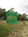
Entry sign
-
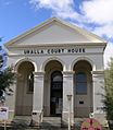
Court House
-
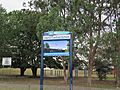
Uralla Central School
-
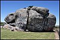
Thunderbolts Rock


.jpg)
