Urubamba, Peru facts for kids
Quick facts for kids
Urubamba
Urupampa
|
|
|---|---|
|
Town
|
|
|
|
|
| Country | |
| Region | Cusco Region |
| Elevation | 2,870 m (9,420 ft) |
| Population
(2011)
|
|
| • Total | 2,700 |
| Time zone | UTC-05:00 (America/Lima) |
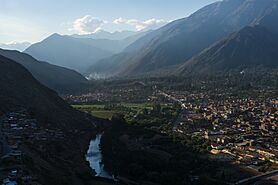
Urubamba is a small town in Peru. Its name might come from the Quechua language words Urupampa, meaning "flat land of spiders." The town is located near the Urubamba River and sits below the snow-capped mountain Chicón.
Urubamba is the main town of its district. It is about an hour away from Cusco. It is also the largest town in the Sacred Valley of the Incas. Many important ruins from the Inca Empire, like Machu Picchu, are close by. You can even find the remains of the Inca palace, Quispiguanca, right in town. Tourists often travel through Urubamba to visit these amazing historical sites.
Contents
Geography and Altitude
Urubamba is located in the high lands of Peru. It is a good place to get used to the high altitude. This can help prevent altitude sickness, which is when your body feels unwell because of less oxygen in the air. Many people stay here before visiting higher places like Cusco.
Economy and Local Markets
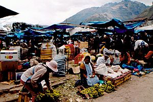
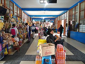
Urubamba has a popular market where you can find fresh fruits and vegetables. You can also buy pots, pans, and other important household items. Since many visitors and volunteers come to Urubamba, the main market also sells things for tourists. You can often find locally made alpaca clothes or crafts in small shops around town.
There is also a smaller market that sells only fresh produce. It is open on certain days of the week. Sometimes, you can find special items there that are not sold in the main market.
Climate and Weather
| Climate data for Urubamba, elevation 2,850 m (9,350 ft), (1991–2020) | |||||||||||||
|---|---|---|---|---|---|---|---|---|---|---|---|---|---|
| Month | Jan | Feb | Mar | Apr | May | Jun | Jul | Aug | Sep | Oct | Nov | Dec | Year |
| Mean daily maximum °C (°F) | 22.2 (72.0) |
22.0 (71.6) |
22.3 (72.1) |
23.0 (73.4) |
23.4 (74.1) |
22.8 (73.0) |
22.4 (72.3) |
23.2 (73.8) |
23.6 (74.5) |
23.6 (74.5) |
23.8 (74.8) |
22.7 (72.9) |
22.9 (73.3) |
| Mean daily minimum °C (°F) | 9.5 (49.1) |
9.6 (49.3) |
9.2 (48.6) |
7.7 (45.9) |
5.0 (41.0) |
3.1 (37.6) |
2.1 (35.8) |
3.6 (38.5) |
6.0 (42.8) |
8.1 (46.6) |
8.9 (48.0) |
9.3 (48.7) |
6.8 (44.3) |
| Average precipitation mm (inches) | 105.4 (4.15) |
101.3 (3.99) |
72.0 (2.83) |
22.5 (0.89) |
4.1 (0.16) |
5.4 (0.21) |
5.4 (0.21) |
6.7 (0.26) |
7.8 (0.31) |
38.1 (1.50) |
56.4 (2.22) |
92.6 (3.65) |
517.7 (20.38) |
| Source: National Meteorology and Hydrology Service of Peru | |||||||||||||
Arts and Culture
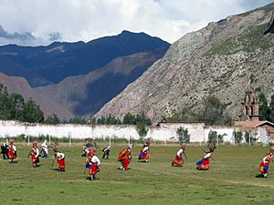
Urubamba has a large sports field. It is used for local football (soccer) games. It also hosts important festivals, like the festival of El Señor de Torrechayoc.
During the first week of June, the town becomes very lively. Dancers and visitors from nearby towns come to perform in the streets. The celebrations often last late into the night. The dancing ends with large group performances on the local football pitch.
Transportation Hub
Urubamba is close to many Inca ruins. This makes it an important place for transportation. The town has a bus station and it is easy to find cabs.
- PeruRail
See also
 In Spanish: Urubamba (ciudad) para niños
 | Jessica Watkins |
 | Robert Henry Lawrence Jr. |
 | Mae Jemison |
 | Sian Proctor |
 | Guion Bluford |


