Valeriana (city)
| Lua error in Module:Wikidata at line 70: attempt to index field 'wikibase' (a nil value). | |
| Coordinates | 18°54′9″N 89°19′3″W / 18.90250°N 89.31750°W |
|---|---|
| History | |
| Periods | Late Preclassic to Late Classic |
| Cultures | Maya civilization |
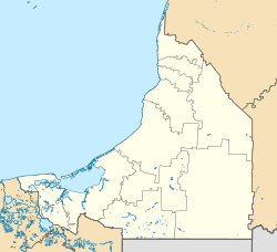
Valeriana is an ancient city built by the Maya people. It's located in the Mexican state of Campeche, close to the border with Quintana Roo. This amazing site was only discovered in October 2024! It was named after a nearby lake.
Contents
What Valeriana Looked Like
Valeriana's buildings and design are similar to other Maya cities in the area, like Chactún and Tamchen. The city had many open areas called plazas, tall temple pyramids, and a special court for playing the Maya ballgame. It even had a reservoir (a place to store water) with a dam. All these features show that Valeriana was likely an important capital city.
Scientists believe the site has more than 6,500 structures. The entire city covers a huge area, about 50 square miles (130 square kilometers).
How Old is Valeriana?
Special building designs, known as an "E-Group assemblage," suggest that Valeriana was founded very early, before 150 AD. This was during the Late Preclassic period of Maya history. The city probably grew and became very powerful during the Classic period (around 250 to 900 AD).
Researchers think that Valeriana had more buildings packed together than almost any other Maya city, except for Calakmul. They believe that between 30,000 and 50,000 people lived there when it was at its busiest, from 750 to 850 AD.
How Valeriana Was Found
People have known since the 1970s that the area around Xpujil was home to many Maya cities. However, not many archaeological studies had been done there.
Modern Discovery Methods
The discovery of Valeriana was made by a team of researchers from several universities, including Northern Arizona University and Tulane University. They also worked with the National Institute of Anthropology and History (INAH) in Mexico.
They used a special technology called Lidar. Lidar uses lasers to create detailed maps of the ground, even through thick forests. This technology has helped find other hidden Maya sites before. Because Lidar can be expensive, the researchers used existing Lidar data from a 2013 project that was monitoring forests.
The researchers plan to do more fieldwork at Valeriana. They said the ruins were "hidden in plain sight," meaning they were very close to Federal Highway 186 near Xpujil and farmland, but nobody had noticed them until now.
Naming the City
The researchers decided to name the city "Valeriana" after a nearby lake called Laguna la Valeriana.
See also
 In Spanish: Valeriana (ciudad maya) para niños


