Vallées en Champagne facts for kids
Quick facts for kids
Vallées en Champagne
|
|
|---|---|

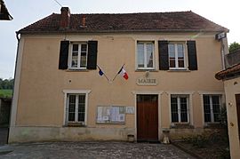
The town hall of Vallées en Champagne
|
|
| Country | France |
| Region | Hauts-de-France |
| Department | Aisne |
| Arrondissement | Château-Thierry |
| Canton | Essômes-sur-Marne |
| Intercommunality | CA Région de Château-Thierry |
| Area
1
|
41.24 km2 (15.92 sq mi) |
| Population
(2021)
|
581 |
| • Density | 14.088/km2 (36.49/sq mi) |
| Time zone | UTC+01:00 (CET) |
| • Summer (DST) | UTC+02:00 (CEST) |
| INSEE/Postal code |
02053 /02330
|
| 1 French Land Register data, which excludes lakes, ponds, glaciers > 1 km2 (0.386 sq mi or 247 acres) and river estuaries. | |
Vallées en Champagne (pronounced French pronunciation: [vale ɑ̃ ʃɑ̃paɲ]) is a charming place in northern France. Its name means "Valleys in Champagne", which gives you a hint about its beautiful location! It's a type of town called a commune in the Aisne department.
Contents
Discover Vallées en Champagne!
Vallées en Champagne is a lovely commune located in the Aisne department, which is in the northern part of France. It's known for its scenic valleys, as its name suggests, and is part of the famous Champagne region. This area is well-known for its sparkling wine.
How the Town Was Formed
Vallées en Champagne is a relatively new town. It was officially created on January 1, 2016. Before this date, it was made up of three smaller towns that decided to join together. These towns were:
By combining, they formed the larger and stronger commune of Vallées en Champagne. This kind of merger often helps towns share resources and work together more effectively.
Who Leads the Town?
Every town in France, including Vallées en Champagne, has a mayor who helps run things. The mayor is like the town's leader. For Vallées en Champagne, the mayor is Bruno Lahouati. He was elected to serve from 2020 to 2026. The mayor and the town council work to make decisions that benefit everyone living in the commune. They handle things like local services, town planning, and community events.
Quick Facts About the Area
Vallées en Champagne covers an area of about 41.24 square kilometers (which is roughly 15.9 square miles). As of 2021, the town had a population of 581 people. This makes it a smaller, close-knit community. The town is part of the Château-Thierry area and is located in the canton of Essômes-sur-Marne. It also works with other nearby towns through a group called the "CA Région de Château-Thierry" to manage services that benefit the whole region.
See also
 In Spanish: Vallées-en-Champagne para niños


