Villa Pehuenia facts for kids
Quick facts for kids
Villa Pehuenia
|
|
|---|---|
|
Municipality and village
|
|
| Country | |
| Province | Neuquén Province |
| Elevation | 3,816 ft (1,163 m) |
| Population
(2010)
|
|
| • Total | 1,611 |
| Time zone | UTC−3 (ART) |
| Climate | Csb |
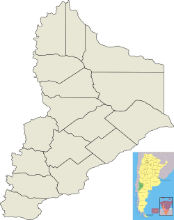
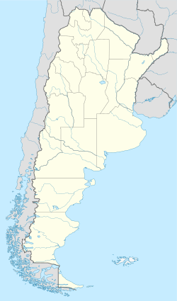
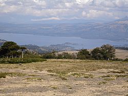
Villa Pehuenia is a small village and a local government area (called a municipality) in Neuquén Province, located in southwestern Argentina. This beautiful town sits on the northern shore of Aluminé Lake. Most of the money earned here comes from people visiting as tourists.
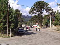
The village is nestled in the Andes mountains. It's only about 10 kilometres (6.2 mi) from the border with Chile, which you can reach by a highway through the Icalma pass. Villa Pehuenia gets its name from a special tree called the pehuén, also known as the monkey puzzle tree (Araucaria araucana). This tree is an endangered species and grows here at the very edge of its natural habitat.
Contents
History of Villa Pehuenia
Early Inhabitants and European Settlers
The Mapuche people, an indigenous group, moved into this area from Chile in the 1700s. They became the main group of people living here until the late 1800s. Before them, other native groups lived in the region.
The first European settlers came to this area because of the logging industry, which means cutting down trees for wood.
Growth of the Village
The village of Villa Pehuenia was officially created in 1989. At that time, only 155 people lived there. By 2010, the population had grown a lot, reaching 1,611 people. This big increase happened because more and more tourists started visiting the area. The Puel people, who are part of the Mapuche group, still have a community living here today.
Exploring Villa Pehuenia's Landscape
Location and Natural Features
Villa Pehuenia stretches for about 5 kilometres (3.1 mi) along the northern shore of Lake Aluminé. However, most of the village is built on two narrow pieces of land that stick out into the lake.
Near the village is the Batea Mahuida volcano. This volcano reaches a height of 1,948 metres (6,391 ft). It is located about 8 kilometres (5.0 mi) north of Villa Pehuenia.
Skiing at Batea Mahuida
The Puel people, who are native to this region, operate a small ski resort on the slopes of the Batea Mahuida volcano. It's a great place for winter sports!
Climate in Villa Pehuenia
Villa Pehuenia has a type of weather called a warm-summer mediterranean climate. This means it has warm, dry summers and mild, wet winters.
| Climate data for Villa Pehuenia 1,163 metres (3,816 ft) above sea level | |||||||||||||
|---|---|---|---|---|---|---|---|---|---|---|---|---|---|
| Month | Jan | Feb | Mar | Apr | May | Jun | Jul | Aug | Sep | Oct | Nov | Dec | Year |
| Mean daily maximum °C (°F) | 24.4 (75.9) |
24.0 (75.2) |
21.4 (70.5) |
16.9 (62.4) |
11.4 (52.5) |
6.7 (44.1) |
6.8 (44.2) |
8.9 (48.0) |
12.4 (54.3) |
16.7 (62.1) |
19.7 (67.5) |
22.0 (71.6) |
16.0 (60.8) |
| Daily mean °C (°F) | 14.8 (58.6) |
14.3 (57.7) |
12.1 (53.8) |
8.7 (47.7) |
5.7 (42.3) |
3.3 (37.9) |
3.7 (38.7) |
4.5 (40.1) |
6.0 (42.8) |
8.6 (47.5) |
11.1 (52.0) |
13.2 (55.8) |
8.8 (47.8) |
| Mean daily minimum °C (°F) | 5.2 (41.4) |
4.6 (40.3) |
2.9 (37.2) |
0.5 (32.9) |
0 (32) |
0 (32) |
0.6 (33.1) |
0.1 (32.2) |
−0.4 (31.3) |
0.5 (32.9) |
2.8 (37.0) |
4.5 (40.1) |
1.6 (34.9) |
| Average precipitation mm (inches) | 23 (0.9) |
29 (1.1) |
53 (2.1) |
74 (2.9) |
164 (6.5) |
195 (7.7) |
183 (7.2) |
132 (5.2) |
80 (3.1) |
45 (1.8) |
49 (1.9) |
36 (1.4) |
1,063 (41.9) |
See also
 In Spanish: Villa Pehuenia para niños
 | John T. Biggers |
 | Thomas Blackshear |
 | Mark Bradford |
 | Beverly Buchanan |


