Vineland, Colorado facts for kids
Quick facts for kids
Vineland, Colorado
|
|
|---|---|

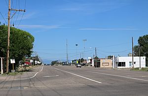
Santa Fe Drive in Vineland, looking west from 36th Lane.
|
|

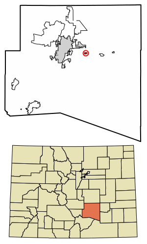
Location of the Vineland CDP in Pueblo County, Colorado.
|
|
| Country | |
| State | |
| County | Pueblo County |
| Government | |
| • Type | unincorporated community |
| Area | |
| • Total | 0.566 sq mi (1.467 km2) |
| • Land | 0.566 sq mi (1.467 km2) |
| • Water | 0 sq mi (0.000 km2) |
| Elevation | 4,646 ft (1,416 m) |
| Population
(2020)
|
|
| • Total | 269 |
| • Density | 474.9/sq mi (183.4/km2) |
| Time zone | UTC-7 (MST) |
| • Summer (DST) | UTC-6 (MDT) |
| ZIP Code |
Pueblo 81006
|
| Area code(s) | 719 |
| GNIS feature ID | 2583313 |
Vineland is a small community in Pueblo County, Colorado, in the United States. It's called a "census-designated place" (CDP) because the government counts its population separately for official records, even though it's not a city or town with its own local government. Vineland is part of the larger Pueblo area. In 2020, about 269 people lived here. The local mail for Vineland comes through the Pueblo post office, using ZIP Code 81006.
Geography of Vineland
Vineland is located just east of the St. Charles River. You can find it along East US Highway 50 (Business), which is also known as Santa Fe Drive. This area is well-known for its many family-run farms that grow fresh vegetables.
The Vineland CDP covers an area of about 1.467 square kilometers (or 362.5 acres). All of this area is land, with no water.
Population of Vineland
The United States Census Bureau first officially recognized Vineland as a census-designated place for the United States Census 2010. This means they started counting its population separately from that point on.
Here's how the population has changed:
- In 2010, the population was 251 people.
- In 2020, the population grew slightly to 269 people.
Schools in Vineland
Students in Vineland attend schools that are part of the Pueblo County School District 70. This community is home to several important schools:
- Pueblo County High School
- Vineland Elementary School
- Vineland Middle School
See also
 In Spanish: Vineland (Colorado) para niños


