Walkerville, Victoria facts for kids
Quick facts for kids WalkervilleVictoria |
|
|---|---|
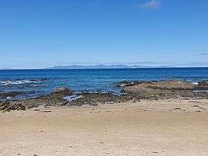
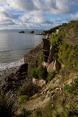
Walkerville North coast looking towards Walkerville South
|
|
| Population | 84 (2016 census) |
| Postcode(s) | 3956 |
| LGA(s) | South Gippsland Shire |
| State electorate(s) | Gippsland South |
| Federal Division(s) | Nicholls |
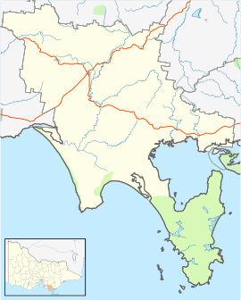
Walkerville is a small village in Victoria, Australia. It is located on Waratah Bay in southwest Gippsland, about 190 kilometers (118 miles) southeast of Melbourne. The village is divided into two main areas: Walkerville North and Walkerville South. There is also an area called Walkerville Promontory View Estate nearby.
Contents
A Look Back: Walkerville's Past
Walkerville is located on the traditional lands of the Brataualung people. They are a clan of the larger Gunai/Kurnai nation.
How Walkerville Grew
The village's Post Office first opened on August 10, 1885. It was known as Waratah Bay until 1892. The Post Office closed in 1972.
Walkerville was most important in the early 1900s. During this time, a lot of lime was produced here. This lime was then sent to Melbourne, which was a fast-growing city. People say that lime from Walkerville was used to help build the famous Flinders Street Station in Melbourne.
Making Lime
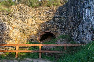
Workers mined raw limestone from the cliffs around Walkerville. They loaded it onto horse-drawn trams. These trams carried the limestone along the coast to six large kilns. A kiln is a special oven used to burn materials at high temperatures.
To fuel these kilns, a lot of trees were cut down from the nearby forests. After the limestone was burned, it turned into lime. This lime was then put into bags and stored in sheds. Ships would pick up the bagged lime from a 300-meter (984-foot) long jetty and take it to Melbourne.
The lime production stopped in 1926. This was because it became too expensive to ship the lime. At its busiest, about eighty people lived in Walkerville. Most of them worked at the lime kilns.
The Walkerville Promontory View Estate
The Walkerville Promontory View Estate was created in the 1960s. The first land blocks there cost 25 pounds.
What Remains Today
By 2005, most of the old lime-making buildings were in ruins. You could still see the stone walls of the kilns. Only one wooden pole remained from the long jetty at Walkerville South. A few more wooden poles from another jetty can be seen near Diggers Island to the south.
Walkerville Today: What to See and Do
Walkerville is a quiet place that offers beautiful natural sights.
Walkerville South
You can reach Walkerville South by a gravel road called Walkerville S Road. This road leads to Walkerville South Beach. The bay here is calm and the beach is sandy. Many families visit in the summer to swim, fish, and paddle in the clear water. There is a ramp at Walkerville South for launching small boats. This ramp is closed to cars during busy times.
Walkerville North
Walkerville North is accessed by a winding, paved road. This road goes through a beautiful forest down to the shore. Once you reach the shore, a gravel road called Loop Road goes through the Walkerville Foreshore Camping Reserve. The paved Walkerville Road then follows the shore for about 1.3 kilometers (0.8 miles). It ends at a ramp that leads to a small beach where boats can be launched.
Along the road, you will find some houses, small picnic areas, a small hall, and public toilets. The hall was moved here from the older town of Waratah, which is now Walkerville South.
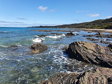
Walkerville North offers amazing views across Waratah Bay to nearby Wilsons Promontory. At low tide, you can explore cool rock pools.
The Limeburner's Walk
A walking trail called the Limeburner's Walk connects Walkerville North and Walkerville South. The trail starts about 100 meters (328 feet) past the end of the beach access ramp. It climbs above some small cliffs.
The trail goes through forests and past small creeks. The water in these creeks is often brown from the tannin of tea tree plants. Along the trail, there are spots with information signs. These signs tell you about the area's short history of mining and logging. They also share facts about the local geography. A short side-trail leads to a hidden historic cemetery. Here, you can see the headstones of the early settlers and workers from the lime mining days.
Camping and Kiosk
The 'Walkerville Foreshore Camping Reserve' is in Walkerville North. It is a one-kilometer (0.6-mile) stretch of dirt road behind the rocky beach. There are camping sites on both sides of the road. The campground is busiest during the Easter and New Year holidays. Inside the camping reserve, you will find the Walky kiosk. This is the only shop in Walkerville.
Walkerville Promontory View Estate
The Walkerville Promontory View Estate has over 250 housing blocks. Some of these blocks have great views across Waratah Bay. There is a CFA fire station located on Panoramic Drive in the estate. The estate does not have a public sewer system or town water supply.
The town was also featured in a song! The Australian band Weddings Parties Anything wrote a song called Walkerville. It was on their 1996 album River'esque.
 | Jackie Robinson |
 | Jack Johnson |
 | Althea Gibson |
 | Arthur Ashe |
 | Muhammad Ali |


