Wallaceton, Pennsylvania facts for kids
Quick facts for kids
Wallaceton, Pennsylvania
|
|
|---|---|
|
Borough
|
|

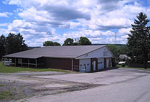
Wallaceton Area Volunteer Fire Station and borough hall
|
|

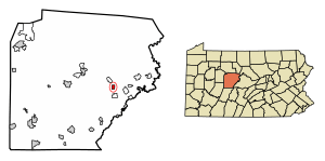
Location of Wallaceton in Clearfield County, Pennsylvania.
|
|

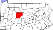
Location of Clearfield County in Pennsylvania
|
|
| Country | United States |
| State | Pennsylvania |
| County | Clearfield |
| Settled | 1813 |
| Incorporated | 1873 |
| Government | |
| • Type | Borough Council |
| Area | |
| • Total | 0.77 sq mi (1.98 km2) |
| • Land | 0.76 sq mi (1.98 km2) |
| • Water | 0.00 sq mi (0.01 km2) |
| Elevation | 1,750 ft (530 m) |
| Population
(2020)
|
|
| • Total | 297 |
| • Density | 388.74/sq mi (150.11/km2) |
| Time zone | UTC-5 (Eastern (EST)) |
| • Summer (DST) | UTC-4 (EDT) |
| ZIP code |
16876
|
| Area code(s) | 814 |
| FIPS code | 42-80640 |
Wallaceton is a small town, also called a borough, located in Clearfield County, Pennsylvania, in the United States. In 2020, about 297 people lived there.
Contents
Wallaceton's Location and Size
Wallaceton is found in the eastern part of Clearfield County. A main road, U.S. Route 322, goes through the southwestern edge of the town. This road can take you about 11 miles (18 km) northwest to Clearfield, which is the main city of the county. It can also take you about 6 miles (10 km) southeast to Philipsburg.
According to official measurements, Wallaceton covers a total area of about 0.77 square miles (2.0 square kilometers). All of this area is land.
People Living in Wallaceton
| Historical population | |||
|---|---|---|---|
| Census | Pop. | %± | |
| 1880 | 106 | — | |
| 1890 | 250 | 135.8% | |
| 1900 | 289 | 15.6% | |
| 1910 | 324 | 12.1% | |
| 1920 | 331 | 2.2% | |
| 1930 | 345 | 4.2% | |
| 1940 | 386 | 11.9% | |
| 1950 | 440 | 14.0% | |
| 1960 | 429 | −2.5% | |
| 1970 | 377 | −12.1% | |
| 1980 | 393 | 4.2% | |
| 1990 | 319 | −18.8% | |
| 2000 | 350 | 9.7% | |
| 2010 | 313 | −10.6% | |
| 2020 | 297 | −5.1% | |
| 2021 (est.) | 297 | −5.1% | |
| U.S. Decennial Census | |||
In the year 2000, there were 350 people living in Wallaceton. These people lived in 131 homes, and 96 of these were families. The town had about 500 people per square mile (193 people per square kilometer). There were 134 houses in total.
Most of the people in Wallaceton were White (about 98.86%). A small number were African American (0.29%), Native American (0.29%), or from two or more racial backgrounds (0.57%).
Households and Families
Out of the 131 homes, about 34.4% had children under 18 living there. Most homes (62.6%) were married couples living together. About 7.6% of homes had a female head of the house without a husband. About 26.0% of homes were not families.
About 22.1% of all homes had only one person living there. About 10.7% of homes had someone living alone who was 65 years old or older. On average, there were 2.67 people in each home and 3.14 people in each family.
Age and Income
The people in Wallaceton were spread out in age. About 26.0% were under 18 years old. About 8.9% were between 18 and 24. The largest group, 31.4%, was between 25 and 44. About 22.6% were between 45 and 64, and 11.1% were 65 or older. The average age in Wallaceton was 35 years.
In 2000, the average income for a home in Wallaceton was $28,000 per year. For families, the average income was $38,083 per year. Men earned about $28,333 per year, while women earned about $16,875 per year.
About 8.4% of families and 17.3% of all people in Wallaceton were struggling financially. This included about 29.2% of those under 18 and 23.8% of those 65 or older.
See also
 In Spanish: Wallaceton para niños


