Wanette, Oklahoma facts for kids
Quick facts for kids
Wanette, Oklahoma
|
|
|---|---|

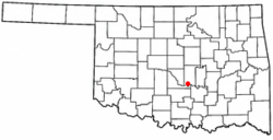
Location of Wanette, Oklahoma
|
|
| Country | United States |
| State | Oklahoma |
| County | Pottawatomie |
| Area | |
| • Total | 0.41 sq mi (1.05 km2) |
| • Land | 0.41 sq mi (1.05 km2) |
| • Water | 0.00 sq mi (0.00 km2) |
| Elevation | 1,020 ft (310 m) |
| Population
(2020)
|
|
| • Total | 279 |
| • Density | 687.19/sq mi (265.27/km2) |
| Time zone | UTC-6 (Central (CST)) |
| • Summer (DST) | UTC-5 (CDT) |
| ZIP code |
74878
|
| Area code(s) | 405/572 |
| FIPS code | 40-78200 |
| GNIS feature ID | 2413446 |
Wanette is a small town in Pottawatomie County, Oklahoma, United States. In 2020, about 279 people lived there. Wanette is part of the larger Oklahoma City Metropolitan Area. It is also close to the towns of Purcell and Lexington.
Contents
History of Wanette
Wanette began in 1868 when two settlers from Kansas built a cabin. More people soon moved to the area. The community had a few different names before it was officially called Wanette. A post office opened with the name Wanette on March 19, 1894.
In 1903, the town moved about one mile north. This move was so it could be right next to the Atchison, Topeka and Santa Fe Railway line. This railway connected towns like Newkirk and Pauls Valley.
By 1907, Wanette had a population of 739 people. The number of people living there reached its highest point in 1920, with 783 residents. The town's main way of making money was through farming. In the 1930s, oil was found nearby in the Wanette-Asher oil field. This helped the economy for a while. However, the town's population still started to get smaller.
Today, farming is still important to Wanette. But many people who live in Wanette now work in bigger nearby cities. These cities include Moore, Norman, and Oklahoma City. This means Wanette has become a "bedroom community."
Geography of Wanette
Wanette is a small town. It covers an area of about 0.4 square miles (1.05 square kilometers). All of this area is land, with no water.
Population Changes
| Historical population | |||
|---|---|---|---|
| Census | Pop. | %± | |
| 1910 | 677 | — | |
| 1920 | 783 | 15.7% | |
| 1930 | 758 | −3.2% | |
| 1940 | 665 | −12.3% | |
| 1950 | 594 | −10.7% | |
| 1960 | 381 | −35.9% | |
| 1970 | 303 | −20.5% | |
| 1980 | 473 | 56.1% | |
| 1990 | 346 | −26.8% | |
| 2000 | 402 | 16.2% | |
| 2010 | 350 | −12.9% | |
| 2020 | 279 | −20.3% | |
| U.S. Decennial Census | |||
In 2000, there were 402 people living in Wanette. These people lived in 147 households, and 108 of these were families. The population was spread out, with many young people. About 30% of the people were under 18 years old. The average age in the town was 29 years old.
The average income for a household in Wanette in 2000 was about $21,818 per year. For families, the average income was about $23,000 per year.
Economy of Wanette
For a long time, farming has been the main part of Wanette's economy. Farmers in the area grow crops like cotton, pecans, oats, corn, alfalfa, and hay. In the early 1930s, oil was found in the nearby Wanette-Asher field. This caused a short period of economic growth. However, this oil boom ended before 1940.
Arts and Culture
The Wanette–Byars Bridge is a special landmark in the area. It is listed on the National Register of Historic Places. This means it is an important historical site.
Education
Students in Wanette attend schools that are part of the Wanette Public Schools district. Wanette High School is located right in the town.
See also
 In Spanish: Wanette (Oklahoma) para niños
 | Selma Burke |
 | Pauline Powell Burns |
 | Frederick J. Brown |
 | Robert Blackburn |

