Wardville, Oklahoma facts for kids
Quick facts for kids
Wardville
|
|
|---|---|
| Country | United States |
| State | Oklahoma |
| County | Atoka |
| Area | |
| • Total | 1.00 sq mi (2.58 km2) |
| • Land | 0.98 sq mi (2.54 km2) |
| • Water | 0.01 sq mi (0.04 km2) |
| Elevation | 679 ft (207 m) |
| Population
(2020)
|
|
| • Total | 53 |
| • Density | 53.97/sq mi (20.84/km2) |
| Time zone | UTC-6 (Central (CST)) |
| • Summer (DST) | UTC-5 (CDT) |
| ZIP code |
74525
|
| FIPS code | 40-78350 |
| GNIS feature ID | 2629940 |
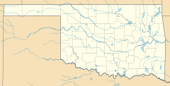
Wardville is a very small place in Oklahoma, United States. It's called an unincorporated community. This means it's a group of homes and businesses that isn't officially a town or city with its own local government. Wardville is located in northern Atoka County, along State Highway 131. It's about 14 miles northeast of a town called Coalgate.
Contents
History of Wardville's Name
Wardville has an interesting history, especially with its name!
From Herbert to Wardville
The area first got a post office on February 6, 1902. Back then, it was called Herbert. This was during a time when Oklahoma was known as Indian Territory. The Herbert post office was in a part of the Choctaw Nation, which was a large area belonging to the Choctaw people.
The name Herbert came from Herbert Ward. He was the youngest son of the first postmaster, Henry Pleasant Ward.
How Wardville Got Its Name
On July 18, 1907, the name of the community was changed to Wardville. This new name honored Henry Pleasant Ward. He was an important person in the area's history.
Henry Pleasant Ward was a politician who served in the government of the Indian Territory. He was part of both the House of Representatives and the Senate. He also worked as a judge in Atoka County. The post office in Wardville stayed open for many years but finally closed in 2007.
Wardville's Population
Wardville is a very small community. According to the 2020 census, only 53 people live there.
 | John T. Biggers |
 | Thomas Blackshear |
 | Mark Bradford |
 | Beverly Buchanan |


